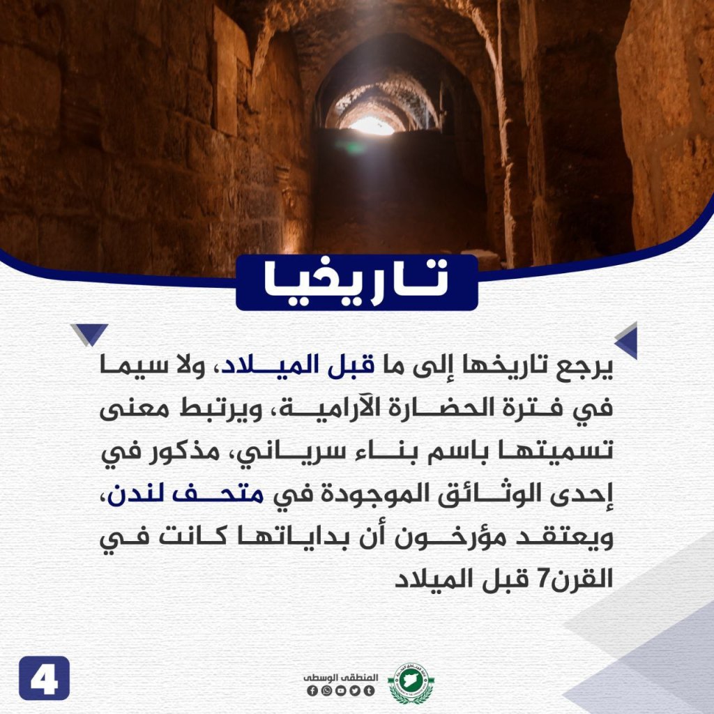
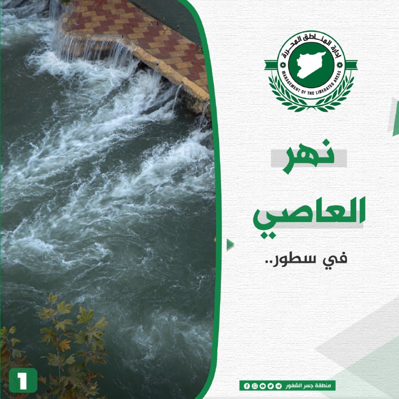
The Most Prominent Water Features in the Jisr al-Shughur Region
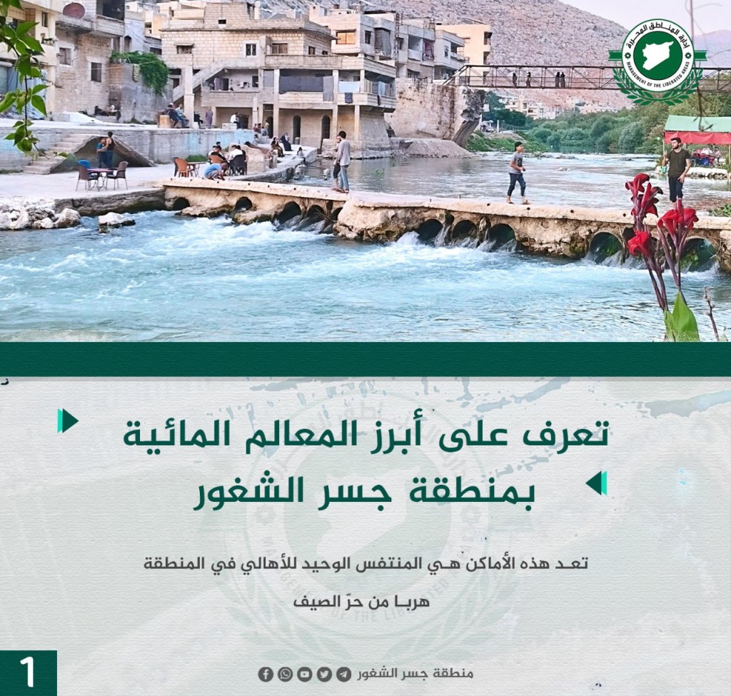
The areas are the only relief people in the town get from the summer heat.
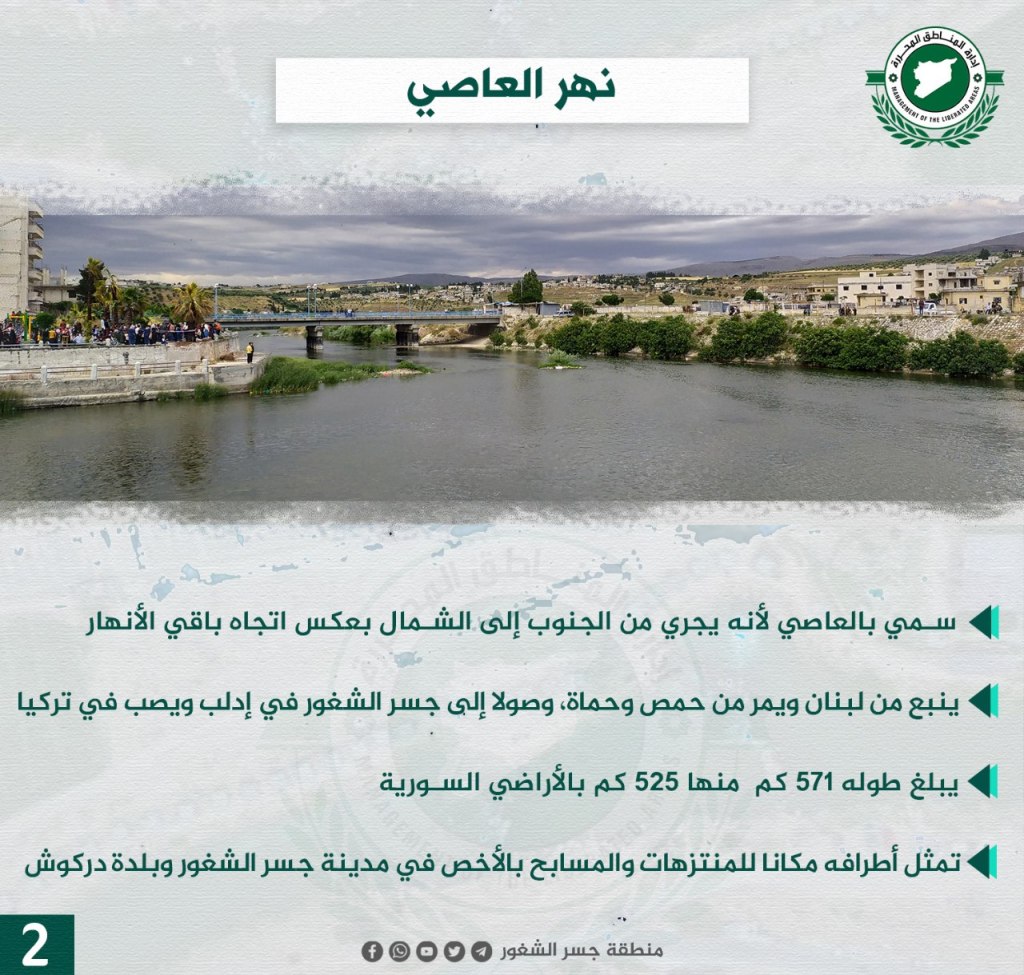
The al-Asi (Orontes) River:
The river is called al-Asi because it runs from south to north in the direction of the rest of the rivers. It originates in Lebanon and passes through Homs and Hama, continuing to Jisr al-Shughur in Idlib and continues into Turkey. The total length is 571km, 525km of which passes through Syrian land. The banks are a great place for parks and swimming pools, particularly in Jisr al-Shughur and Darkush.
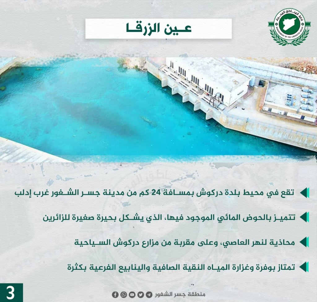
‘Ayn al-Zarqa:
‘Ayn al-Zarqa is located in the area of the town of Darkush, 24km from Jisr al-Shughur, west of Idlib. It is notable due to its water basin, which forms a small lake for visitors to use. It’s adjacent to the al-Asi River, and close to the Darkush tourist farms. Its water is abundant and clear, and many springs branch off of it.
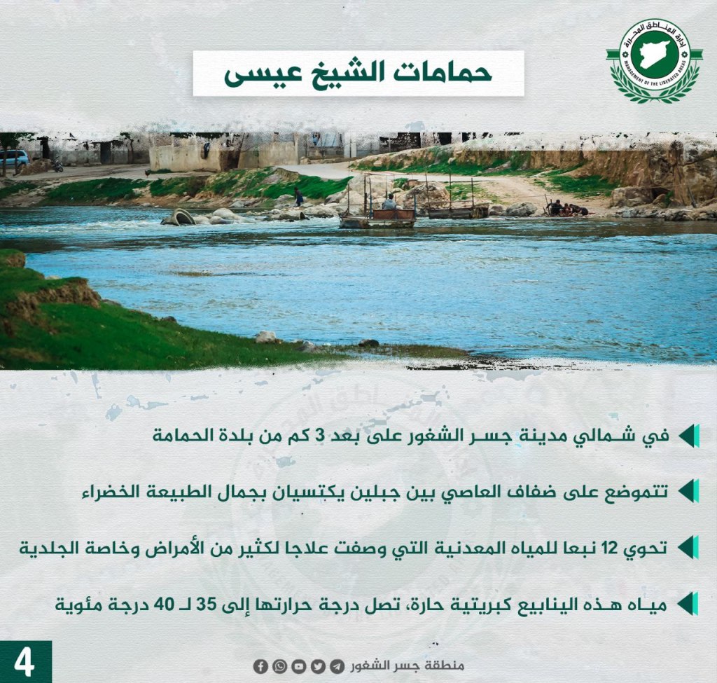
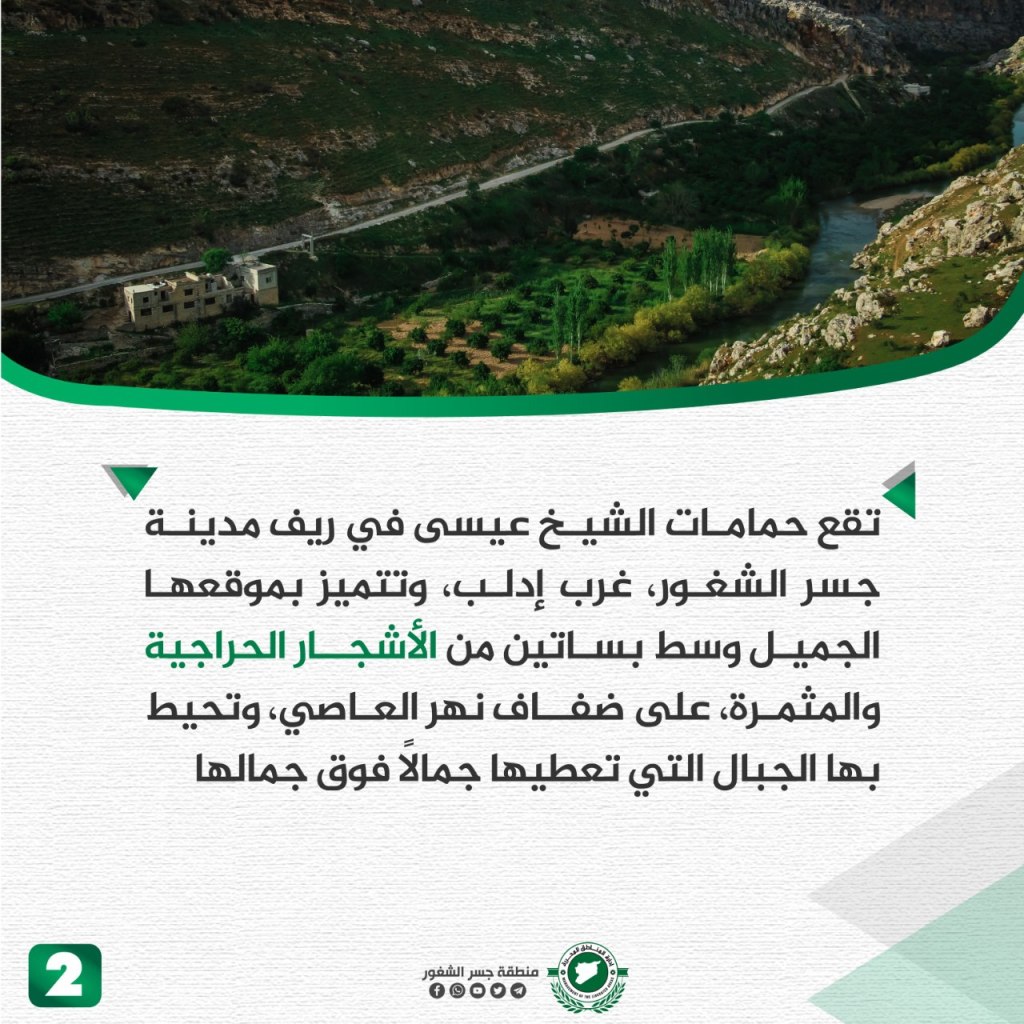
Baths of Shaykh ‘Isa:
The baths are located north of Jisr al-Shughur, 3 km from the town of al-Hamamah. The baths are on the banks of the al-Asi River between the two mountains, and the banks are covered with green grass. The baths contain 12 mineral water springs that are described as the cures for many diseases, particularly skin diseases. The water of the springs is hot, between 35 to 40 degrees celsius.
The Green Idlib
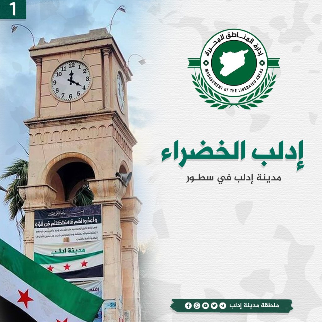
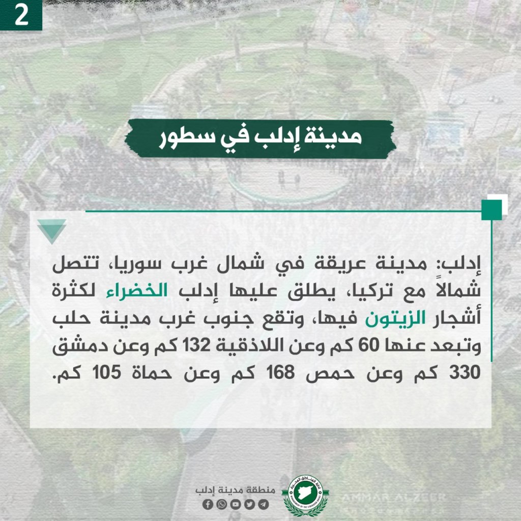
Idlib is located in northwest Syria, connected to the north with Turkey. It’s called “The Green Idlib” because of the many olive trees in it. Idlib is located 60 km southwest of Aleppo, 132 km from Latakia, 330 km from Damascus, 168 km from Homs, and 105 km from Hamah. The name is of Syriac origin, with “Id” meaning the word for hand, and “Lib” meaning the heart, in total meaning “the hand of the heart,” or the spirit of the place and its purity. The area is covered in green, with around 14 million olive trees covering its hills and plains.
The city is 451 meters above sea level, and maintains a rainfall rate of 495 mm. Temperatures range from 30/40 degrees in the summer, and in winter ranges from -3-12 degrees celsius. While olives are the city’s strategic crop, other crops are popular, including melon, barley, vegetables, figs, and grapes. The book “the Crown of the Bridge” remembers that Idlib was originally two localities: the northern locality was the largest and the southern was the smaller. The largest remained and is known as Idlib today. It was originally known as the town of Sarmin, located to the east, where the Ottoman Sultan Muhammad Pasha al-Kobarli used the town as a waqf for the Two Holy Mosques and made it tax-exempt, making it a destination for neighboring villages. This contributed to the expansion of greater Idlib. The town faced the French occupation and gathered its men around “Ibrahim Hananu” that started a revolution against the French, which expelled the French colonizer from Syria. The revolution cost the city many sacrifices, including the French bombing of the city on January 20, 1920.
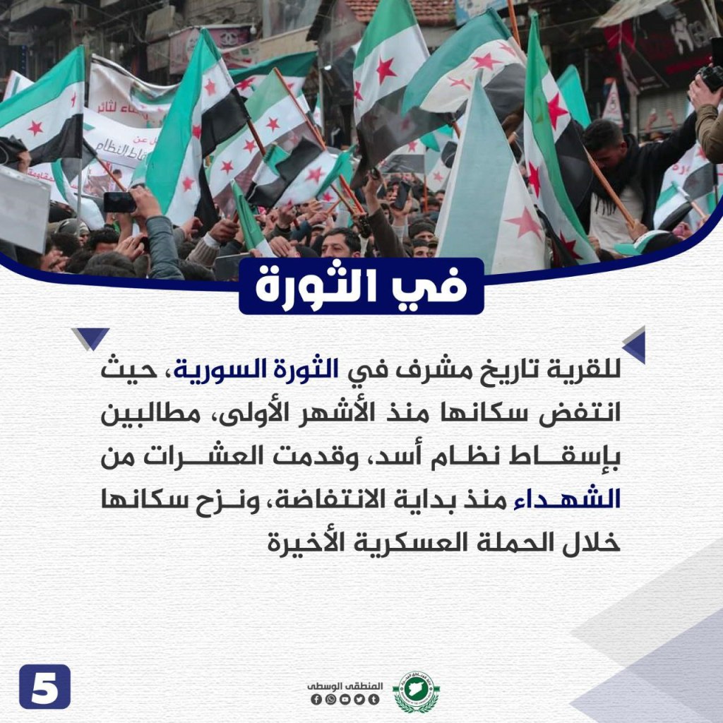
The City of Harim: The Victory of the Grandparents and the Revolution of the Grandchildren
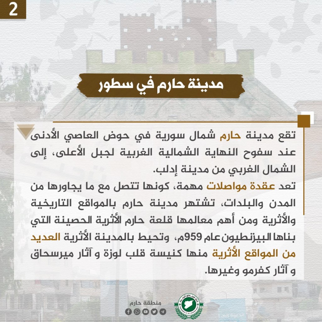
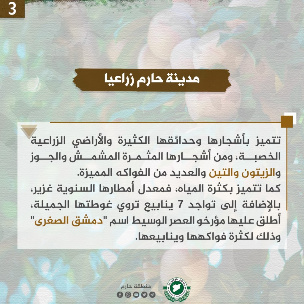

Harim is located in northern Syria in the lower Asi basin, at the foothills of the northwestern end of the Al-Ala Mountain, northwest of Idlib. The city is an important transportation node, connecting the neighboring cities and towns. It’s famous for its historical and archeological sites, and its important landmark is the fortress of Harim, built by the Byzantines in 959 CE. Harim is known for its trees and gardens as well as agricultural lands, where abundant apricots, walnuts, olives, figs, and many other fruits grow. There is also abundant water supplies there due to abundant rainfall and the presence of 7 freshwater springs. Historians called it “little Damascus due to the presence of streams.
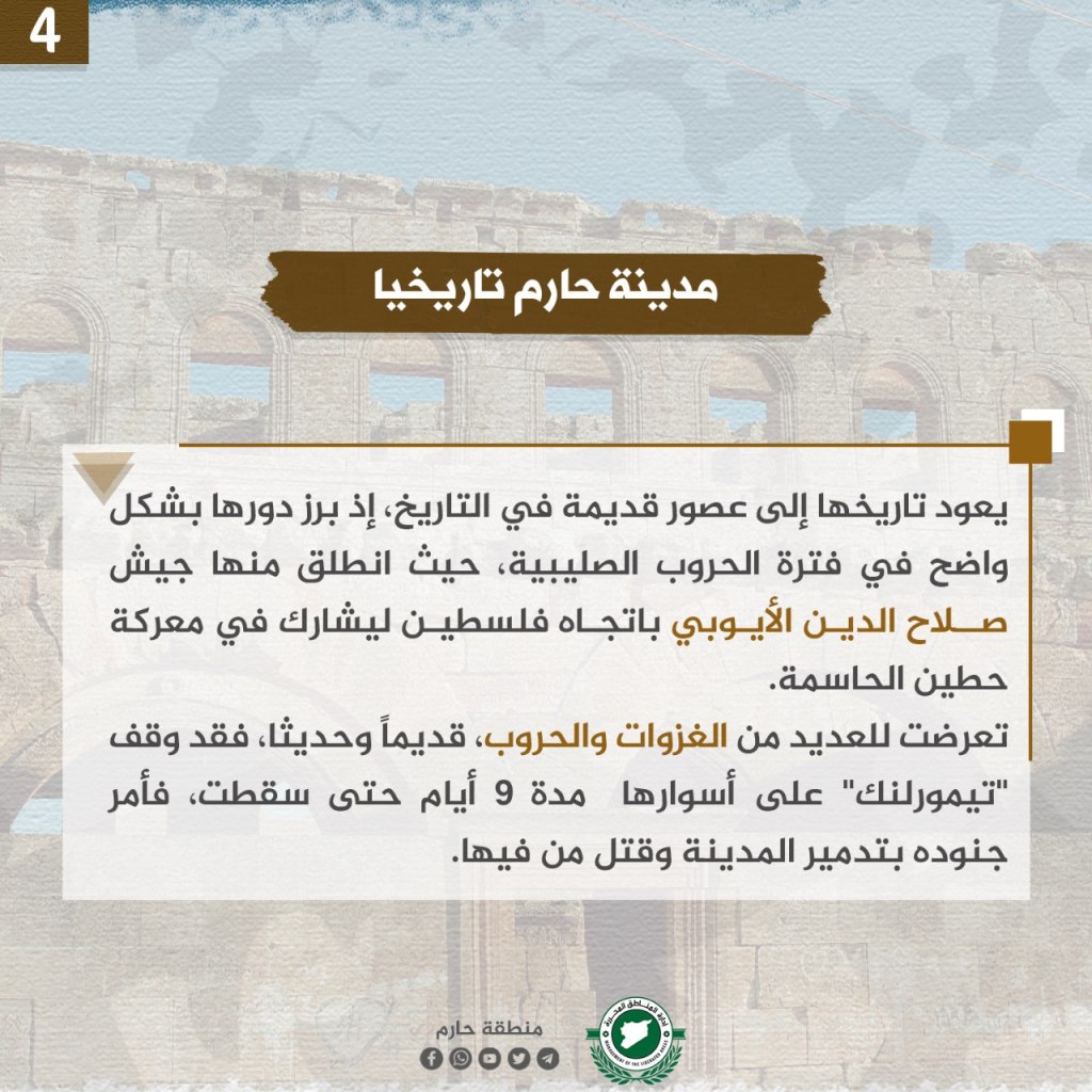
Harim’s origins date back to the Crusades, where the army of Salah al-Din al-Ayubi stormed towards Palestine to participate in the Battle of Hittin. There have been many invasions and wars there. Harim was one of the most notable revolutionary cities, as the regime turned its castle into a military base. The city faced significant artillery bombardment but the city was liberated by HTS. Harim is famous for its historic citadel and “will remain the land where grandparents triumphed and grandchildren follow.”
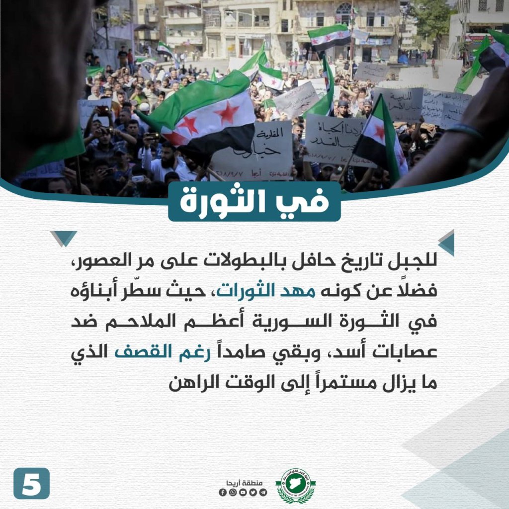
Ariha City

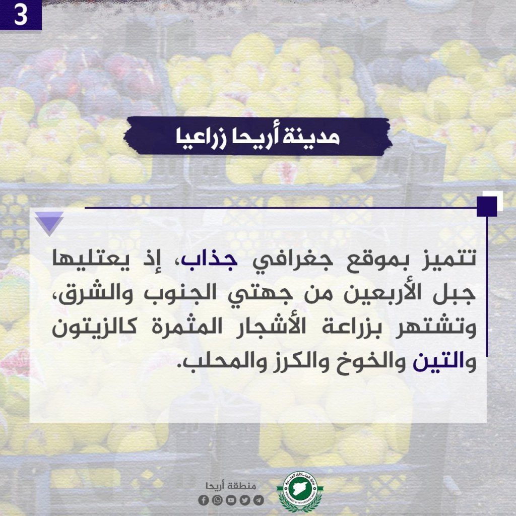
Ariha is a rich Syrian city of a rich Syrian Aramaic name “a good smell,” or the “scent of flowers.” It’s located on the international M4 road south of Idlib. It is located between four cities, Jisr al-Shughur 27 km to the west, Saraqib 22 km to the east, Ma’arat al-Nu’man 25 km to the southeast, and Idlib city 12 km to the north. Ariha is located 258 km away from Damascus. Ariha is located in a geographically attractive area, surrounded by Jabal al-Arba’in to the south and east. It’s famous for cultivating olives, figs, peaches, cherries, and mahleb.
Ariha is an ancient city, and has been mentioned by many archeologists, including Yaqut al-Hamawi in his writings, in which he said “Ariha is a town on the outskirts of Aleppo, the best and most beautiful of God’s country, with orchards and trees, and in the outskirts of Aleppo there is no clearer from it.” The city has some archeological sites dating back 5,000 years.
Ariha is the center of the area, surrounded by dozens of towns, villages, and farms, most notably Urm al-Jawz, al-Rami, Nahliya, Majdaliya. It’s known for its tourist parks, related to the slopes of Jabal al-Arba’in. However, the continuing bombings by Assd’s militias and the Russian occupation destroyed these sites, and many of its residents fled the city and are displaced.
al-Atarib City

al-Atarib is located in the countryside of western Aleppo, about 30 km outside of the city. Its history dates back to 5,000 years BCE. Yaqub al-Hamawi notes the town in his book, “Glossary of Countries.” al-Atarib is derived from “al-Tharab,” meaning grease. The Greeks called the city “Litarbi,” while the Arab named it al-Atarib. al-Atarib and its rural areas number more than 30 villages, towns, and olive, fig, and grape farms. It’s also known for its wide plains that are used to cultivate rain-fed grains. It’s a commercial center for most of the surrounding countryside.
Its most famous archeological landmark is the Atarib Fortress and to the north of the city is the village of Al-Sahara, which sits on a mountain and is surrounded by hills. Next to the village is an ancient roman fortress, Deir Amman. After the Crusader invasion from 1099 CE to 493 H, the Muslim leader ‘Imad al-Din al-Zanki conquered it in 532 H, however one year later a severe earthquake hit the area, destroying much of it.
In today’s time, the city has revolted since the spring of 2011 against the Assad regime, prompting the regime to commit many massacres there, notably the blood mark massacre in the spring of 2014, and the massacre of 2017 where 80 civilians were killed.
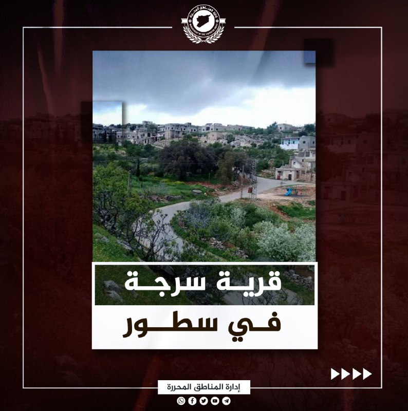
Sarma City

Sarmada is an ancient Syrian city located north of Idlib, approximately 30 km from the city. It’s name is connected to Bab al-Hawa, the significant crossing that connects northern Syria to Turkey and Europe. The name of the city means “the eternal,” with older names being Sarmad. There is an old mosque located in Sarmada called “Sheikh Shahid,” and other archeological sites were built there, including the “Manlius” dating back to 112 CE, and some Greek writings. To the south of Sarmada is the Sarmada Castle, whose famous column is a symbol of the city. Sarmada is also a commercial hub and industrial center, as many displaced people came there, and the industrial infrastructure provides job opportunities for tens of thousands of young people.
Salqin City


Salqin is located in northwest Idlib, southwest of Harim, 45 km from Idlib City, and 80 km from Aleppo. The name of the city came from the Roman city of “Seleucus,” as well as has the meaning of “to ascend” as the city is located between two mountains. The al-Assi river and Iskenderun plains are viewed from the river and many people come there to hike. The city and the countryside has fertile soil for agriculture and is known for the cultivation of trees where olives, pomegranates, figs, grapes, almonds, and walnuts grow. There has been significant urban development within the past decades, and it is considered a commercial and industrial center, and contains industrial facilities working with the manufacture of olive oil and canning of olives.
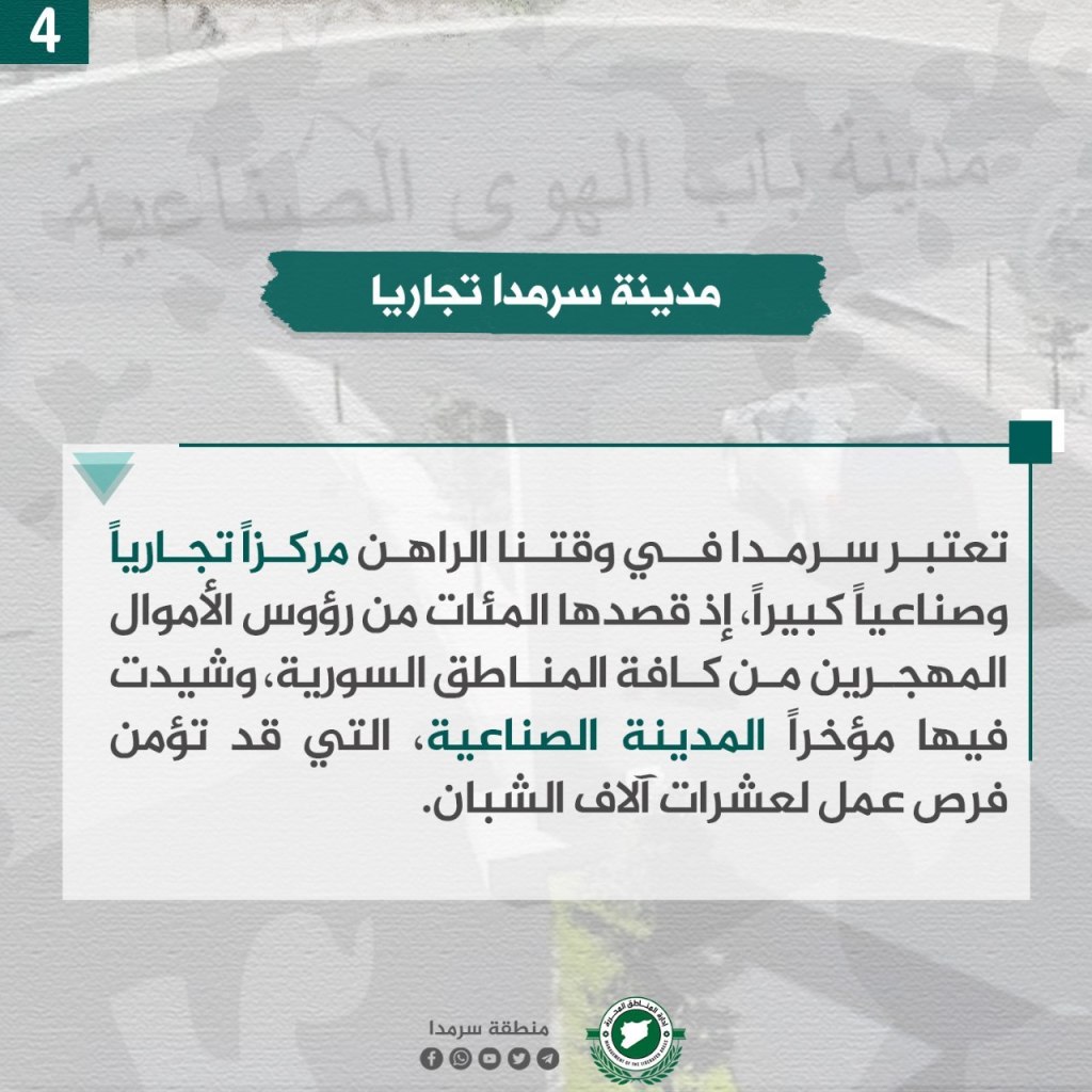
Binnish City

Binnish is northeast of Idlib, located 7 km away from Idlib City, located about 371 meters above ground. It is considered one of the most important cities in northwest Syria. Its name is Syriac in origin, a combination of “bin” and “nish,” meaning a lion’s farm, and is mentioned in ancient documents, including Ugaritic documents in the 2nd millennium BCE, as “Bananch.” The city is notable for its diverse agriculture, full of fruitful fig, olive, and grape trees, as well as grain crops. It’s surrounded by wide agricultural areas in the south and east.
The city played a large role in the Syrian revolution against the Assad regime, and it was famous for its beautiful banners and slogans. Because of this, the Assad-aligned militias carried out revenge against it, and perpetrated several massacres there.
Jisr al-Shughur City

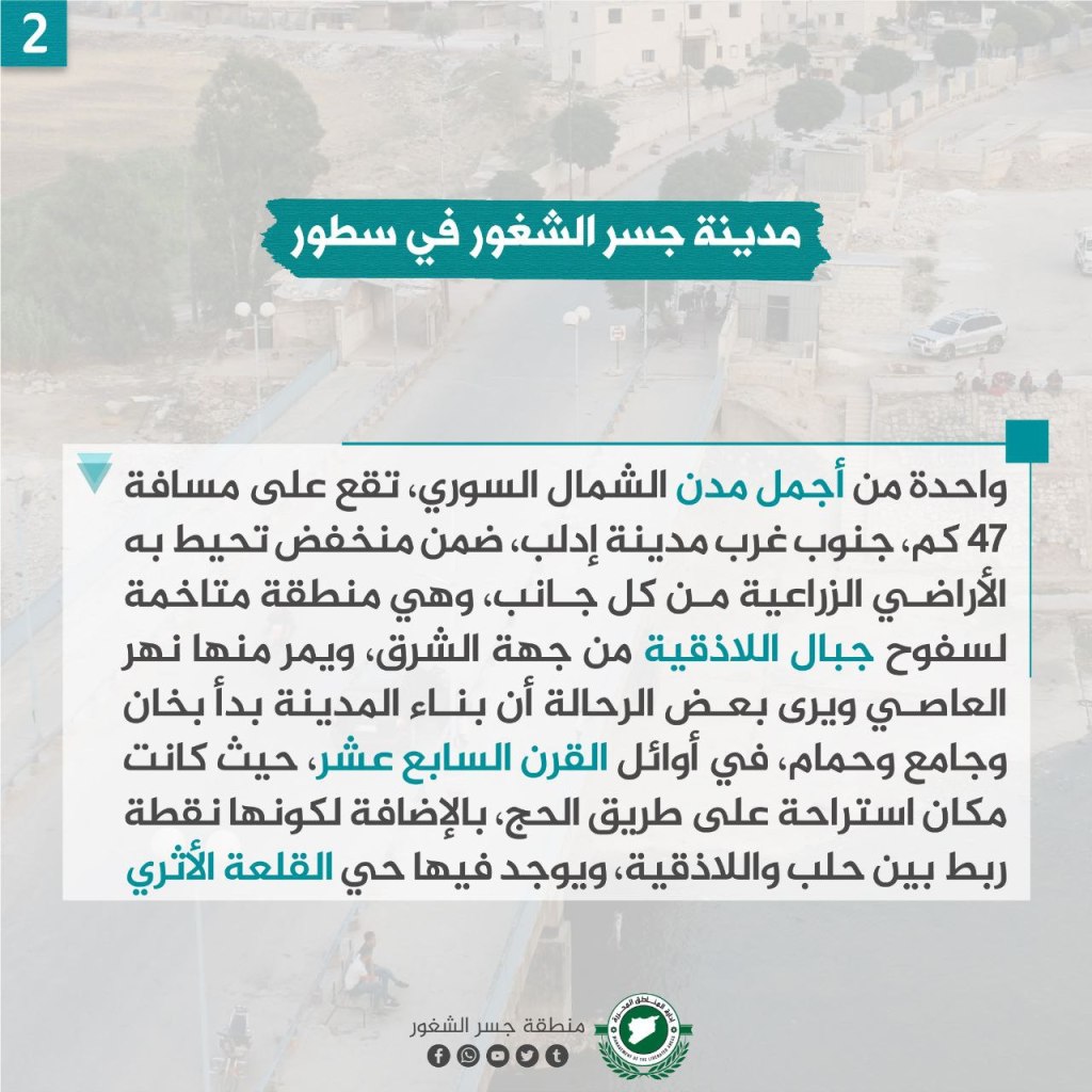
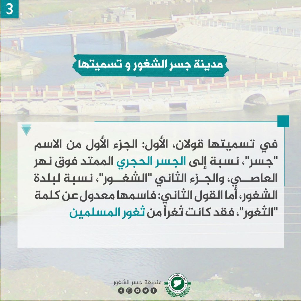
One of the most beautiful cities in Northern Syria, located 47 km southwest of Idlib City, in a valley surrounded by agricultural areas. It’s an area surrounded by the Latakia mountains to the east, and passing through it is the al-Absi river. The construction of the city began with a mosque and several baths in the beginning of the 17th century, as it was resting place on the route to the Hajj, in addition to being a linking point between Aleppo and Latakia. There is an archeological castle located there as well. The name of the city corresponds to a stone bridge extending over the al-Asi river as well as the town of Shughur. Others say its name was changed from Thughur, which meant “gaps between Muslims.”
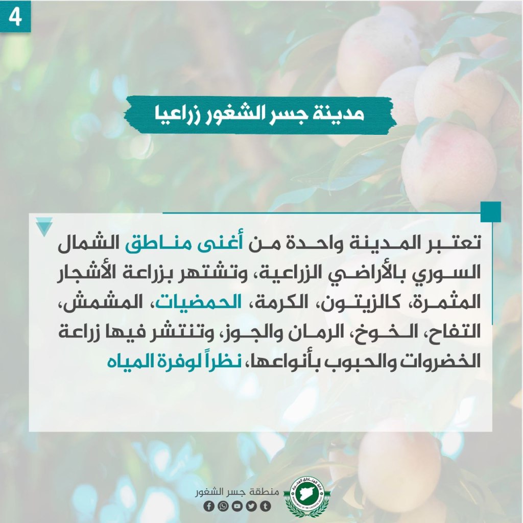
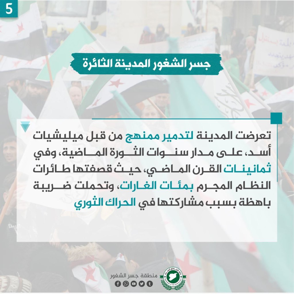
The city is one of the richest agriculturally in northern Syria, and is known for its cultivation of olives, grapes, citrus fruits, apricots, apples, peaches, pomegranates, and walnuts, as well as grains and vegetables. Water is also abundant there. However, the city was systematically destroyed during the revolution by Assad’s militias, and during the 1980s, when the Assad regime bombarded it.
Atme Village


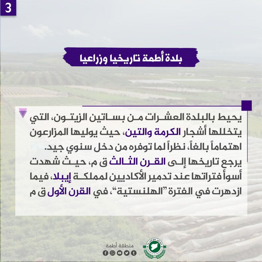
The town is near the Syrian border with Turkey in the north of Idlib, named after a castle located nearby. “Atam” means castles, with its singular being “Atme,” with the name of the town being castle.
There are dozens of olive orchards in the town, as well as vine and fig trees, which are tended by local farmers who get their income through it. The orchards/groves date back to the third century BCE during the time when the Akkadians destroyed the Kingdom of Ebla. However, the groves flourished again in the Hellenistic period in the first century BCE.
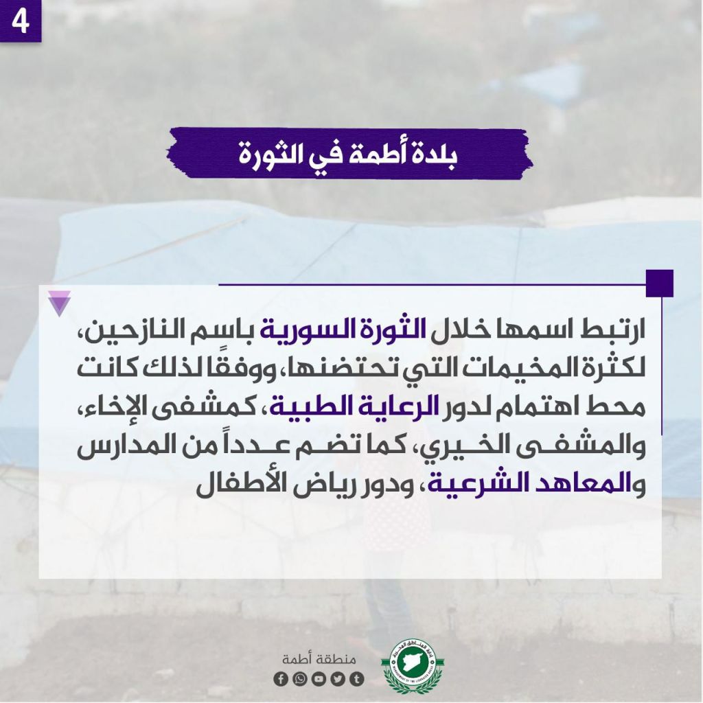
The town participated throughout the revolution by helping the displaced, hosting lots of camps. The town is a point of focus for medical care sites, including the al-Ikha’ Hospital, the Charitable Hospital, and a number of schools, Sharia institutes, and kindergartens.
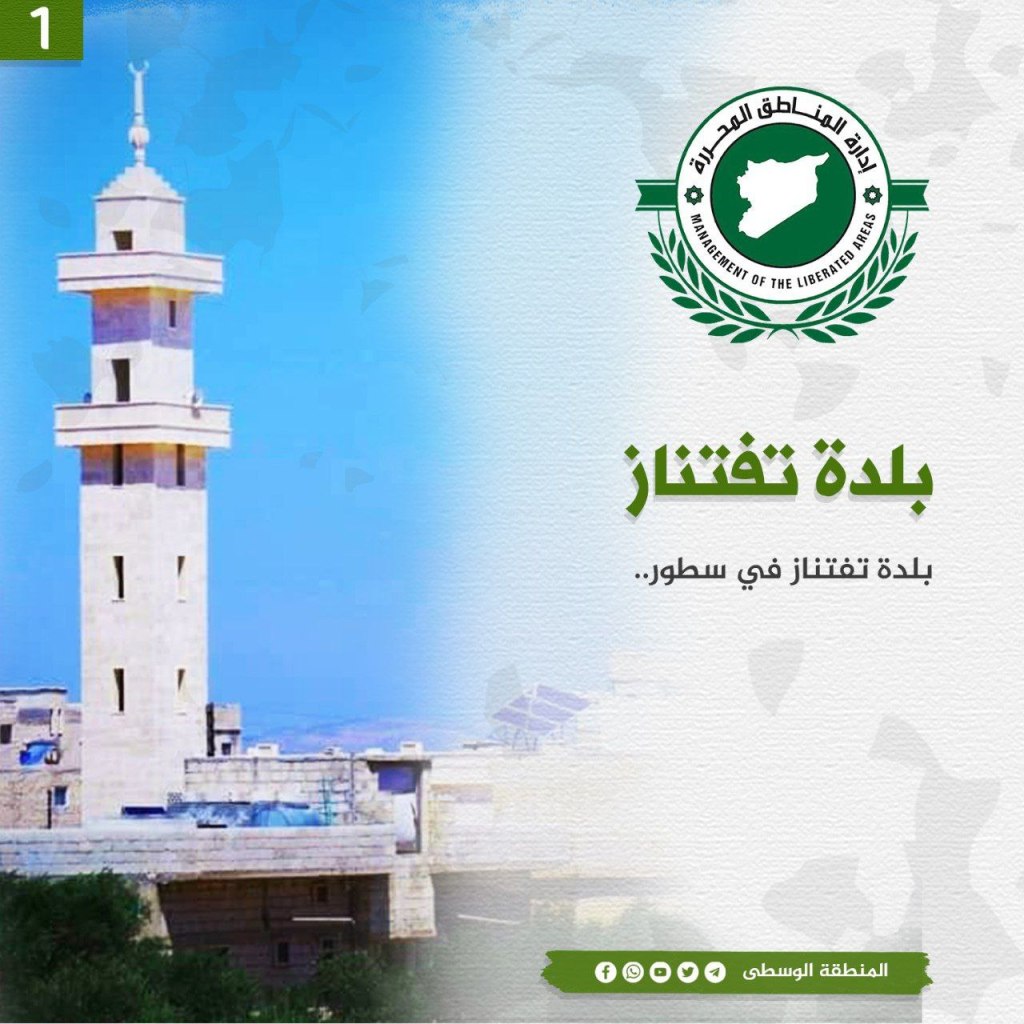
Taftanaz Village
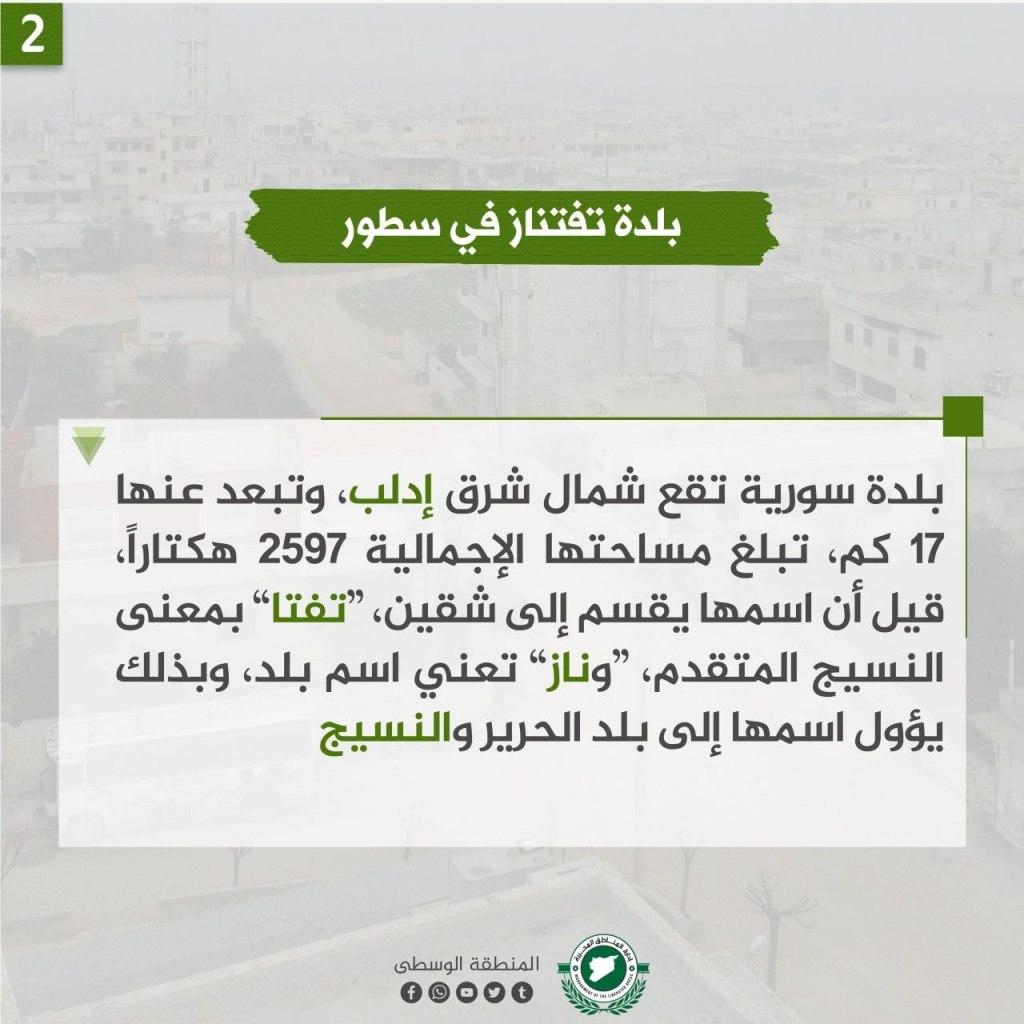
Located in northeastern Idlib approximately 17 km from the city. The total area of the town is 2597 hectares (10.03 square miles). The name of the town has two parts, “Tafta,” meaning advanced weaving, and “Naz,” meaning the name of the town, with the overall name meaning a town of liberation and weaving.
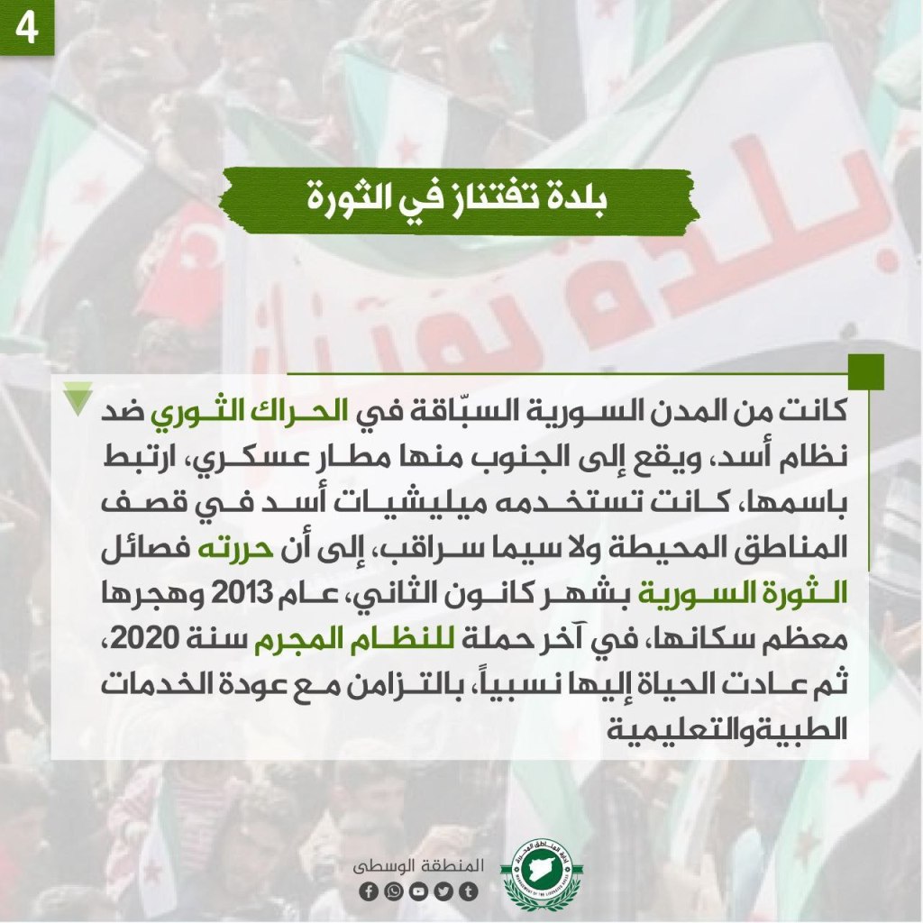
Taftanaz is one of the towns that participated in the revolution. Located to the south of the town is a military airbase that shares the town’s name, and militias aligned with the Assad regime used the airbase to bomb the surrounding areas, paritcularly the city of Saraqib until the airbase was liberated by revolutionary factions in January 2013. Many of its inhabitants emigrated from the area during the last regime campaign in 2020, however many people returned to the area when educational and public goods services returned.
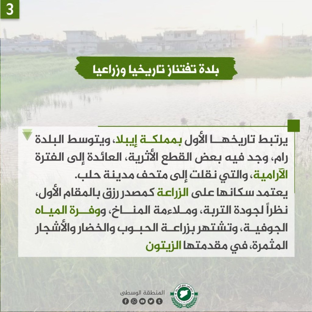
The history of Taftanaz is linked to the Ebla monarchy, in the middle of the town is “Ram,” where some artifacts are located dating back to the Aramaic period, which were connected to the Museum of Aleppo. The ancient inhabitants of the city depended on agriculture for their livelihoods because of the rich quality of soil, the appropriate climate for farming, and the abundance of groundwater. The area is known for grain, vegetable, fruit, and particularly olive cultivation.
Kfar Najd Village

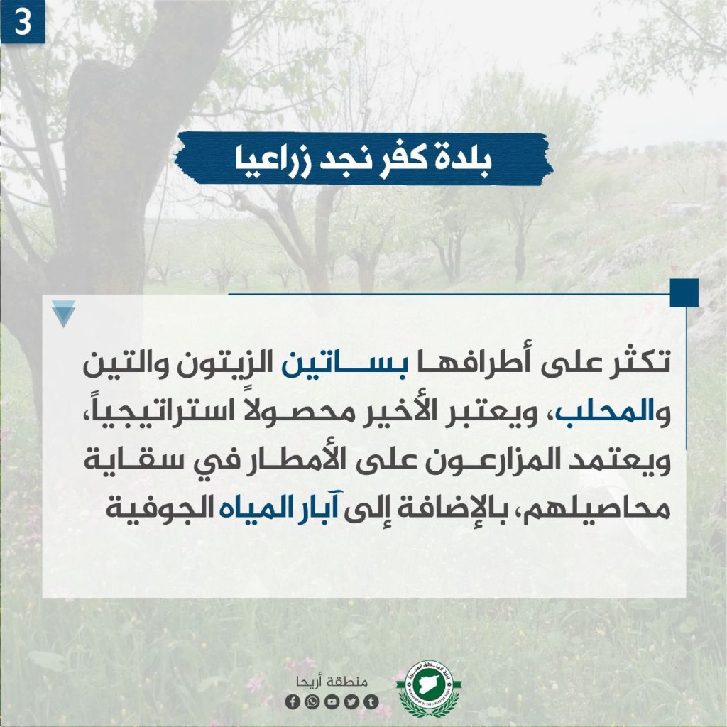
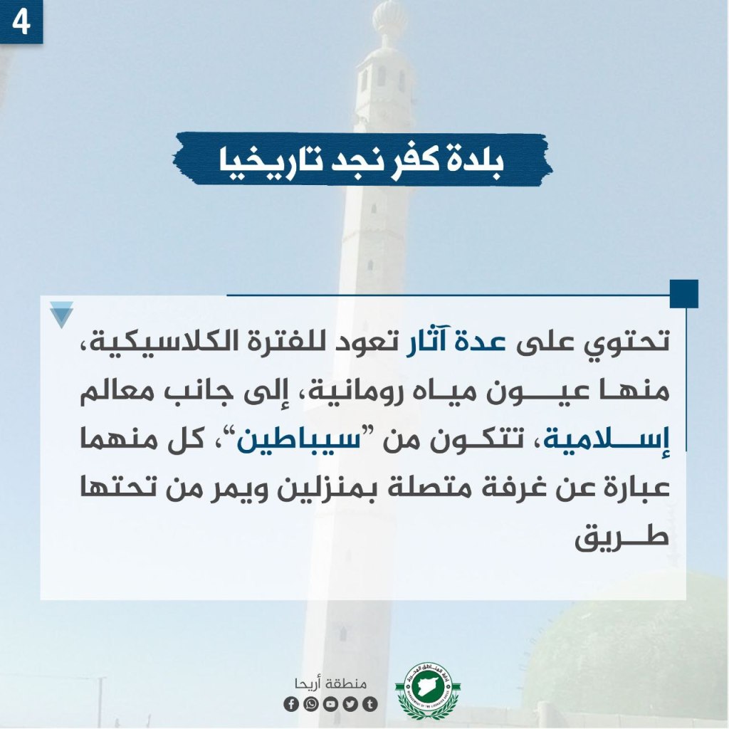

Kfar Najd is a village west of Ariha (1.6km away), and 11 km away from Idlib. The population is around 6,000. The name of the town is originally in Syriac, and is derived from “a farm of high ruins.” Across the village there are olive, fig, and mahleb (spice) groves. Mahleb is a strategic crop for the agricultural industry in Kfar Najd. Farmers depend on rain and groundwater wells for irrigation.
In the village, there are lots of influences from the classical era, including Roman water springs, and also landmarks of Islam, including two “sibateen,” each of which is a room connected to two houses and a road passes under them.
The citizens of Kfar Njad were strongly involved in the Syrian revolution, holding demonstrations calling for the fall of the regime. A militia associated with the Assad regime stormed the town on August 2, 2013, and committed a massacre there that killed dozens of people by burning and shooting.
The Pomegranate Festival: Civilization and the Memory of Liberation
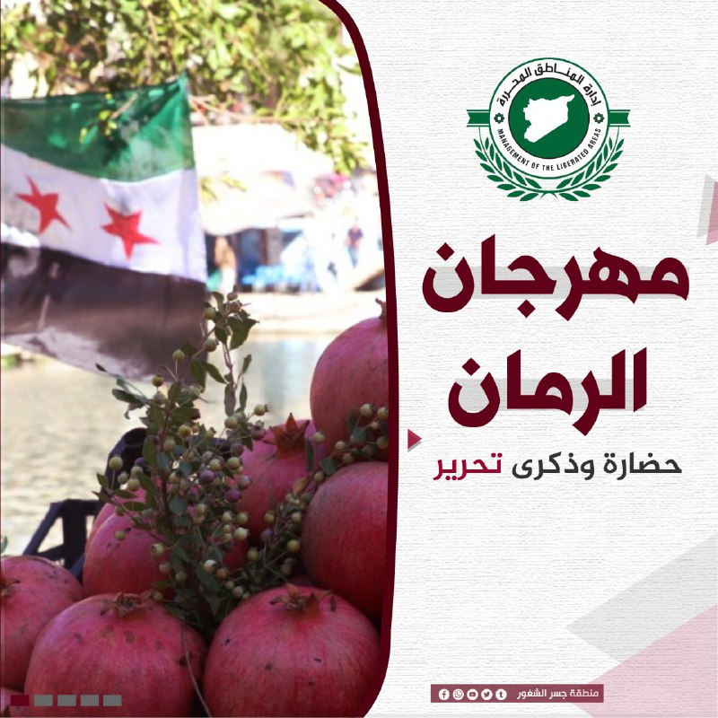
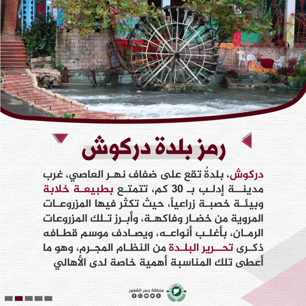
Darkush, a town located on the banks of the al-Asi river, west of the city of Idlib by 30 km, is full of beautiful nature and environment, where agricultural crops, including fruits and vegetables, are abundant. Most prominent of the crops is the pomegranate, and most of its types, which symbolize the season and memories of the liberation of the town from the Assad regime, and it is what makes the occasion special for the people.
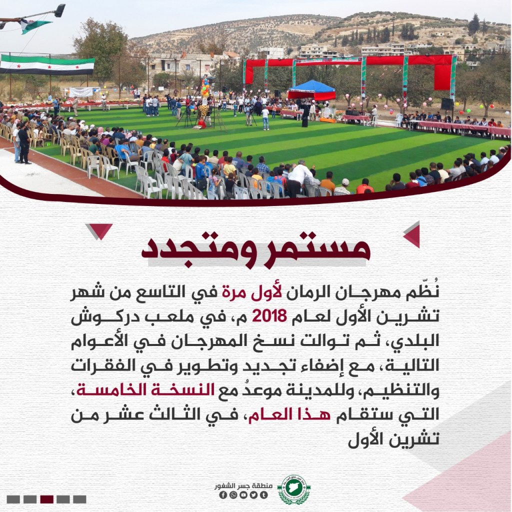
The pomegranate festival was first organized on October 9, 2018 in the Darkush town stadium and continued throughout the next several years, renewing and developing in sections and organizations, and this year will be the fifth edition, on October 13th.
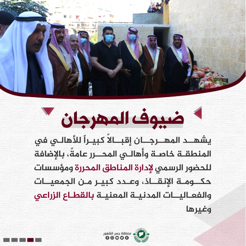
There is a large turnout for the festival in Darkoush in particular but also across the entire “liberated area.” Also, a lot of members of the administration, the Salvation Government, associations, and civil groups associated with the agricultural sector attend.
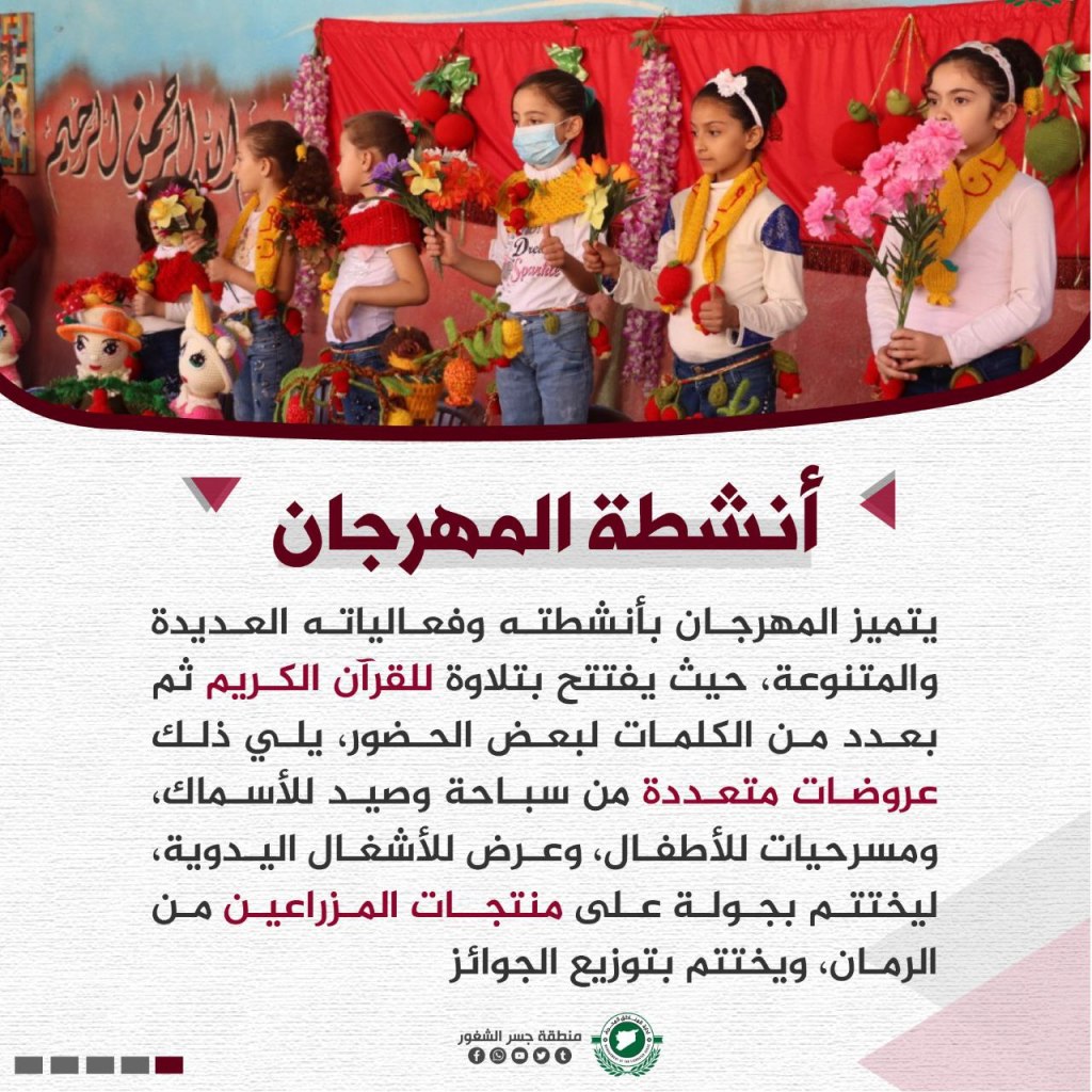
The festival opens with a reading of the Qur’an and with speeches by some of the attendees. Other activities include: performances of swimming and fishing, plays for children, displays of crafts, and prizes distributed to farmers and producers for their crops.
al-Dana City

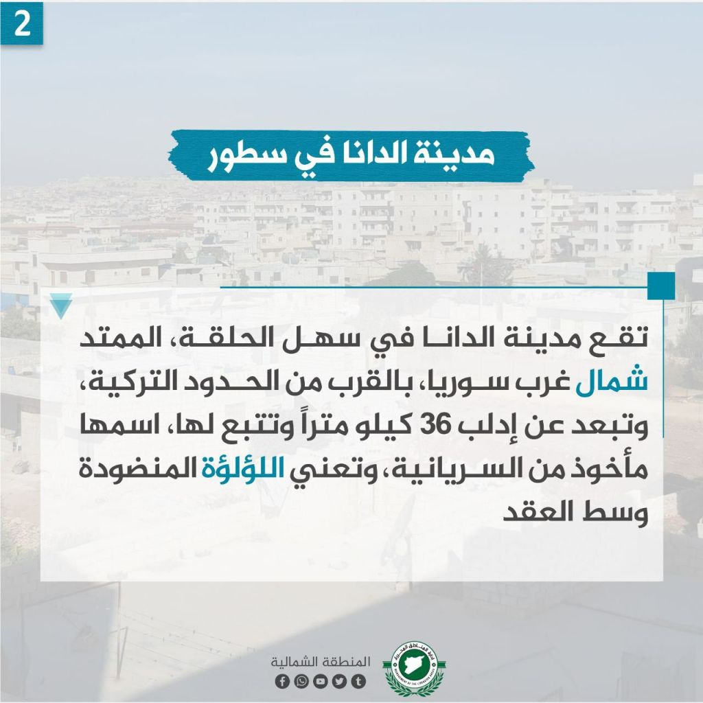
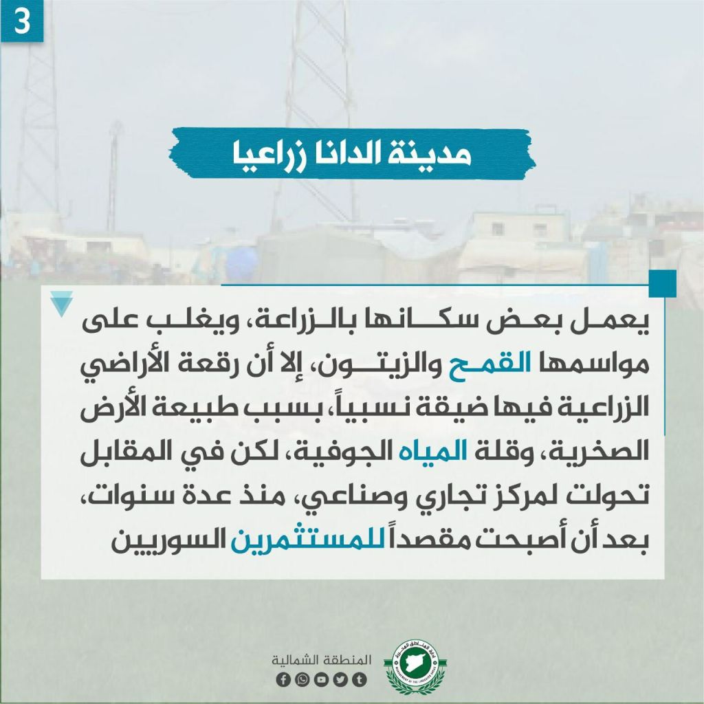
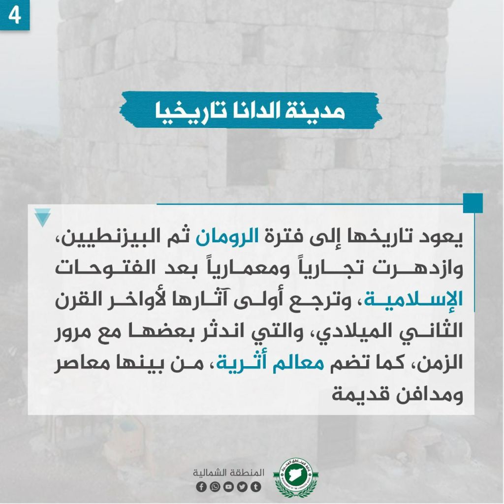
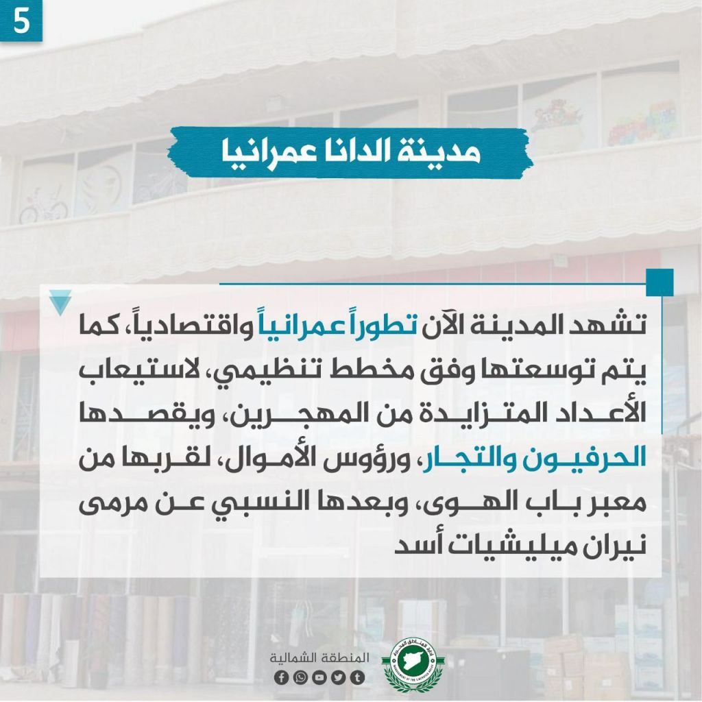
The history of al-Dana originates back to the Roman era (late 2nd century CE), with mentions during the Byzantine and then the Islamic conquests, where it was successful commercially and architecturally. Some residents of Al-Dana work in agriculture, particularly in growing wheat and olive crops; however, the land is rocky and there’s limited groundwater. However, it has turned into a commercial and industrial center several years ago after it became a destination for Syrian investment. The city is now a hub for urban economic development and is being expanded organizationally to accommodate more displaced people. The city is attractive to craftsmen, traders, and capital due to its proximity to the Bab al-Hawa crossing and its relative distance from the fire of Assad’s militias.
Darat ‘Iza City
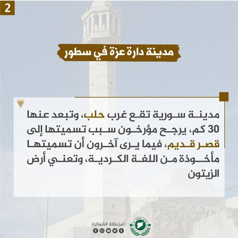
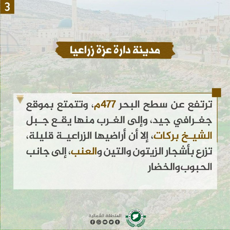
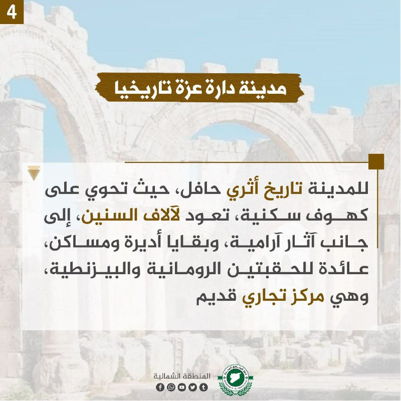
Darat ‘Iza is located 30 km west of Aleppo. Historians’ believe that it was the location of an old palace. Others believe that its name is of Kurdish origin, meaning “the land of olives.” The city is located at 477 meters above sea level in a good geographic location, as to the west is al-Shaykh Barakat Mountain and its land is good for farming. In Darat ‘Iza, farmers tend to olive, fig, and grape trees, as well as other grains and vegetables.
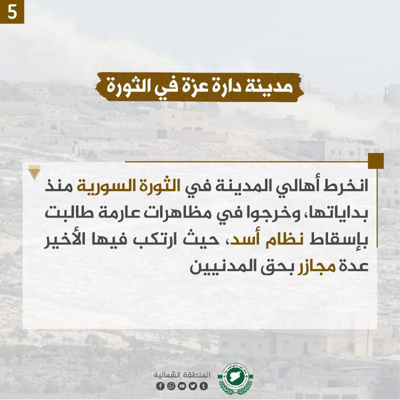
The city also contains residential caves from thousands of years ago as well as Aramaic ruins, the remains of Roman and Byzantine monasteries and dwellings. It was also an ancient trade center. During the Syrian revolution, the city played an important role, as its people participated in massive demonstrations against the Assad regime, which later committed massacres there.
Wadi Murtahun
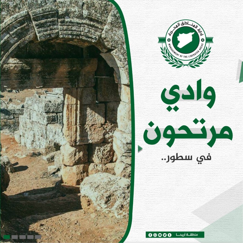

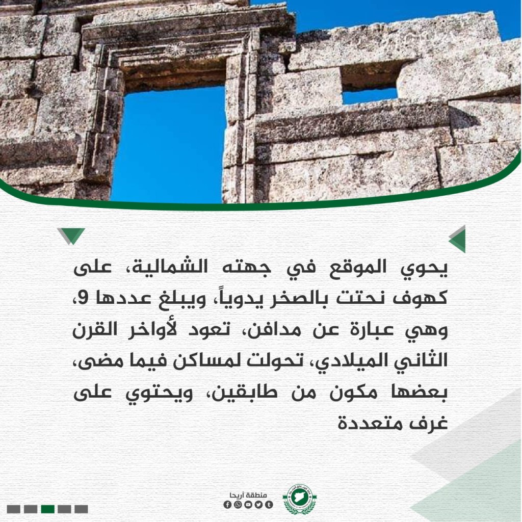

Wadi Murtahun is an archaeological site located in Jabal al-Zawiya, in the southern countryside of Idlib. The ruins date back to the Roman and Byzantine eras, and are surrounded by other archaeological sites, including the al-Barah ruin that is located 3 km. On the northern side, it contains 9 caves that were carved by hand from the 3rd century CE.
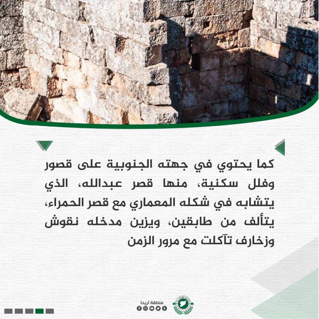
On its southern side, there are palaces and ancient villas, including the ‘Abd Allah Palace, which contains two floors and the entrance is decorated with inscriptions that have eroded over time. The Murtahun ruins are one of the most beautiful historical sites in the Ariha region, which has tons of sites that are located in Idlib as well, hosting a third of Syria’s antiquities. Most of the sites are registered in the UNESCO world heritage list.
Armanaz City

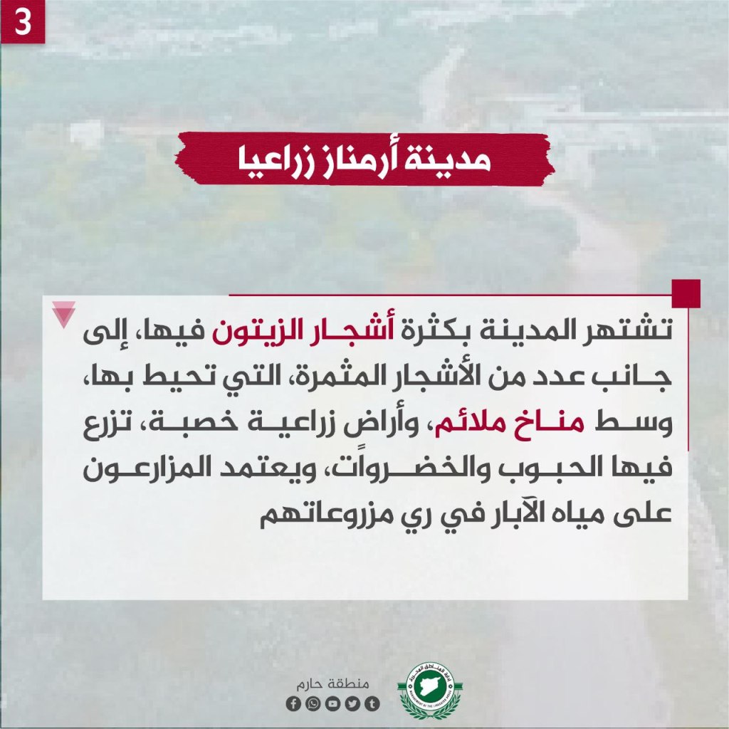
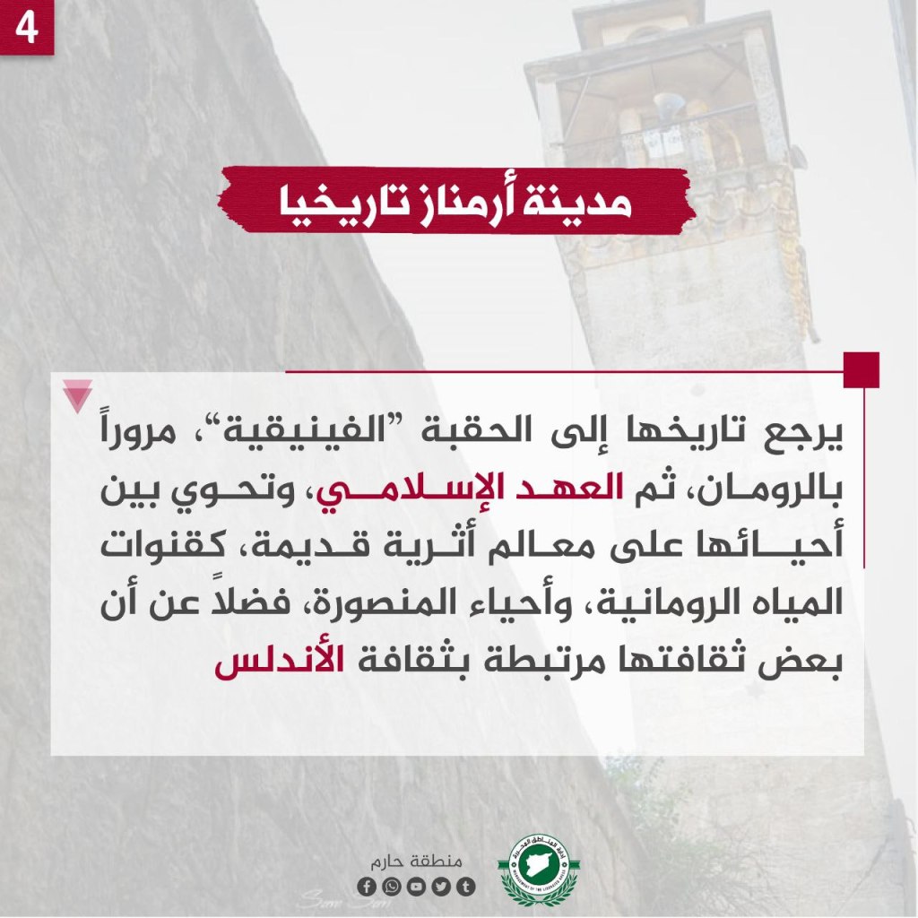

Armanaz is a Syrian city, located in the Harim area, in the northern Idlib countryside, about 55 km from Aleppo. Some historians believe its name is Syriac in origin, meaning “land of the king Naz,” while others view the name as meaning the committee in the Armenian language. The city is covered in many olive trees, next to many fruitful trees, as they are located in a favorable climate and fertile agricultural lands. Grains and vegetables are grown there, and crops rely on irrigation from well water.
The history of Armanaz dates back to the Phoenecian period, continuing through the Roman, and then to the Islamic era. The city contains between its neighborhoods an ancient archeological landmark of Roman water channels and the Mansoura neighborhoods, as well as some of its cultures are connected to the Andalucia region. The city held an honorable position within the revolution, as their inhabitants went out in demonstrations since 2011 calling for the fall of the Assam regime, and in 2017, more than 50 civilians from the city were killed by a bombs from regime planes.
The Town of Bidama
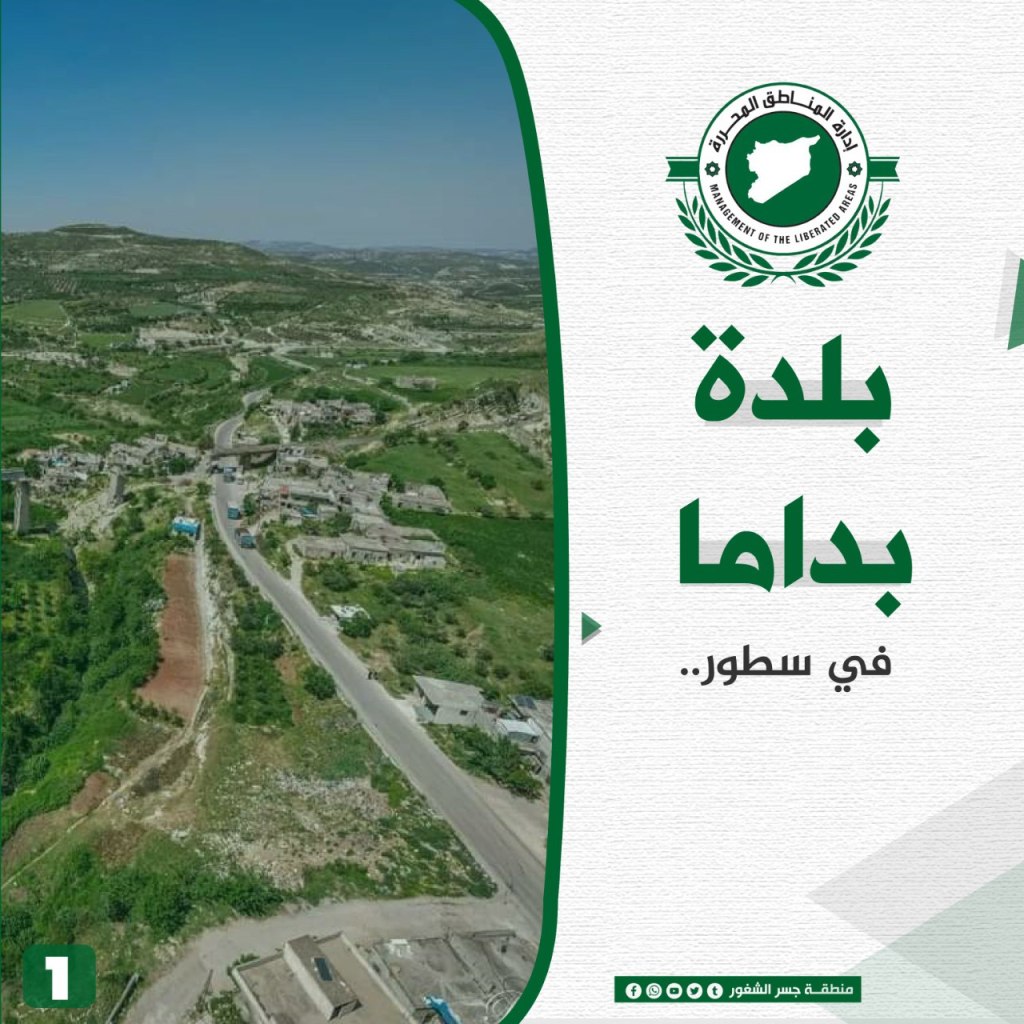

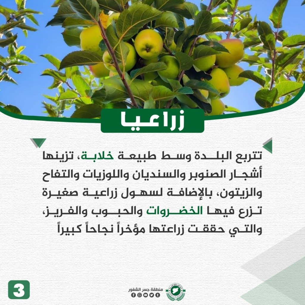
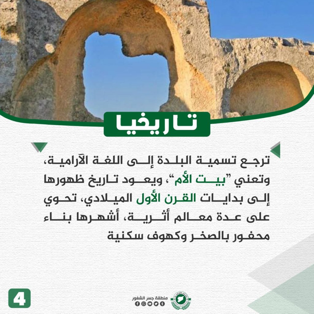
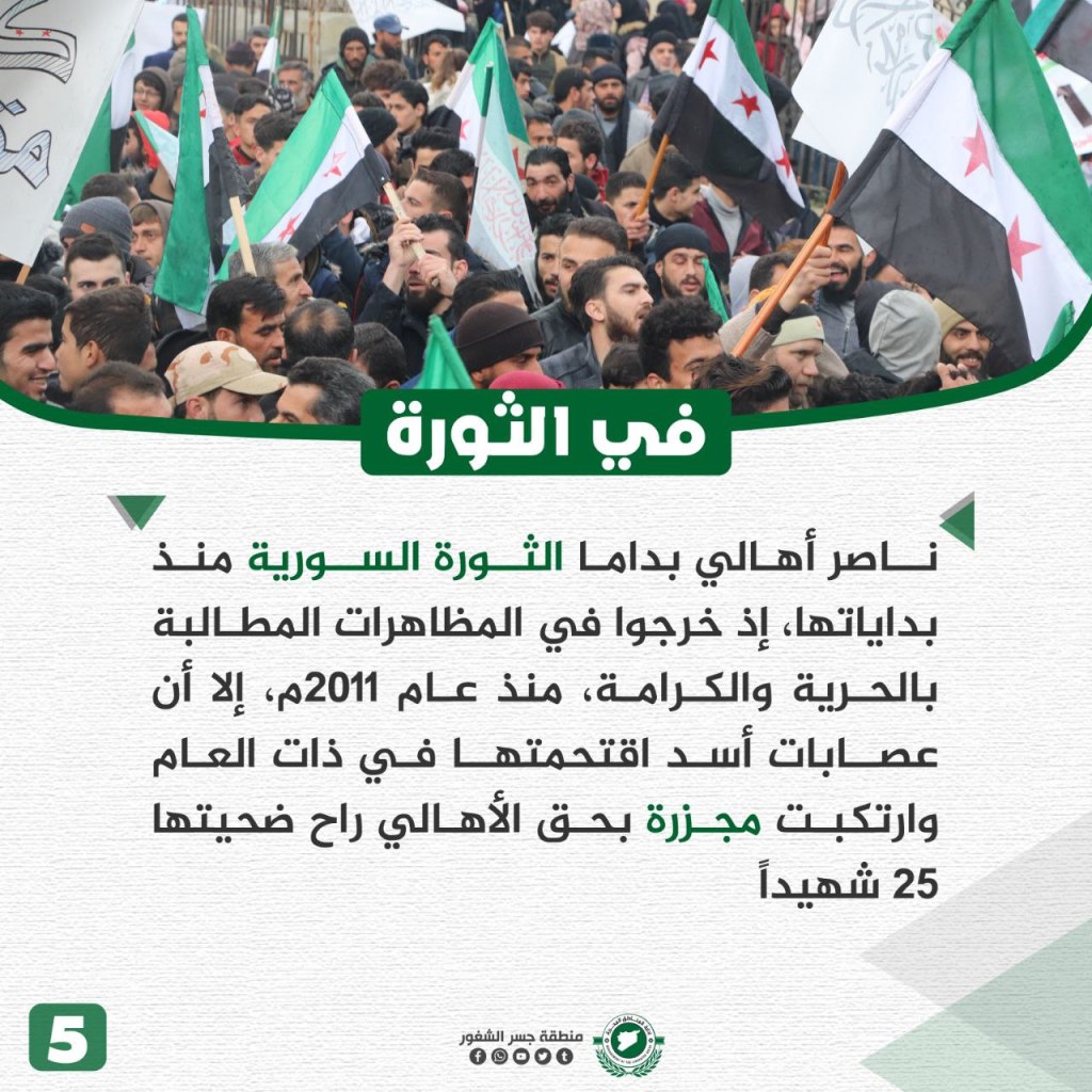
Bidama is a town in the countryside of Jisr al-Shughur and is located on the road between Aleppo and Latakia, and 40 km west of Idlib. The town is located about 500 meters above sea level, and its weather is beautiful in the summer and cold in the winter. The nature around the town is “amazing,” and filled with olive shrubs and vegetable, grain, and strawberry crops. The name of the town, “Bidama,” is Aramaic in origin and means “home of the nation.” The town’s history began in the first century CE, and the town contains several archeological sites, the most famous of which is a building made out of cut-up rocks and caves. The town’s residents participated in the revolution from the beginning when they participated in street demonstrations asking for decency and freedom. In 2011, the Assad regime “invaded” the town and committed a massacre against its people, killing 25 people.
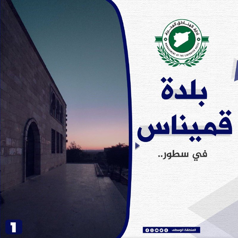
The Village of Qminas
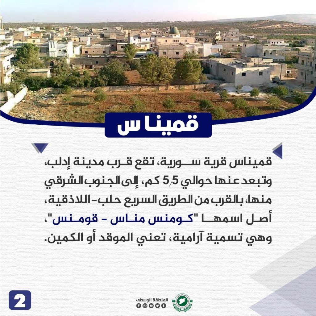
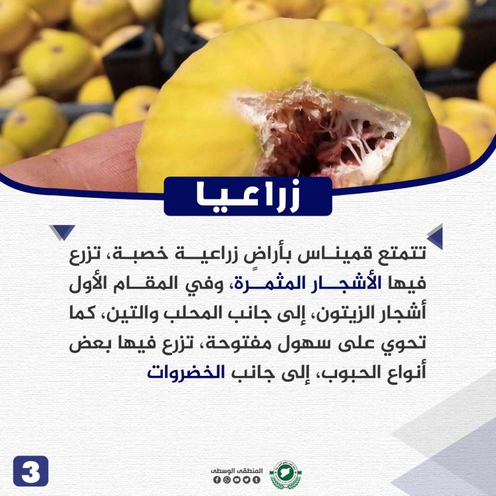
Qminas is located about 55 km southeast of the city of Idlib and is near the Aleppo-Latakia highway. The city’s name is Aramaic in origin, meaning “the hearth” or “the ambush.” The town has fertile agricultural land, bearing fruitful trees, most prominently olive bushes, in addition to mahlab and fig plants. Qminas also has plains where some types of grains and vegetables are grown. The history of the town dates back to the Aramaic civilization, and the meaning of its name is connected to the name of a Syriac building mentioned in a document kept in the Museum of London. Qminas had an honorable role in the Syrian revolution, as its residents joined the protests in its first months against the Assad regime. Dozens of its residents were killed since the beginning of the uprisings and many have been displaced.
al-Marj al-Akhdar
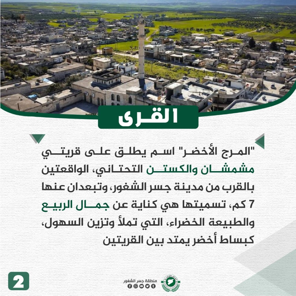
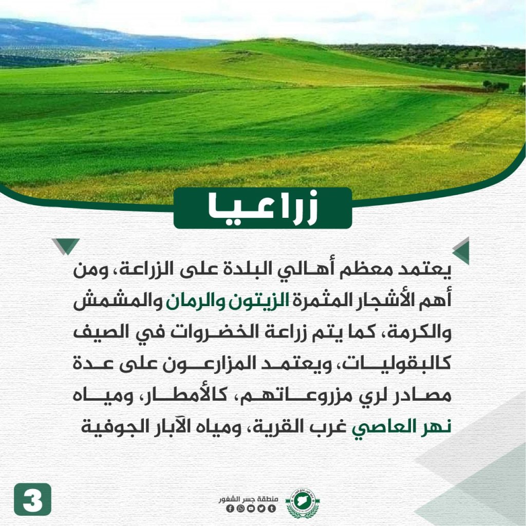
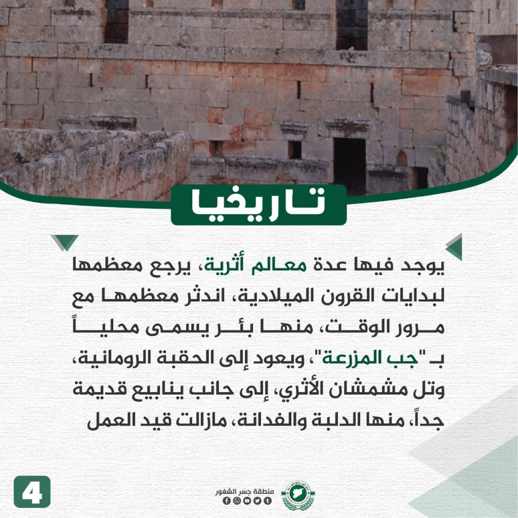
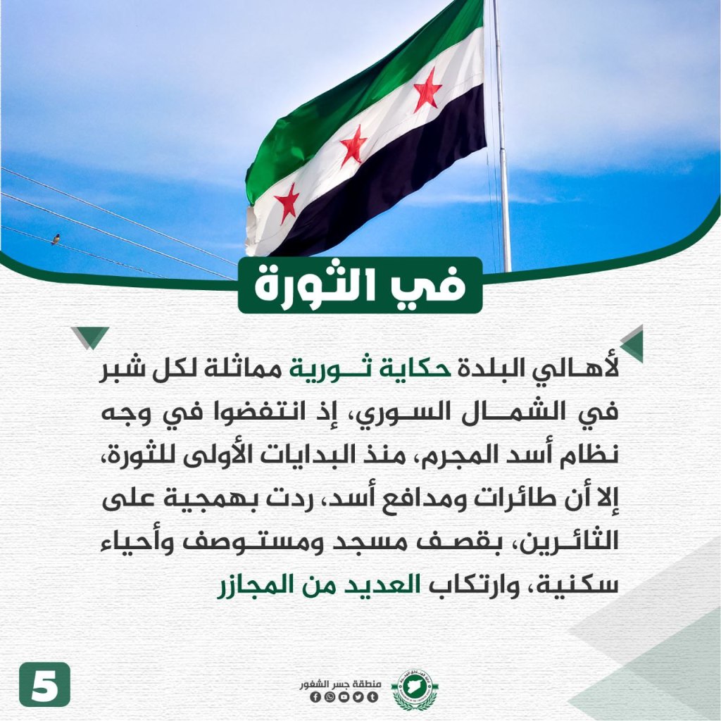
“The Green Meadow/al-Majr al-Akhdar” is a name that refers to the area between the two villages of Mishmashan and al-Kustan al-Tahtani located 7 km away from Jisr al-Shughur. Its name is a metaphor for the beauty of the spring and the green nature that adorns the plains as a green rug between the villages. Most of the people of the area rely on agriculture, including the most important crops from the fruitful olive, apricot, chestnut, and pomegranate trees, and also rely on vegetable production in the summer, including crops such as legumes. The crop production relies on rainfall, the water from the al-Asi river that lies west of the village, and on underground wells. Several important historical sites are located in the village, dating back to the beginning of the common era. The sites include one well known locally as “Jib al-Muzara’,” dating back to the Roman era, the archeological hill of Mishmashan, and ancient springs, including al-Dilbah and al-Fidanah, still running today. In the revolution, the people of the area had an important role, going out against the regime from the beginning of the uprising, through the bombing campaign by the Assad regime in which the forces targeted a mosque, a clinic, and residential neighborhood, “committing many massacres.”
The Village of Muntaf (Moataf)
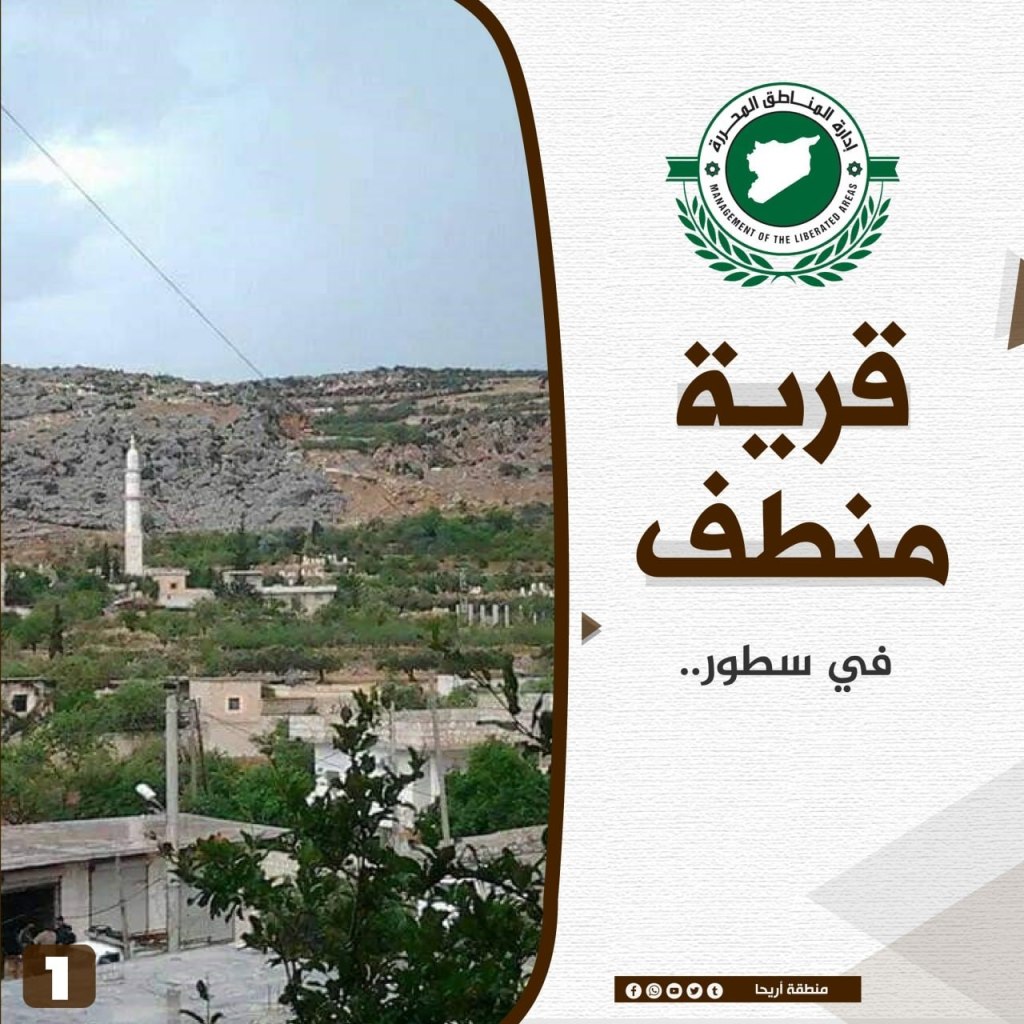
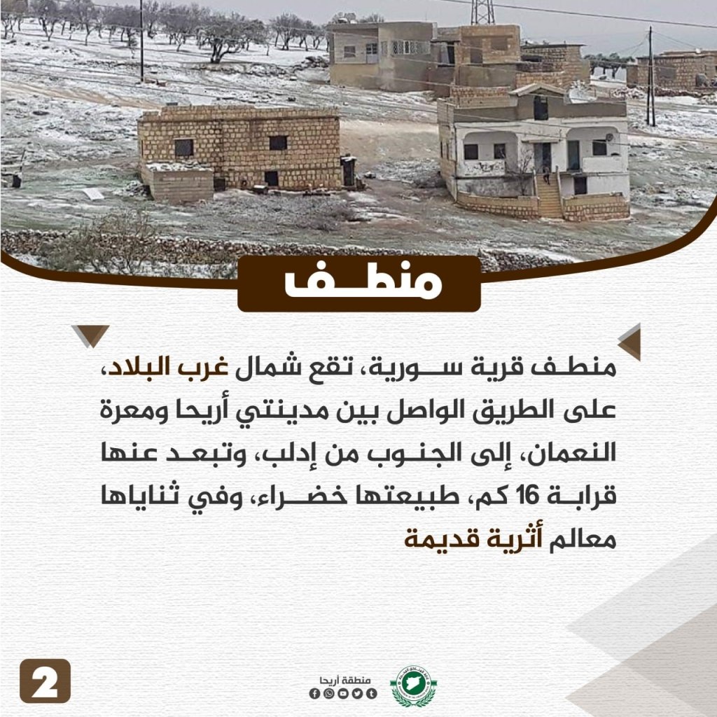
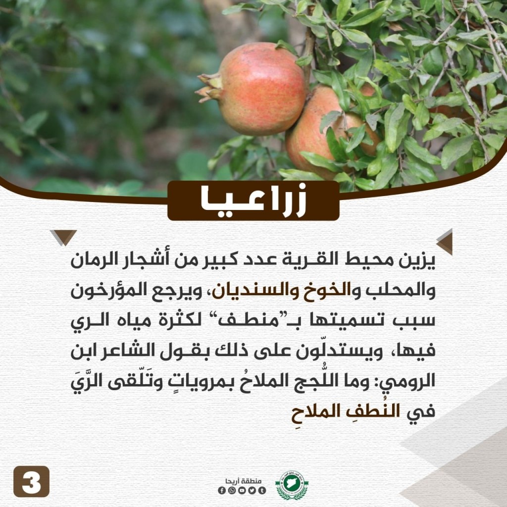
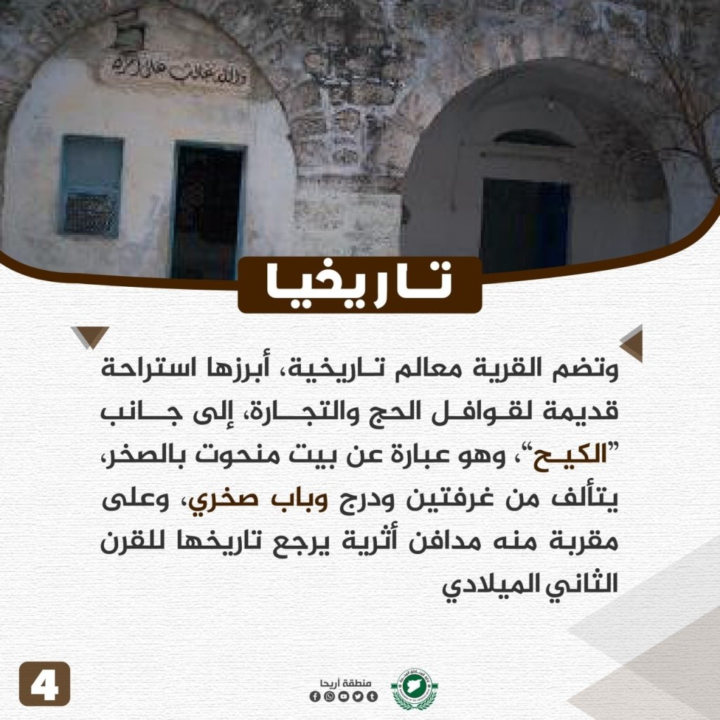
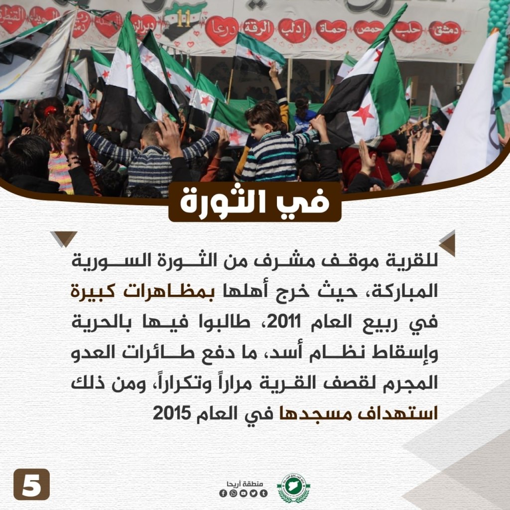
Muntaf (Moataf) is a Syrian village located in the northwest area of the country on the road leading between Ariha and Ma’arat al-Nu’man, about 16 km to the south of Idlib. It has green vegetation as well as ancient monuments. Surrounding the village there are many pomegranate, mahlab, peach, and oak trees. The most notable historical site in the village is an old rest area for Hajj caravans and merchants. Next to it is “al-Kih,” a house carved into the rock, consisting of two rooms, a staircase, and a door. Nearby are ancient burial sites dating back to the second century C.E. During the revolution, the village had an honorable role in large demonstrations during the spring of 2011 against the Assad regime, leading the regime to bomb the village repeatedly and target its mosque in 2015.
Halluz Village
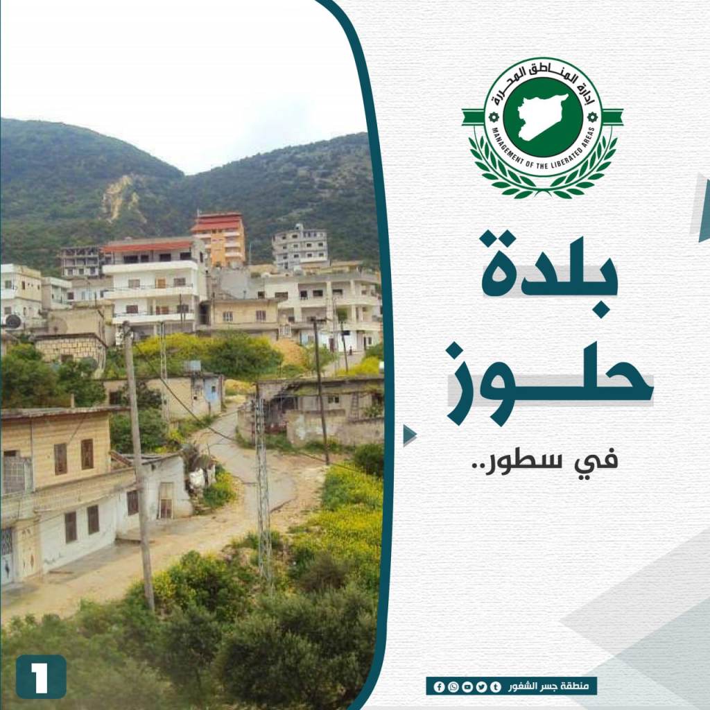
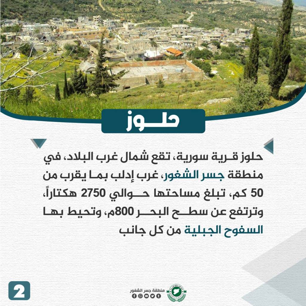
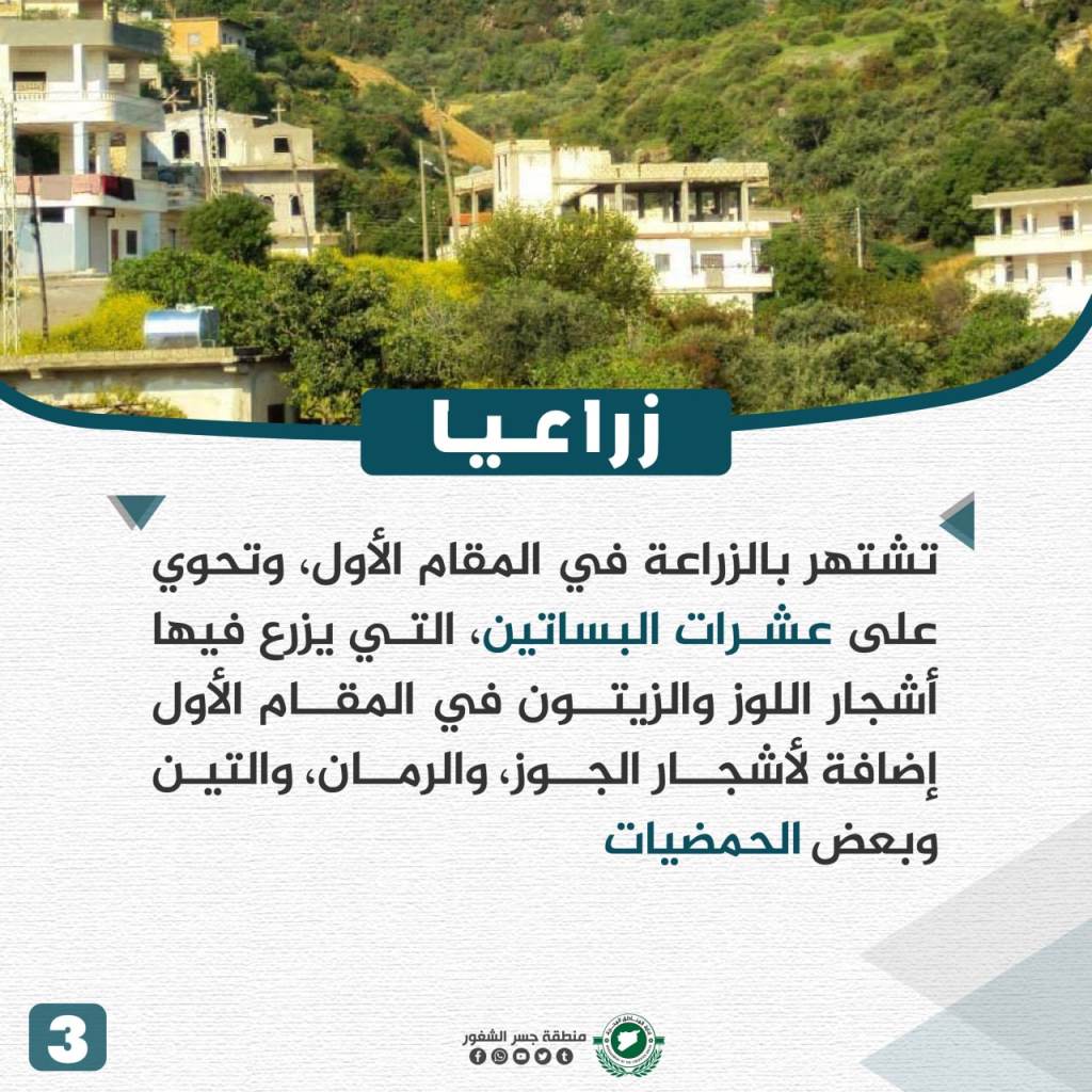
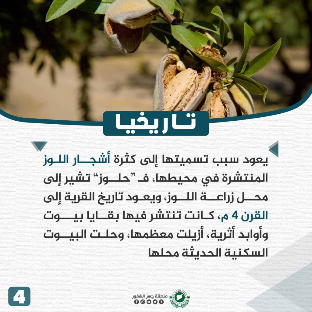
Halluz is located in northwestern Syria in the Jisr al-Shughur area, 50 km west of Idlib. The town is a total of 2,750 hectares and is located about 800 meters above ground. Surrounding the town are mountain slopes on all sides. The town’s economy is reliant on agriculture and is comprised of dozens of orchards, growing almonds, olives, walnuts, pomegranates, figs, and some citrus fruits. The town is named for its almond trees and the almond store that originated there. The town’s history originates to the fourth century CE and some ancient homes are still there in addition to modern homes and stores. During the revolution, the Assad regime waged several bombardments on the town, forcing most residents to abandon it along with the surrounding areas.
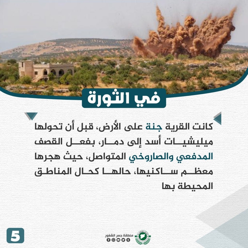
Afes Village

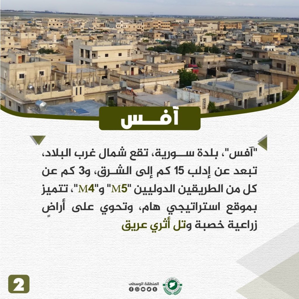
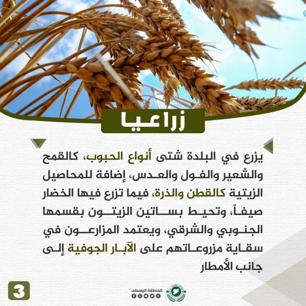
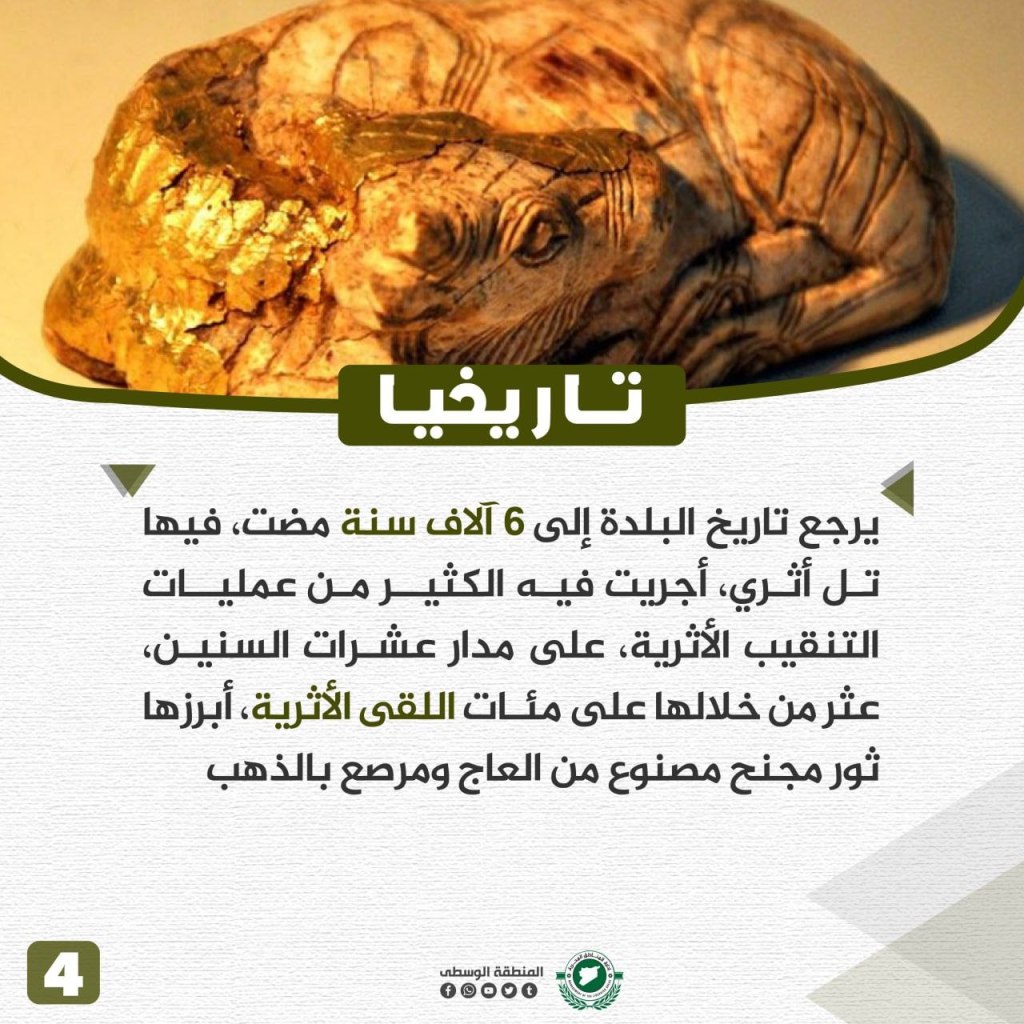
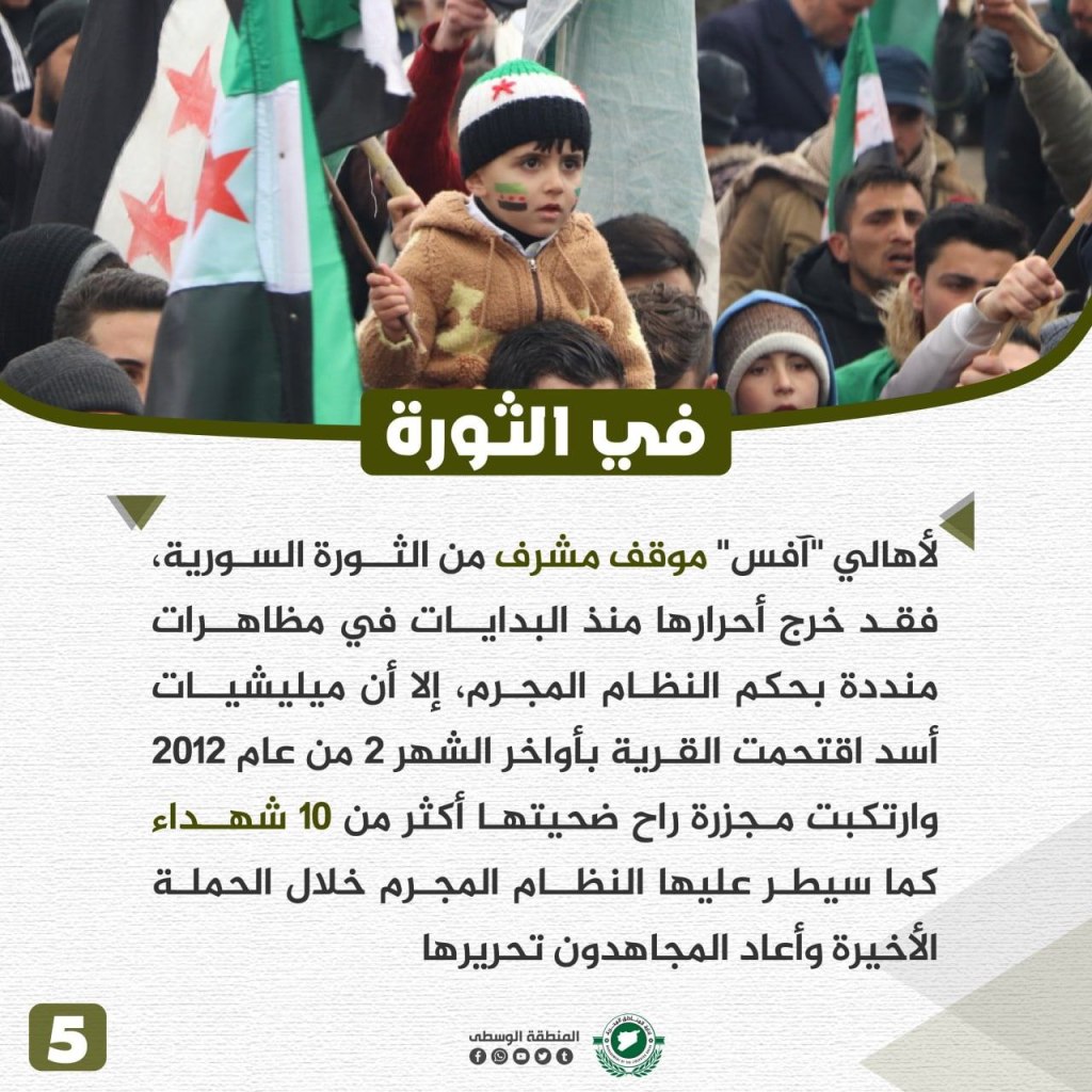
Afes is located in the northwest of Syria about 15 km east of Idlib and 3 km down the M4-M5 road. The town is strategically located and is highly important due to its fertile agricultural lands and the ancient hill located there. Barley, beans, and lentil crops are plentiful there, in addition to crops such as cotton and corn. In the summer, vegetables grow, and on the east and south sides of the town, olive groves bloom. The town relies on underground wells and rainwater to irrigate crops. The town’s history dates back to 6,000 years ago. Many archeological excavations have been conducted there and notable discoveries have been made, including a “winged bull made of ivory and gold.” During the revolution, the Syrian people held an honorable position among the demonstrators, fighting against Assad’s militias when they surrounded the town in February 2012, ultimately killing 10 citizens. The town was controlled by the regime until the mujahidin liberated it.
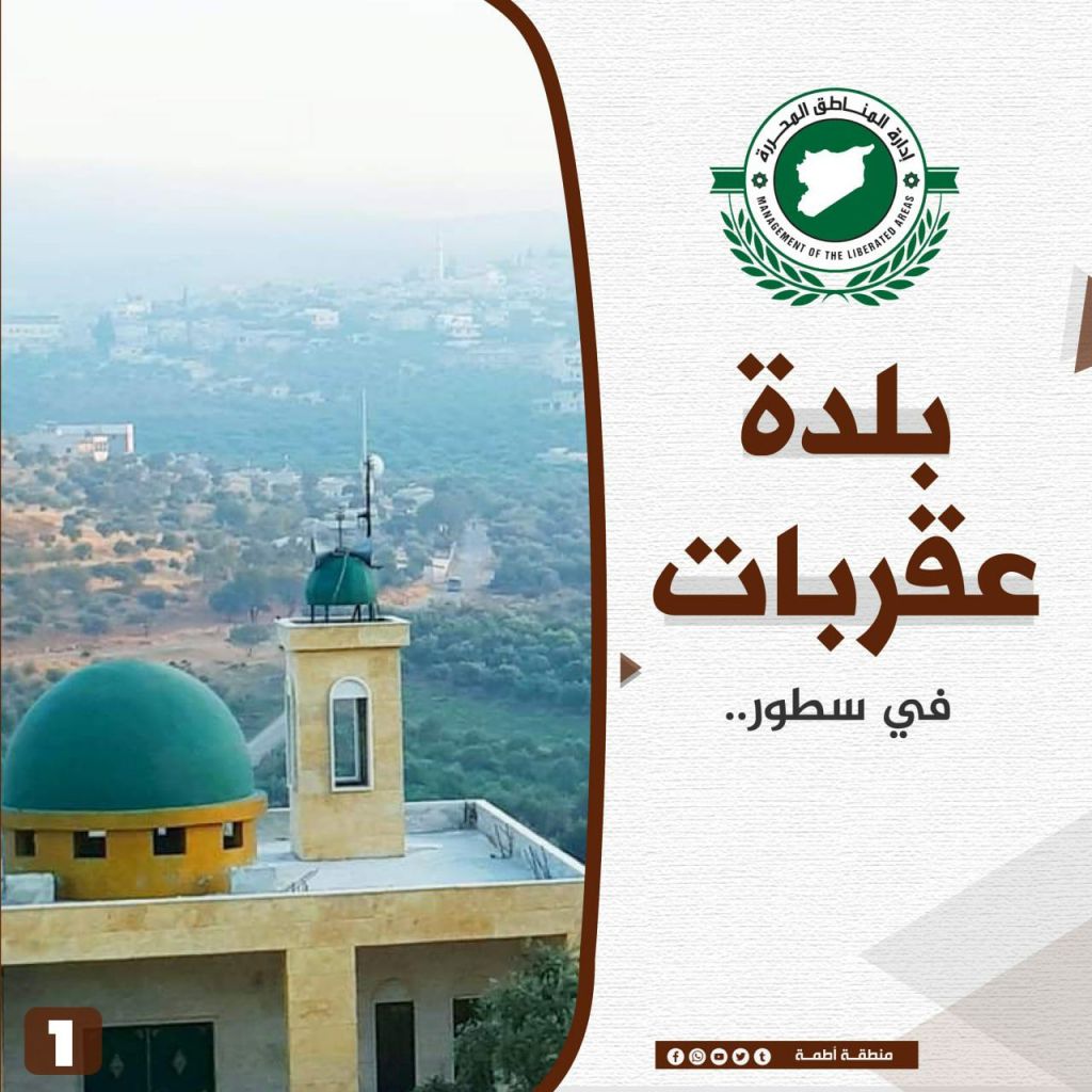
Aqrabat Village
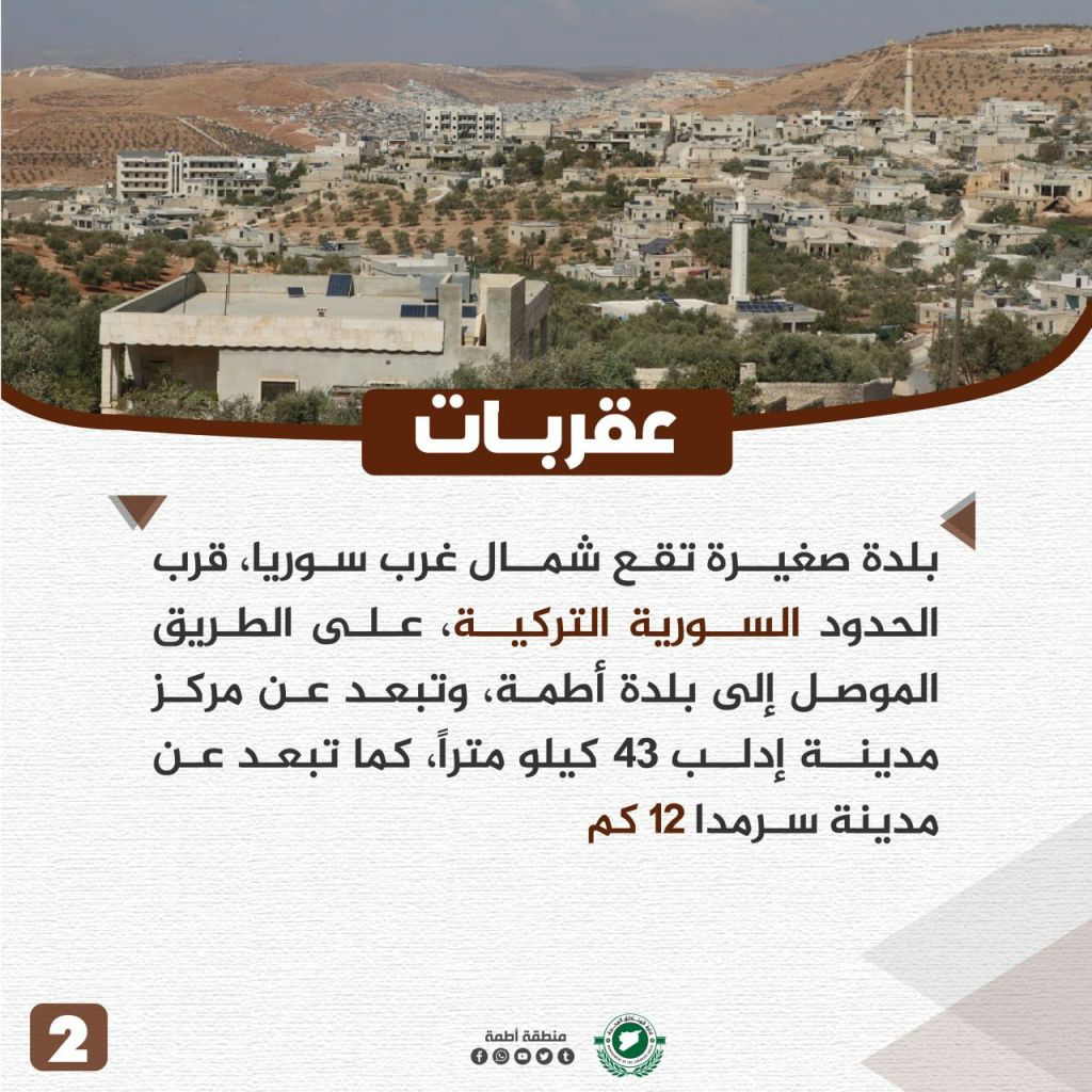
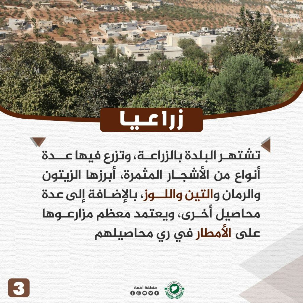

Aqrabat is a small town located in northwest Syria, near the Turkish-Syrian border, on the way to the town of Atme. Aqrabat is located about 43 km from the city of Idlib and 12 km from Sarmada. The history of the town of Aqrabat originates before the common era. Aqrabat is famous for its agriculture, consisting of many fruitful trees, most notably pomegranate, fig, and almond trees. The town’s crops are reliant on rain water for irrigation. Peasants found ancient stone carvings there, shedding light on the deepness of its history. Its name is also ancient, consisting of two parts, “araq” and “bat,” meaning grape fermentation. Since the start of the revolution, Aqrabat has attracted thousands of displaced people fleeing the regime, and has since become a focus of the Salvation Government’s attention, as several projects have been established there to meet the needs of an increasingly growing population.
Kafr Takharim City


Kfar Takharim is located on a mountainous plateau surrounded by mountains on its east and west sides. There are several theories of its name, but most likely it relates to its geographical features, and the presence of many valleys and mountain cracks in it. “Kfar” means the farm, while “Takharim” is the plural of valley, and by combining the two words, the name means “the farm of the valley.” The town is full of beautiful nature, making it a destination for many of the residents of the surrounding areas, especially during the summer. Most of the residents of the town work on farms, the most famous crops of which are olives, almonds, figs, grapes, nuts, and apricots.
Many ancient archeological sites are located there, including an old mosque dating to the 2nd century Hijri. The city also has an ancient covered market similar to the old markets of Aleppo. It is the city from which the leader of the Jabal al-Zawiya revolution, Ibrahim Hanano, fought against the French occupation. The city’s inhabitants have demonstrated against the Assad regime since 2011, and suffered several aerial bombings, the most famous of which was the Kfar Takharim Surgical Hospital massacre in 2017, which killed and injured dozens in the vicinity.
Kafr Karmin Village


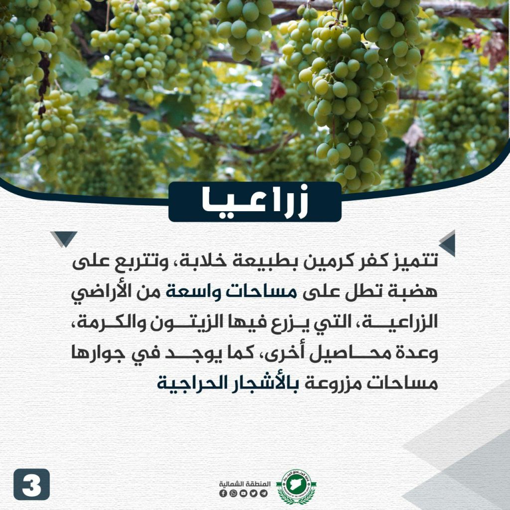

Kafr Karmin is a Syrian village located in the Jabel Sma’an area in the western countryside of Aleppo, about 4 km west of the city of al-Atarib. The village is called “Kafr Karmin” because of its notoriety in the cultivation of the “Karamah” grape trees. Its name means “the Karoum farm.” The town is known for its wonderful environment, situated on a hill overlooking a wide space of agricultural lands where olives and grapes are grown, in addition to other crops. Furthermore, around the town, there are forests full of trees. In the town, there remains several archeological sites originating to the 6th century C.E. One of the most notable is a cobblestone Roman road that is about six meters wide, some of which is made of the ruins of grape presses. During the revolution in 2011, the citizens of the town participated in demonstrations in al-Atarib. The town faced repeated bombings by Assad’s militias throughout the years of the revolution.
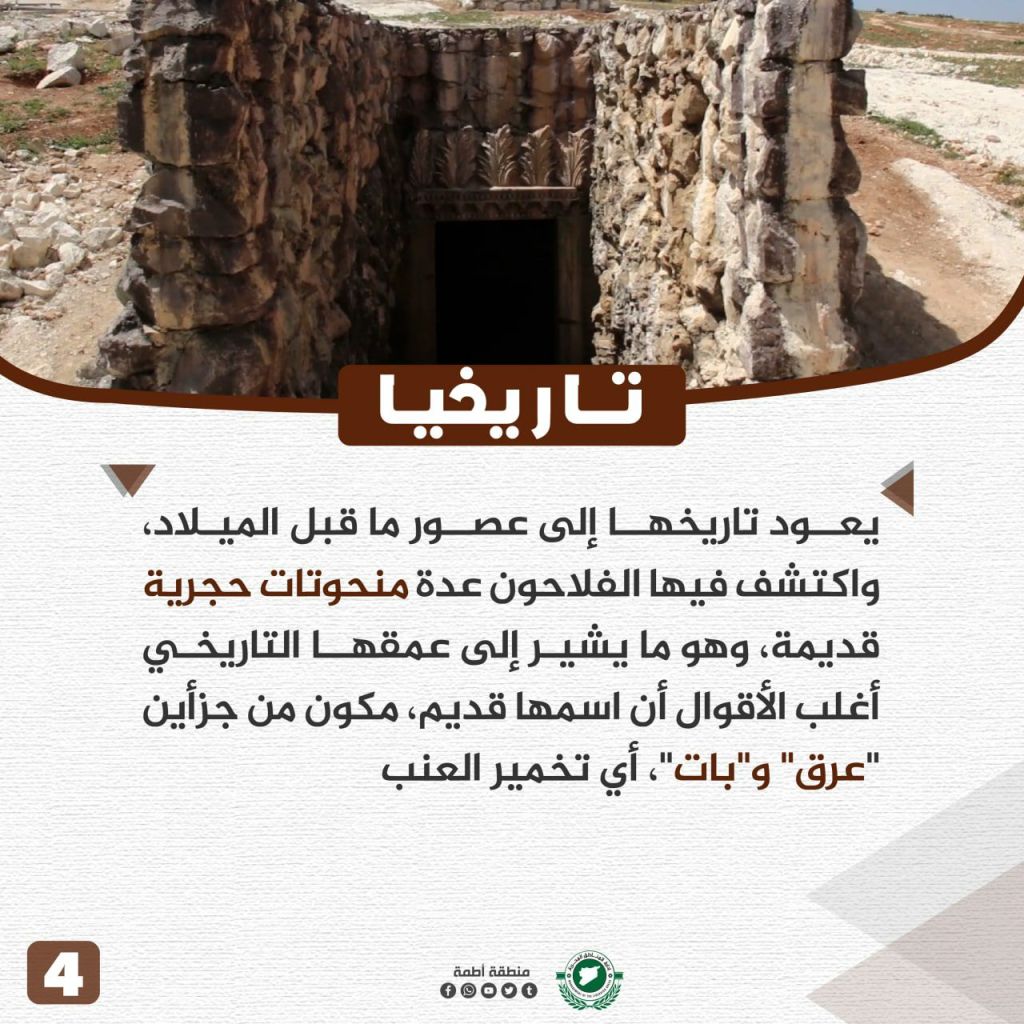
Kafr Dariyan Village

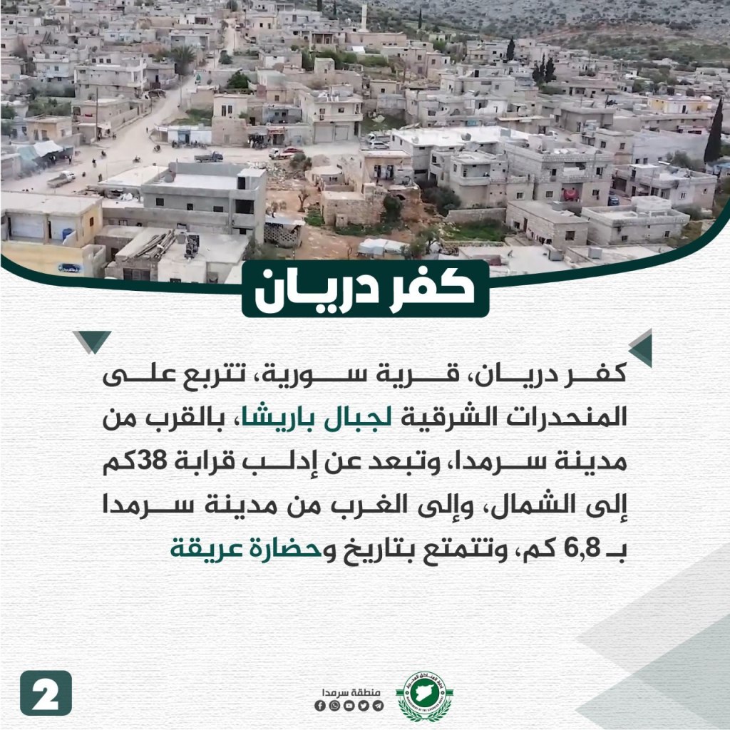

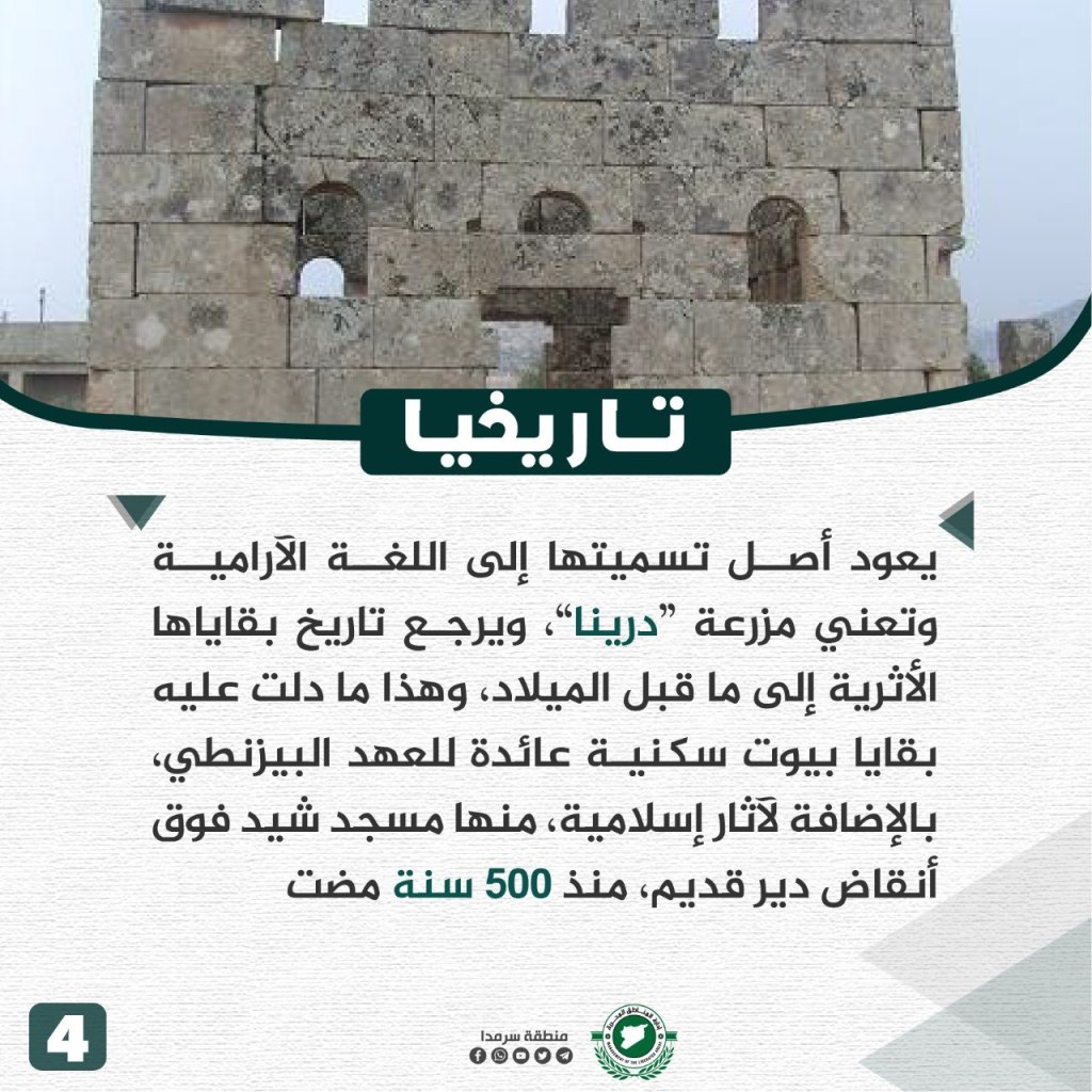
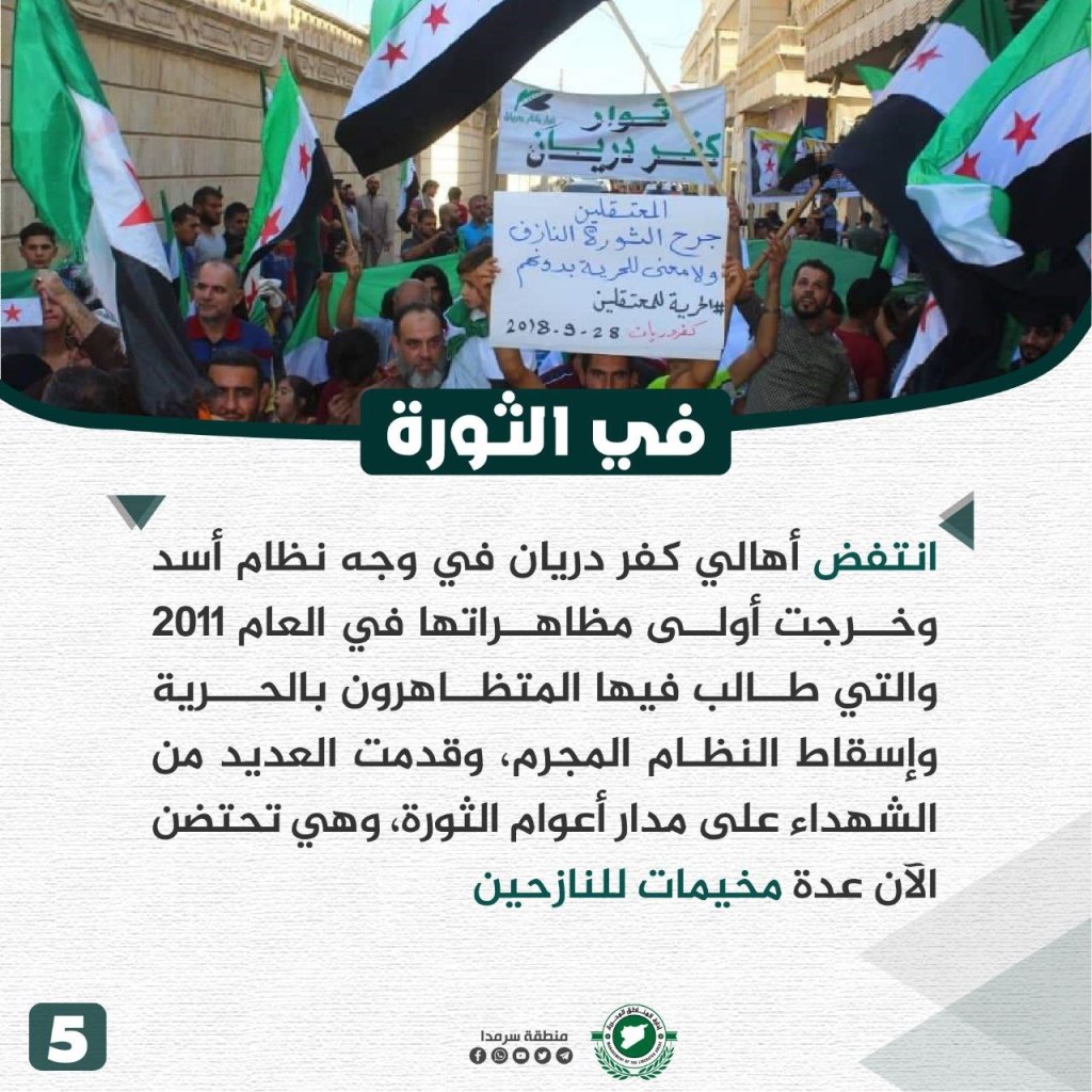
Kfar Dariyan is located on the eastern slopes of the Barisha mountain near the city of Sarmada (6-8km) and about 38 km north of Idlib. The city’s environment is mountainous, but this does not stop the people from cultivating it. The main crops are olives and grapes in addition to some seasonal crops. The village relies on underground well water for drinking and agriculture. The town’s name is Aramaic in origin and means the crop “drina,” originating to ancient history before the common era. Some of the buildings in the village date back to the Byzantine and Islamic eras, including a mosque that was built on the ruins of an old monastery about 500 years ago. During the revolution, the people of Kfar Dariyan have participated in protests since 2011, asking for freedom and the fall of the regime. The town suffered from many casualties and now hosts several camps for the displaced.
al-Najiya Village
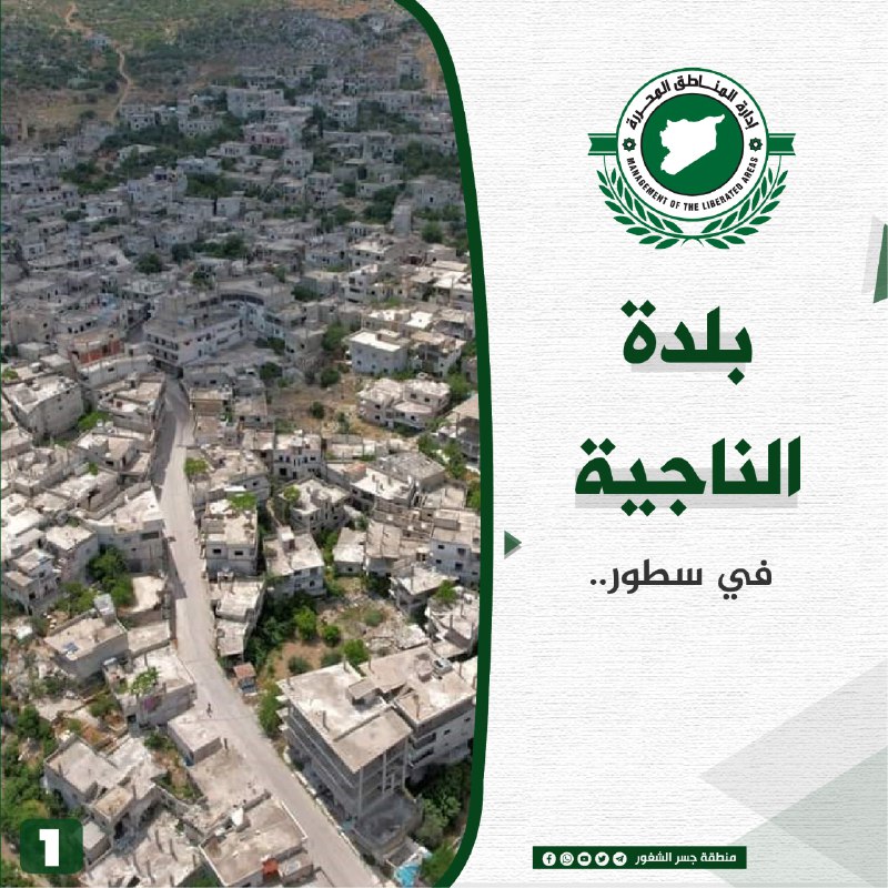
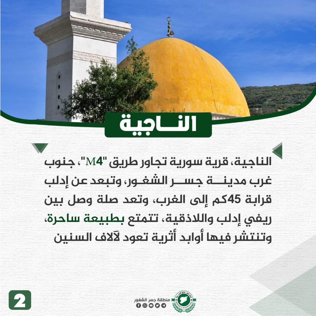

al-Najiya is located on the M4 road, southwest of Jisr al-Shughur and about 45 km west of Idlib. The town serves as a link between rural Idlib and Latakia. al-Najiya has a charming nature and is known for its archeological remains dating back thousands of years. The town is known for its variety of fruit trees, including apple, olive, orange, almond, and pomegranate orchards, in addition to other vegetable crops. The people rely on rain and well water to grow their crops. The name al-Najiya is Aramaic in origin, meaning “west Kafr Najd.” Its name indicates a village with prominent ruins, with sites that date back to before the common era, including the Dabdabah Cave, created in the Roman era. The town has been subject to mass displacement due to repeated airstrikes by the Assad regime, including cluster and barrel bombings, as punishment for rebellion. Dozens of citizens died for the revolution.
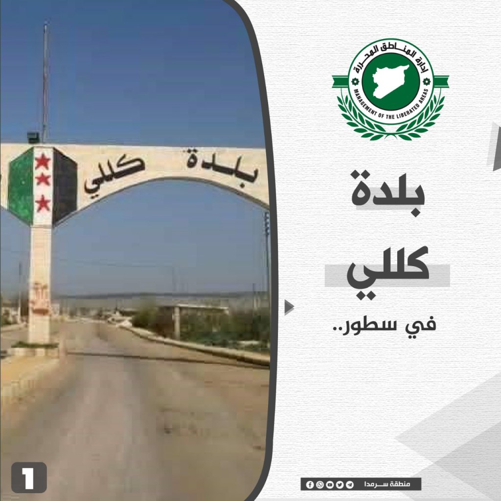
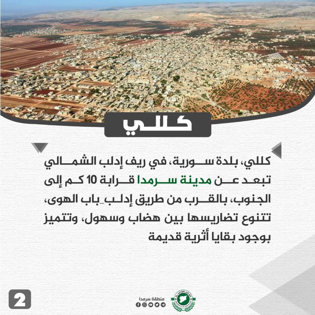
Killi Village
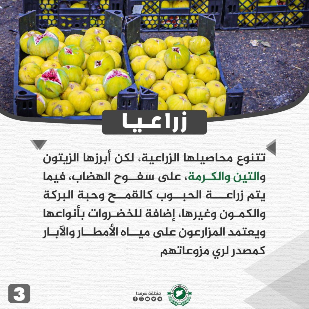
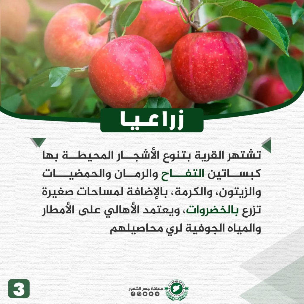
The town of Killi is located in the northern countryside of Idlib, about 10 km south of Sarmada and near Bab al-Hawa. Its terrain varies between plateaus and plains, and is characterized by the presence of ancient archeological remains. Its agricultural products vary, but the most notable are olives, figs, and grapes. On the slopes of the hills, grains such as wheat, black cumin, and cumin, etc. are grown, in addition to a variety of vegetables. The agricultural sector relies on rain and well water to grow crops.
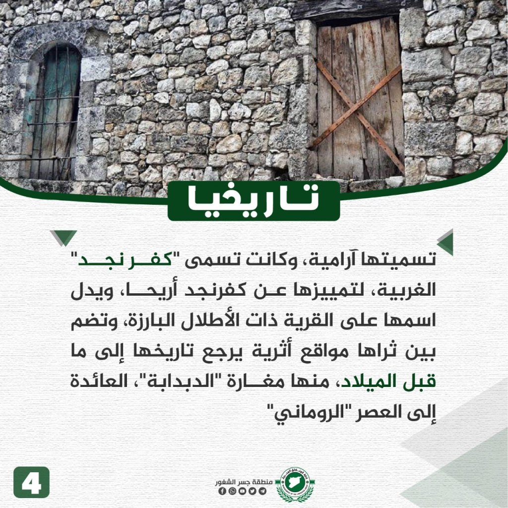
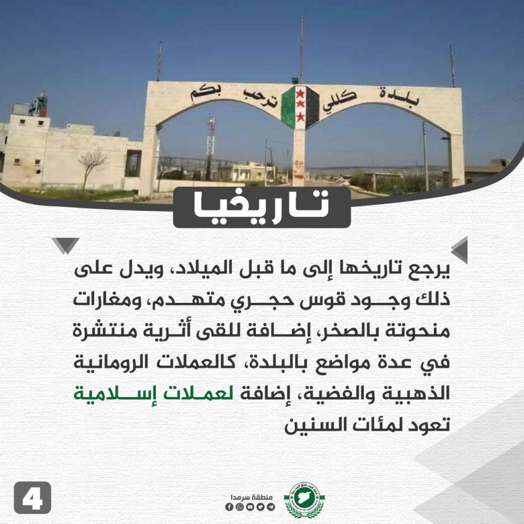
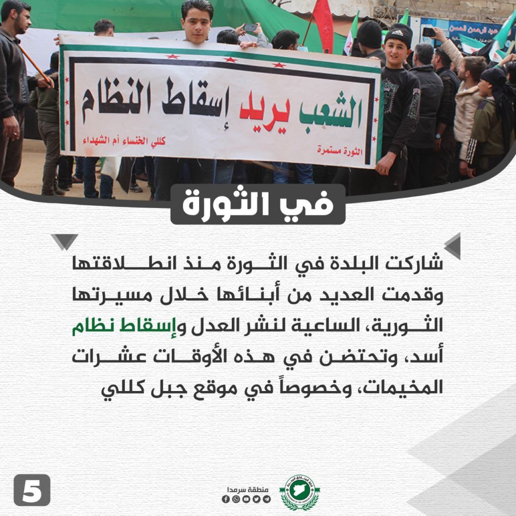
The history of Killi originates before the common era. In the village, there is a large stone arch and caves cut out from rock. Roman gold and silver coins, in addition to Islamic coins dating back hundreds of years, have been found in several places across town. The town participated in the revolution from its beginnings, and the people stood in demonstrations asking for justice and the fall of the Assad regime. Now, Killi hosts dozens of IDP camps, especially on the Mount Killi site.
Haranabush Village
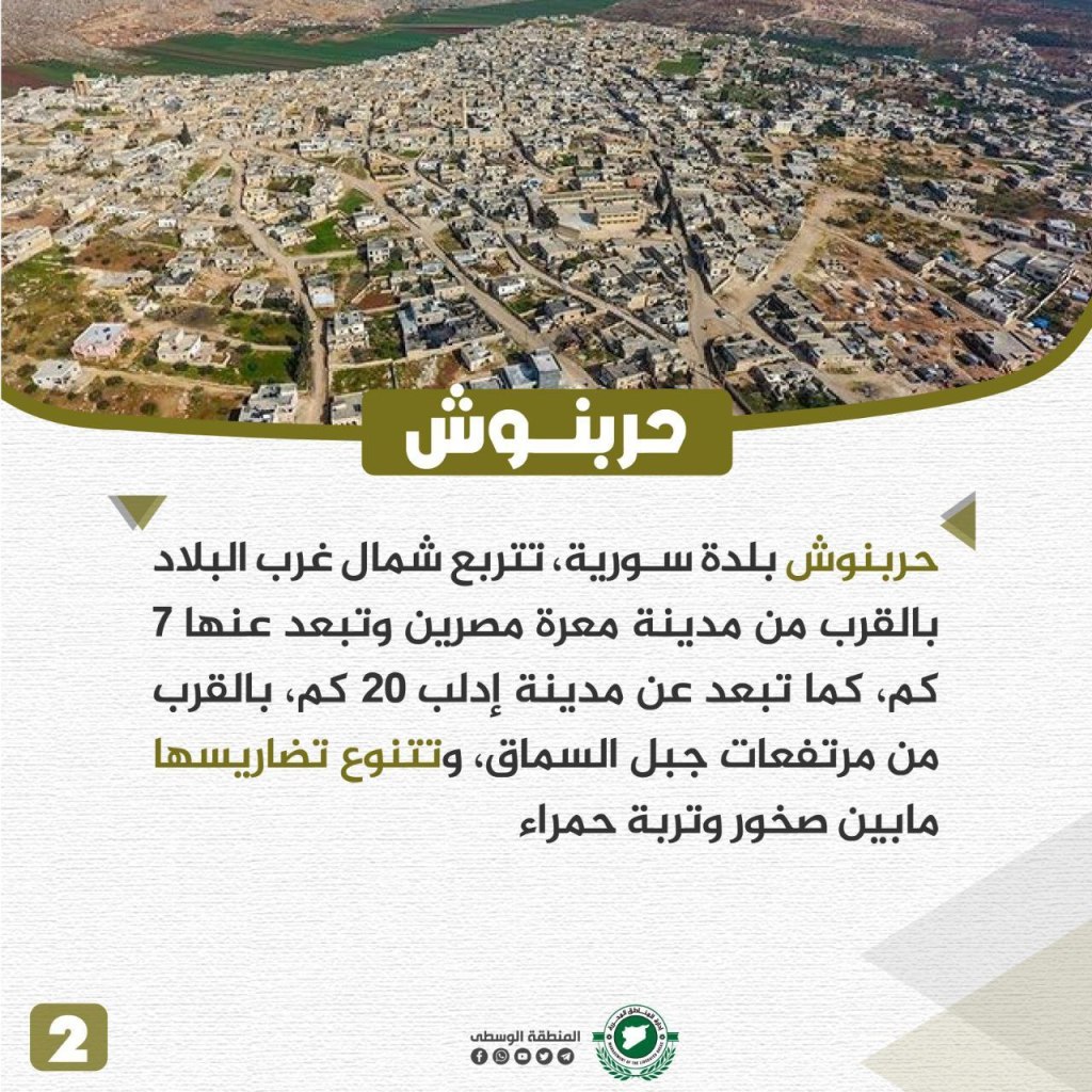
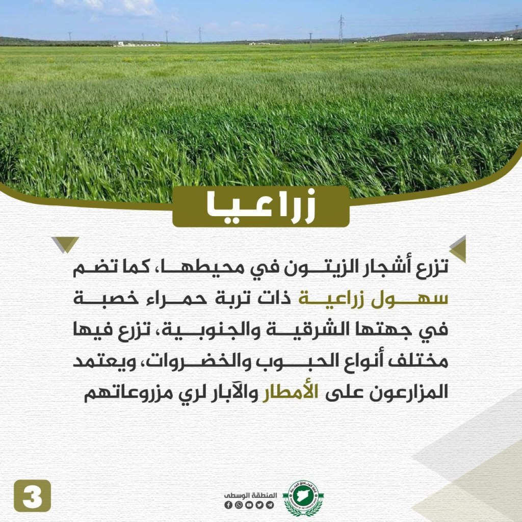
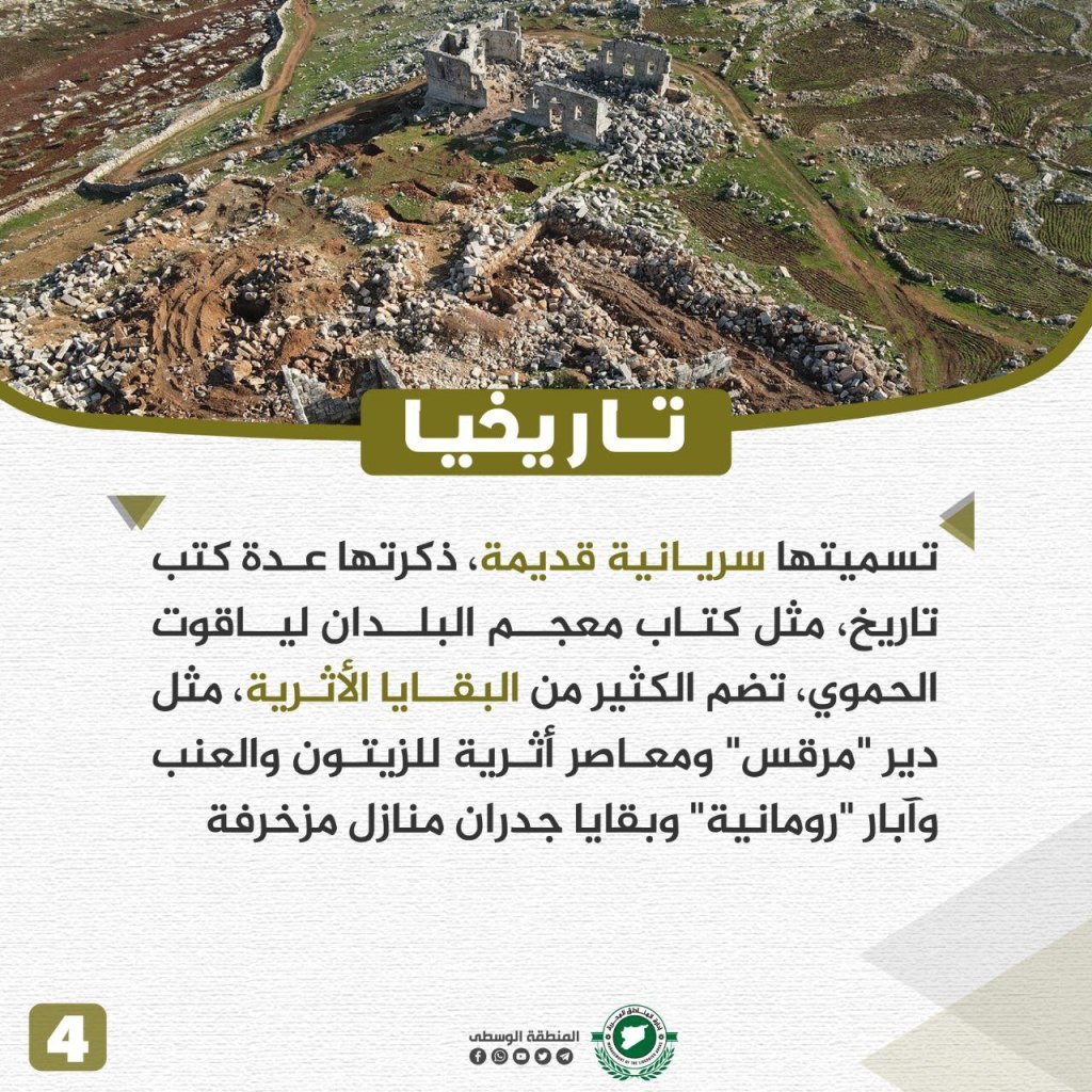
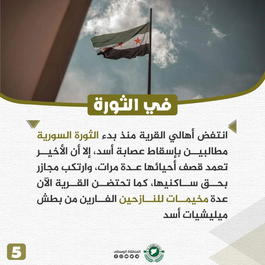
Haranabush is located in the northwest of the country, near the city of Ma’arat Misrin (about 7km) and about 20 km from Idlib. Haranabush is also located near the heights of Mount Summaq (in the Harim Mountains). The town’s terrain consists of both red rocks and soil. Olive trees grow in the surrounding areas, while Haranabush has agricultural plains with fertile red soil on its eastern and southern sides, in which various types of grains and vegetables are grown. The agricultural sector relies on rain and well water to grow crops. The name of the town is in ancient Syriac, according to many history books, such as the dictionary of countries by Yaqut al-Hamawi. Haranabush contains many archeological remains, including the “Marks” monastery, ancient olive presses, and the remains of the walls of ornate homes. The people of Haranabush participated in the revolution from its beginnings, asking for the fall of Assad’s gangs. However, the regime repeatedly bombed the town’s inhabitants and committed massacres against them. Now, the town contains displaced persons camps.
Jabal al-Zawiyah
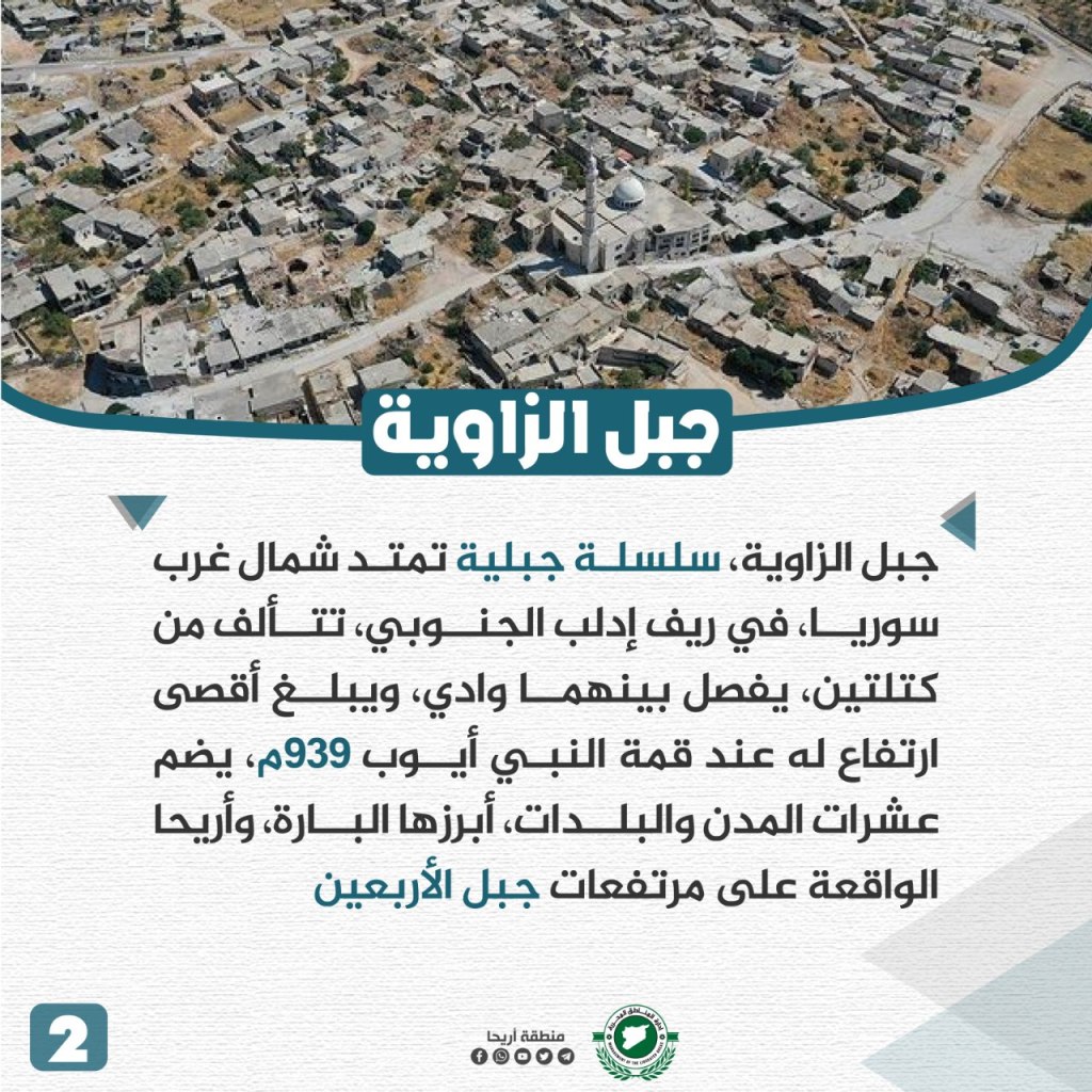
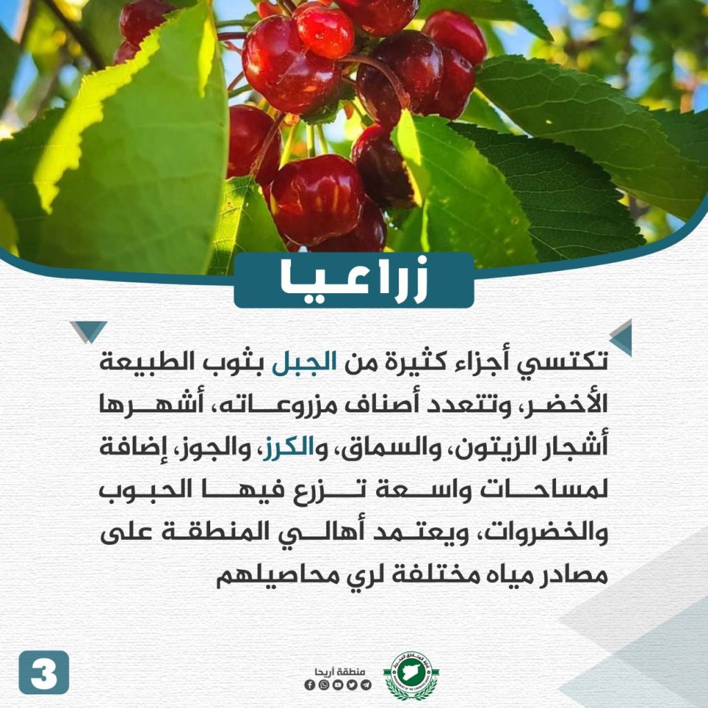
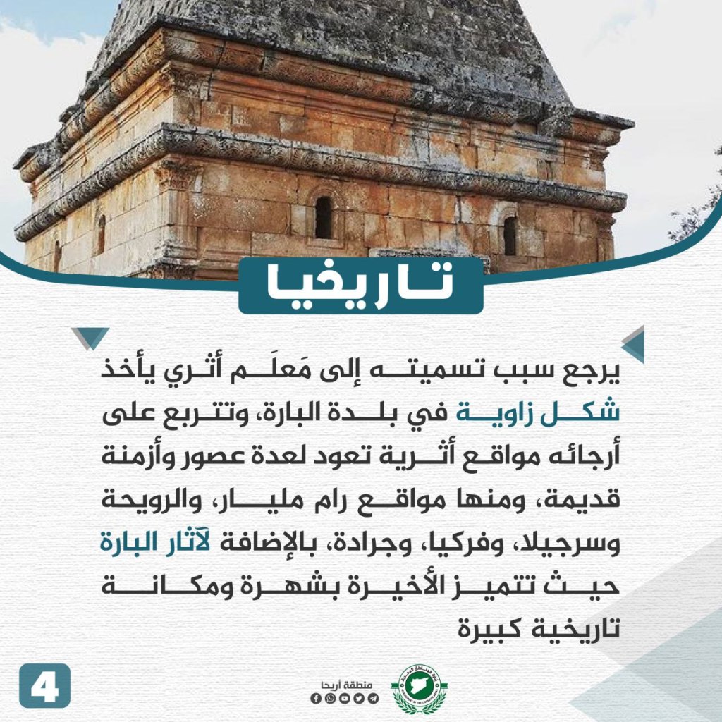
Jabal al-Zawiya is a mountain range extending through northwest Syria and in the southern countryside of Idlib. It consists of two sections separated by a valley, with its maximum elevation at the summit of the Prophet Ayub of 939 meters (3081 feet). The range includes dozens of cities and towns, most notably al-Bara and Ariha, located on the heights of Jabal al-Arba’in. Its parts are dressed in the clothes of green nature, with a variety of farms, with many olive, sumac, cherry, and walnut trees. Grains and vegetables also grow there. The people of the area rely on different sources of water to grow their crops. The name of the range comes from an archaeological landmark that takes the form of a corner in the town of al-Bara. There are archaeological sites dating back to several eras and ancient times, including the sites of Ram Billion, al-Ruwayha, Sirjilah, Friki, Jaradah, in addition to the ruins of al-Bara distinguished by its reputation and large historical status. The mountain has a history full of heroes throughout the ages, as well as being the cradle of the revolution, where its songs lie in the Syrian revolution in the greatest of epics against Assad’s gangs, and they remained steadfast despite the bombings that still continuously strike through the current time.
Ketyan Village
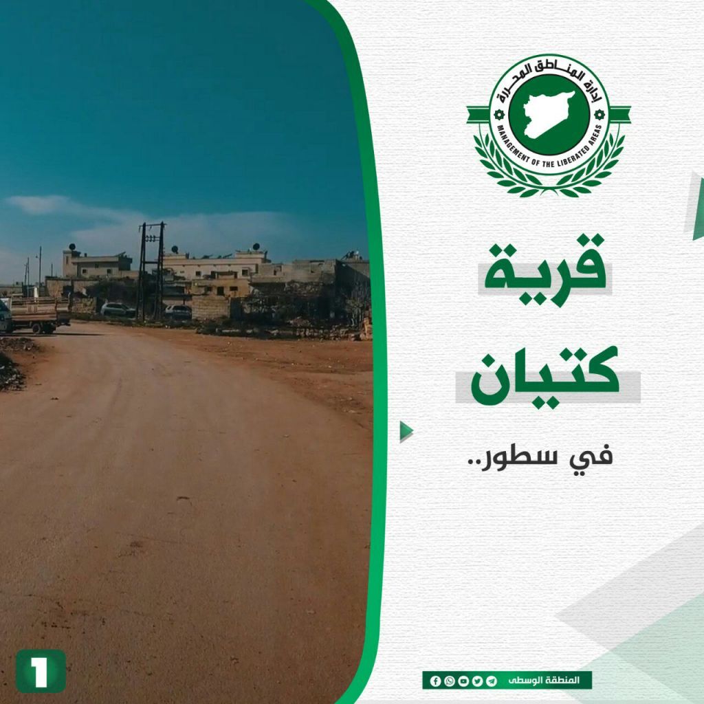
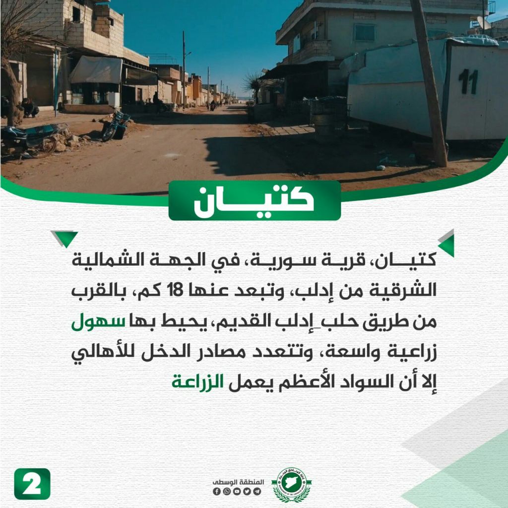
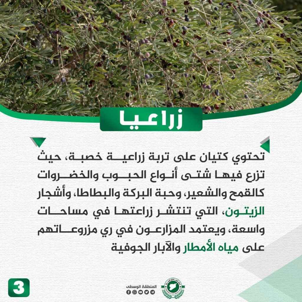
Ketyan is located about 18 km northeast of Idlib near the road between Aleppo and Idlib. Located in it is an agricultural plain that has internal resources for the citizens. The vast majority of its citizens work in agriculture. The town has fertile agricultural soil where a variety of crops grow, including wheat, barley, cumin, potatoes, and olives. The agricultural sector relies on rainwater and well water for irrigation. Ketyan’s history dates back to the middle of the first millennium CE, as some pottery and Byzantine coins have been found there. There is also an old pigeon tower located there from the 9th century CE that accommodates 14,000 pairs of pigeons. During the revolution, the citizens of the village demonstrated against the regime, however Assad’s militias attacked the village and bombed it continuously.
al-‘Asi (Orontes) River
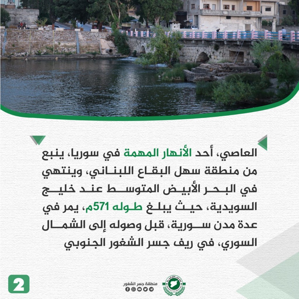
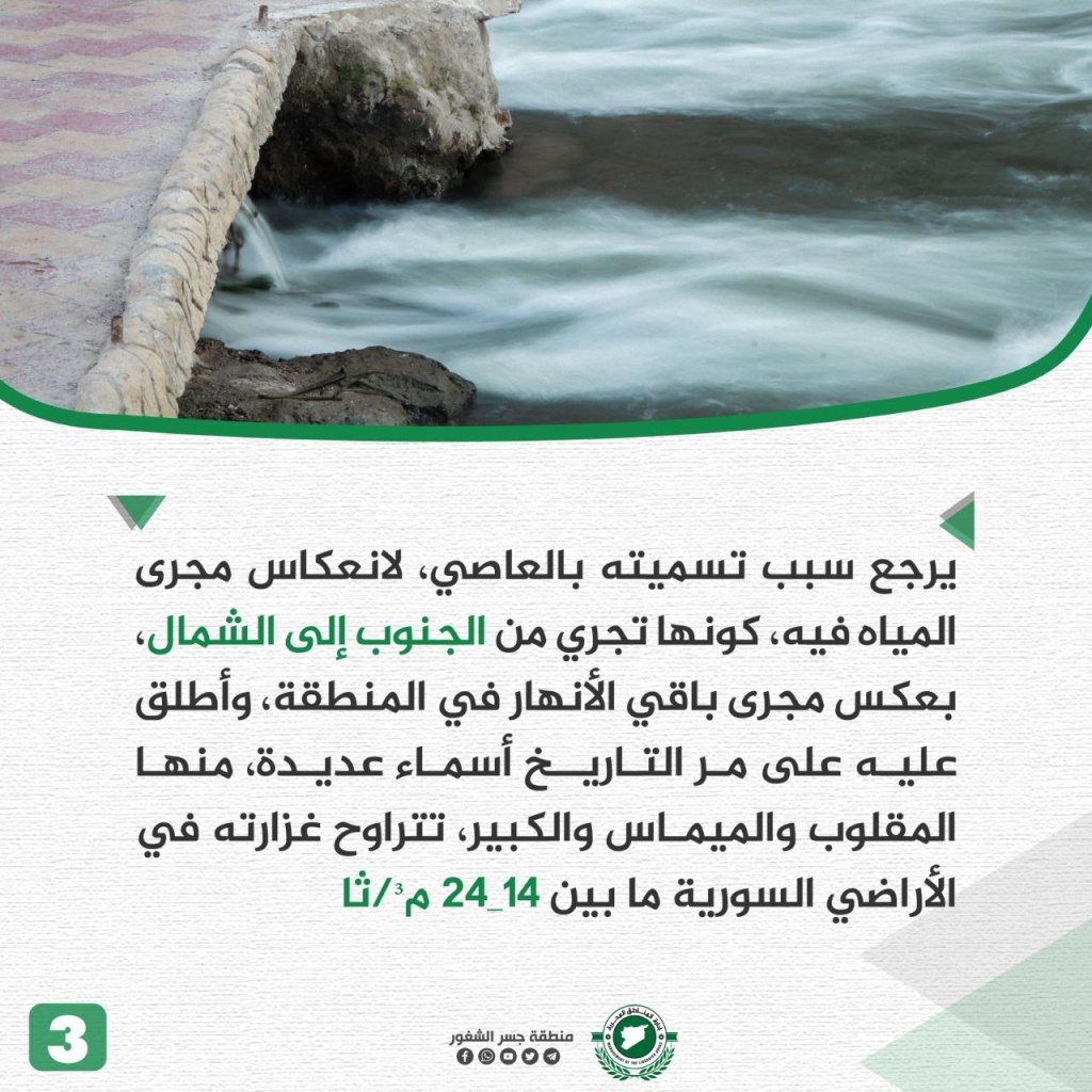

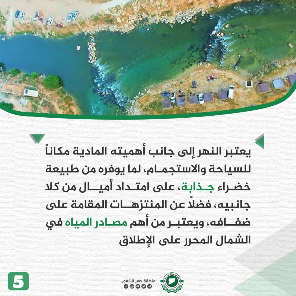
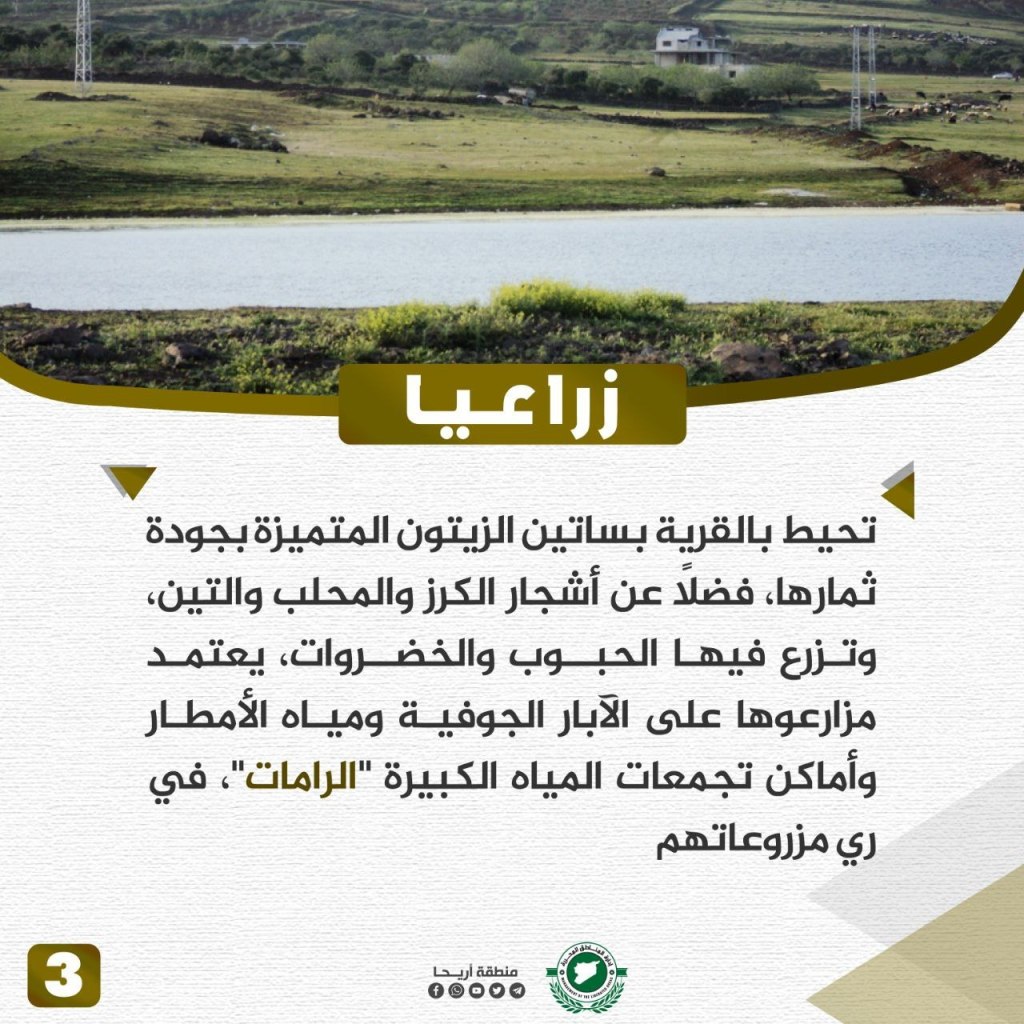
al-‘Asi is one of the important rivers in Syria, starting in the Bekaa Valley in Lebanon and emptying in the Mediterranean Sea, specifically in the Swedish Bay, with a length of 571 meters. It passes through several Syrian cities before reaching the north, in the southern countryside of Jisr al-Shughur. The river is called al-‘Asi due to the direction of the water flow from south to north, unlike the other rivers in the region. Throughout history, the river has been called by many names, including al-Maqlub, al-Mayamas, and al-Kabir. al-‘Asi flows through Syrian territory at a rate between 14-24 meters per second. The river has an important economic and agricultural role, as it serves as an important water source for irrigation in several surrounding villages within the northwestern countryside of Idlib. This includes supplying water in Darkoush, and thousands of farmers rely on the river to water citrus crops, pomegranate, and other basic crops. The river is also considered a place for tourism and recreation due to its attractive green nature and the parks established on its banks. Overall, it’s considered one of the most important sources of water in the liberated north.
Dweila Village
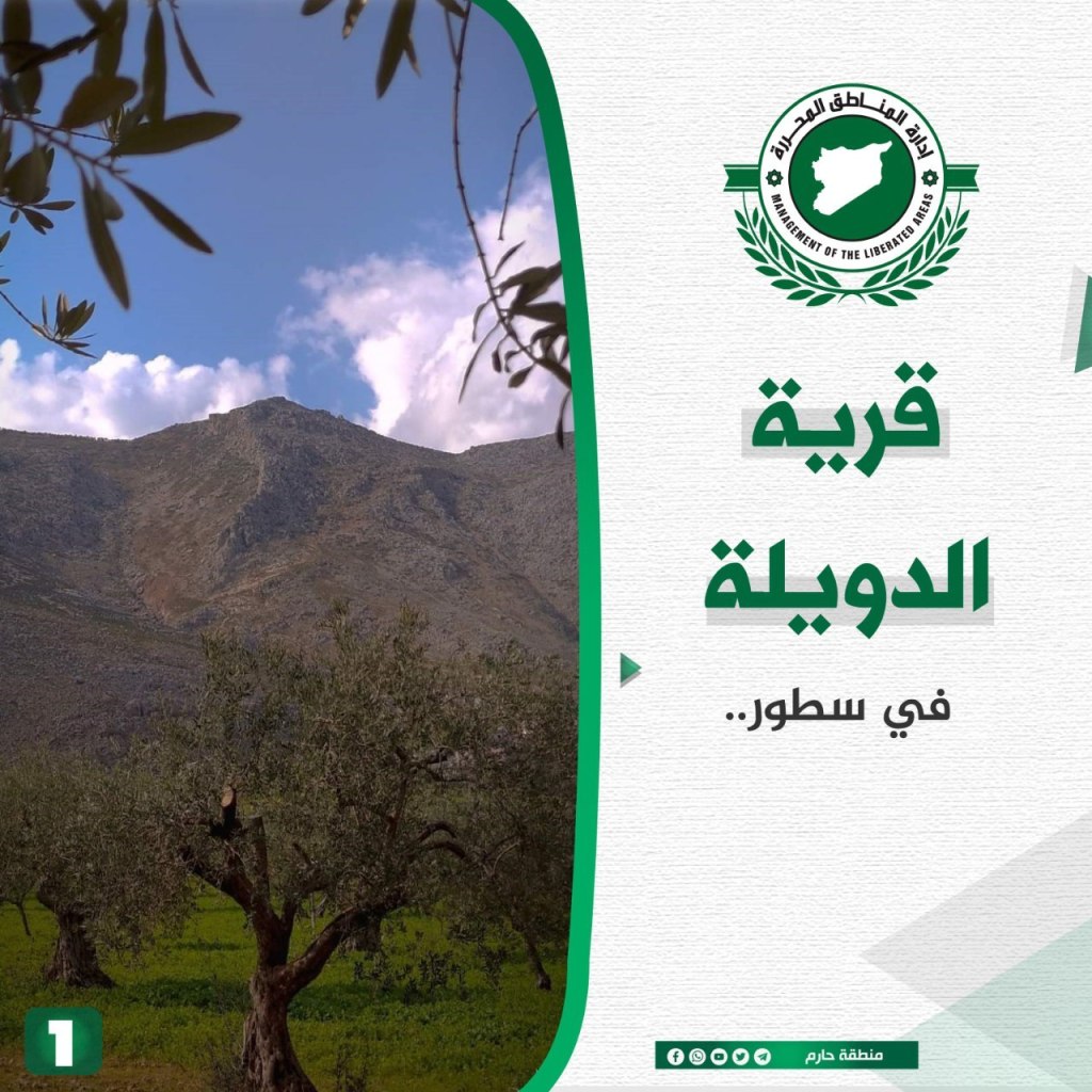
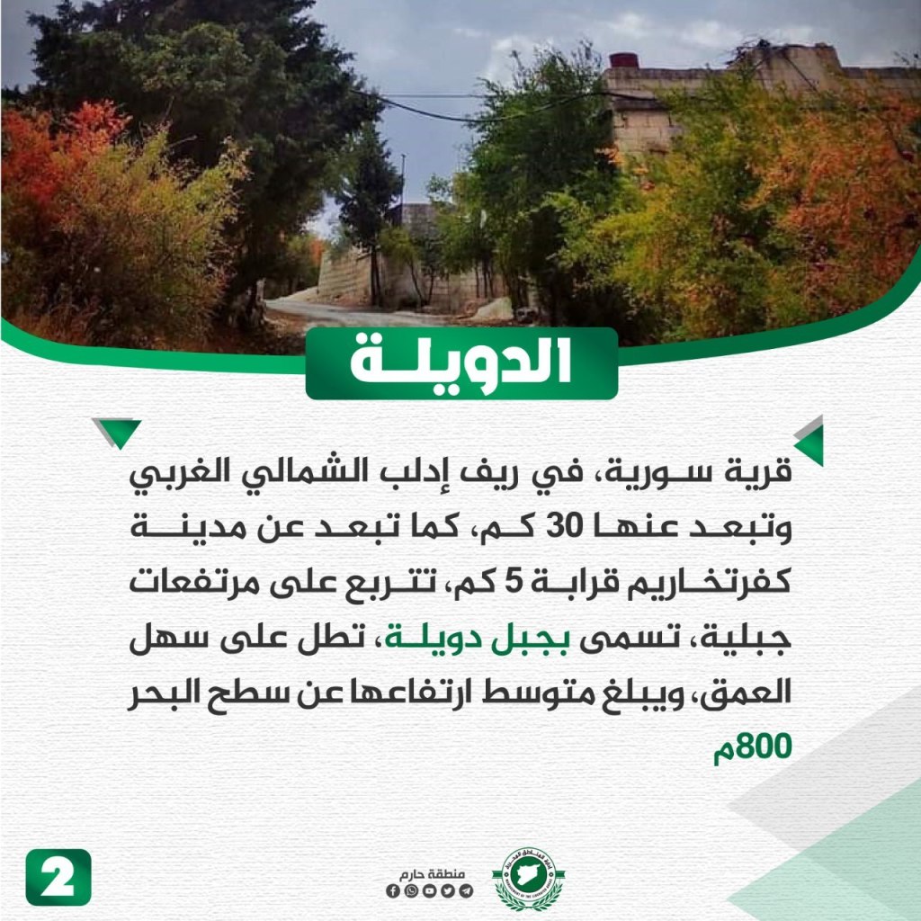
Dweila is located about 30 km northwest of Idlib and 5 km from Kfar Takharim. It sits on the Dweila mountain, overlooking the al-Amaq Plain. It’s located about 800 m above sea level. Agriculturally, the village relies on growing olives, grapes, figs, and other semi-rain-fed crops for income. The people depend on rain water to irrigate as well as underground wells. Dweila is an ancient name that is a diminutive of “a state,” and dates back to the 3rd century CE. It was a strategic outpost in the region and perhaps was the remains of a military fort. Furthermore, the name of the town is mentioned in the records of the Crusades. During the revolution, the people of Dweila participated from its beginnings and participated in demonstrations calling for the fall of the regime. The town welcomed many of the displaced that were targeted by the Assad regime in previous military campaigns.
Ihsim Town
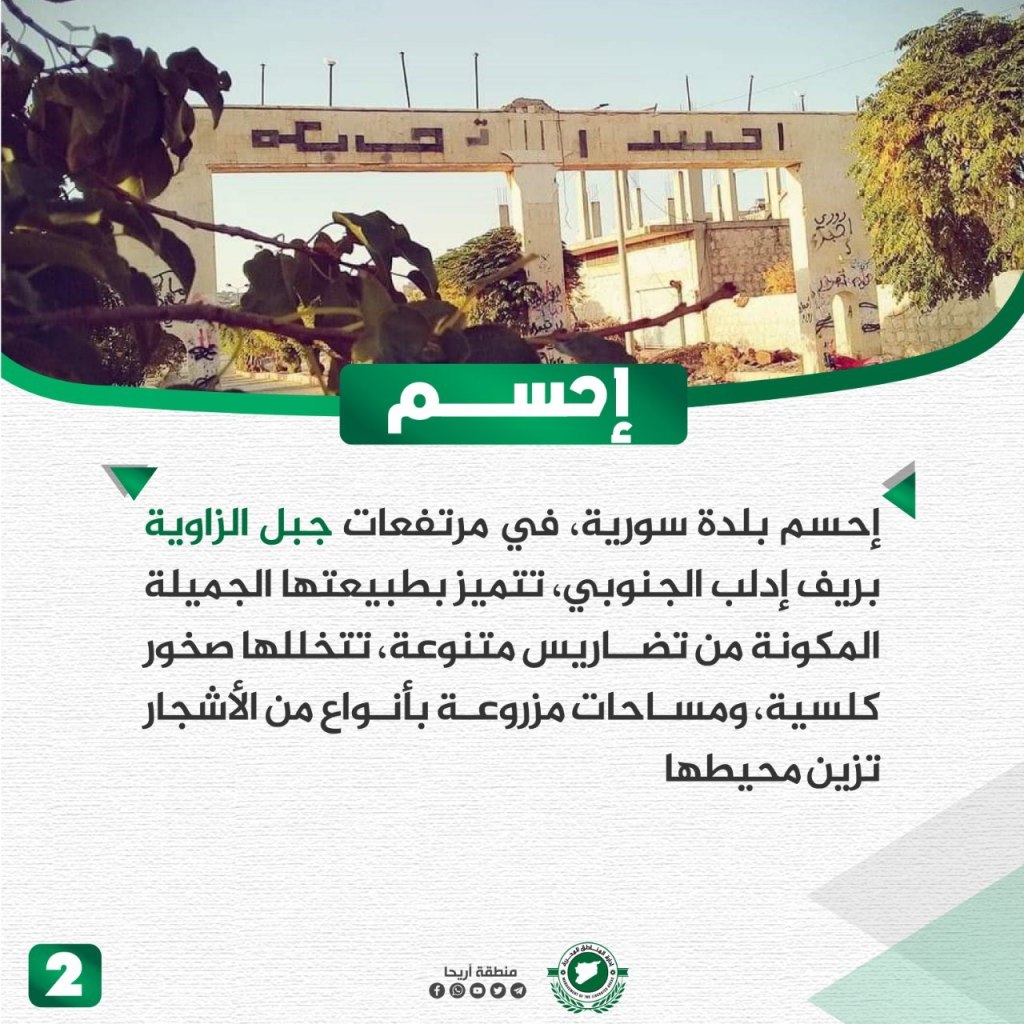
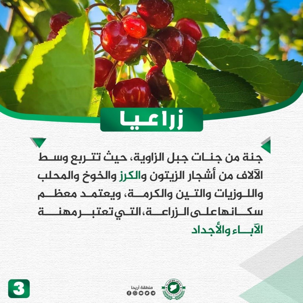
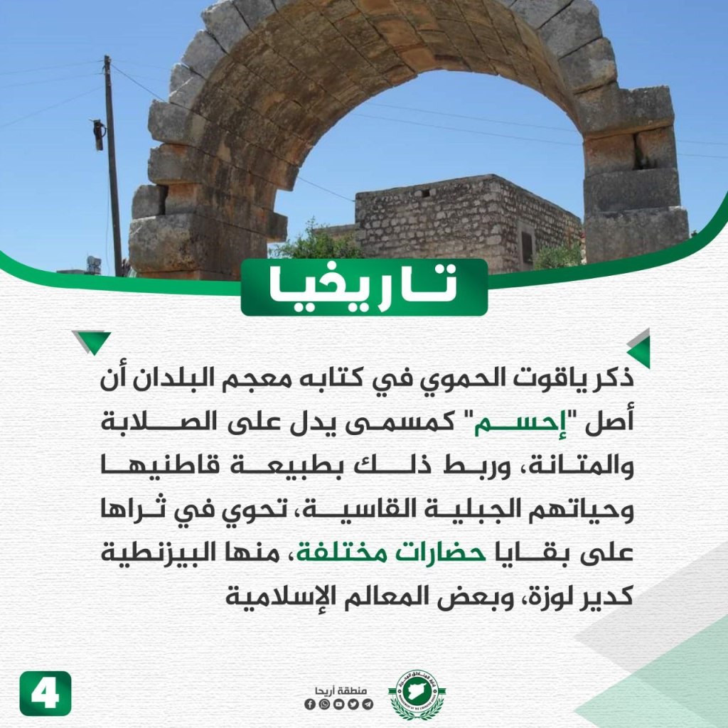
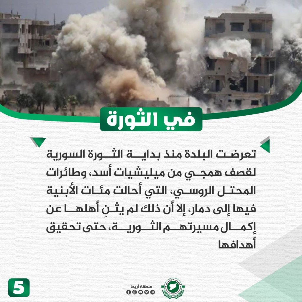
Ihsim is near Jabal al-Zawiya in the southern Idlib countryside. The town contains beautiful nature and diverse topography, as its land is interspersed with calcareous rocks. The agricultural area has various trees, including olive, peach, cherry, and almond trees. Its residents rely on agriculture for their livelihoods, considering it the profession of parents and grandparents. The name Ihsim denotes solidity and durability, linking it to the nature of its inhabitants and its harsh mountain environment. The area contains artifacts from different civilizations, including the Byzantine Deir Lozeh and some other Islamic monuments. The residents of Ihsim have faced bombings from Assad’s militias and Russia’s planes since the beginning of the revolution, which destroyed many of its buildings, but persist in pursuing their revolutionary goals.
Kafr Yahmul Village
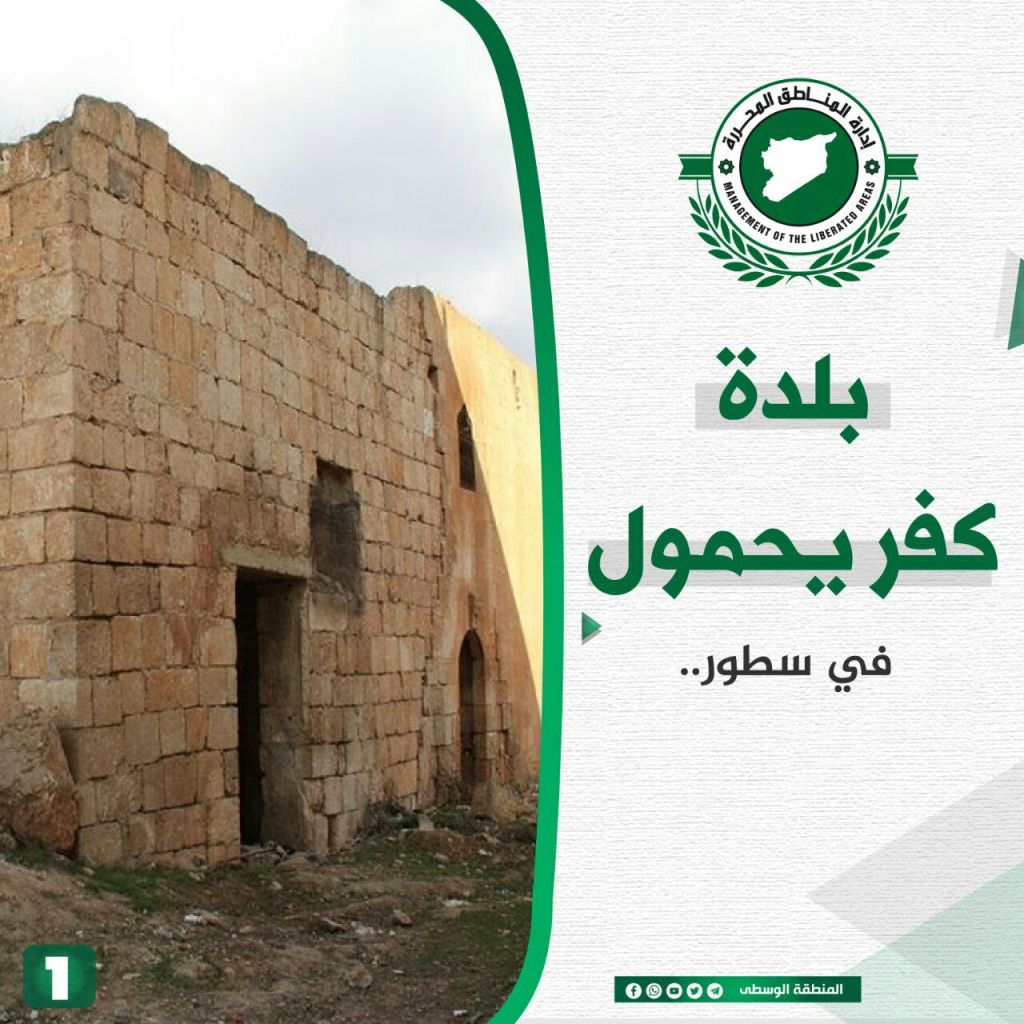


Kfar Yahmul, located in northwest Syria, is about 6 km from the city of Ma’arat Misrin and 15 km from Idlib. It is located along the important road between Bab al-Hawa and Idlib and has fertile agricultural soil. A variety of crops grow in the town, such as wheat, barley, black cumin, a variety of potatoes, and crops that grow on stalks such as corn, in addition to vegetables. The crops rely on underground wells for irrigation. In addition, there is an agricultural science research station located there. The town’s name originates from the name of one of its ancient residents, “Yahmul,” and Kfar means farm. There are caves carved from the rock there that originate from the Byzantine era, and a press machine from the Roman era to press olives, named locally as “Bayt al-Ras.” Homes remain there that are built in the Islamic style. During the revolution, the town suffered from regime bombings, but still accepted many of the displaced.
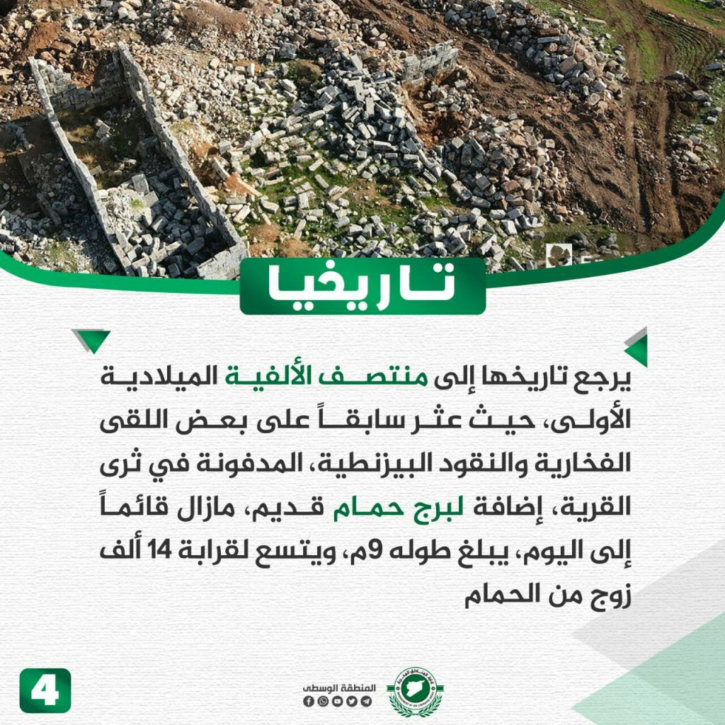
Hamams of Shaykh ‘Isa

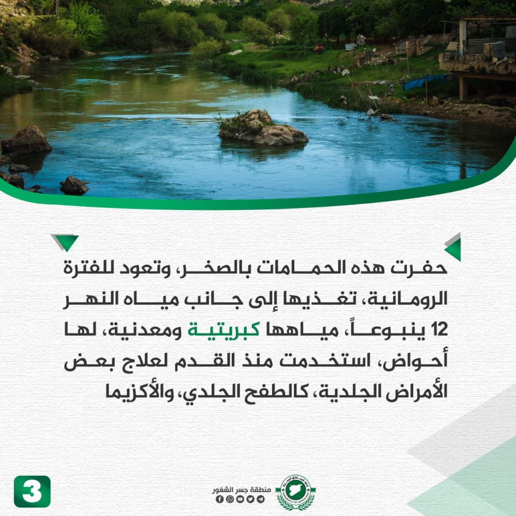
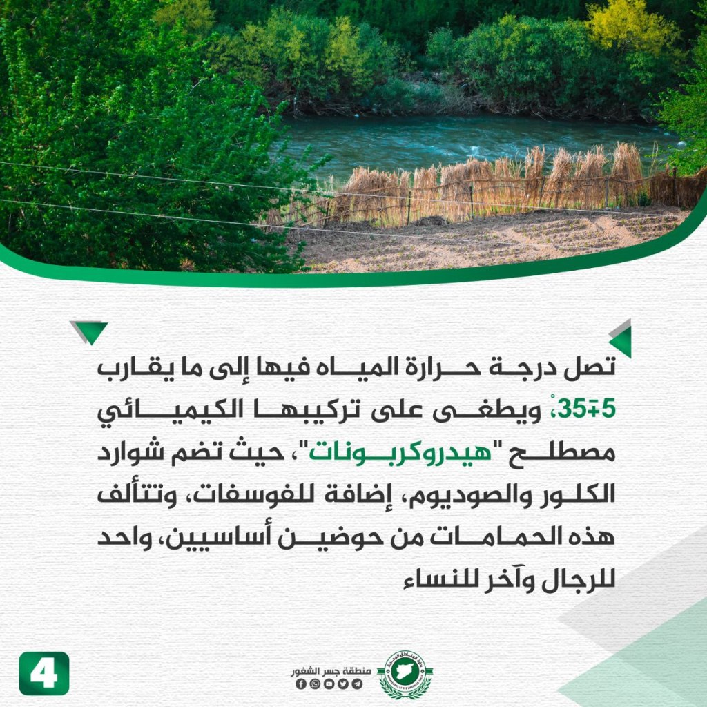
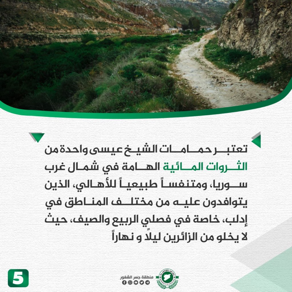
The Shaykh ‘Isa baths are located in the countryside of Jisr al-Shughur in a beautiful location in the middle of a forest on the banks of the al-Asi river. Surrounding the baths are the mountains, which give them “beauty beyond their beauty.” The bathes are dug out of rocks dating back to the Roman era and are fed by 12 springs of sulfuric and metallic water, which has been used to treat several skin diseases, including eczema and rashes. The water reaches temperatures between 35-40 degrees Celsius (95-104 Fahrenheit), and is made up of hydrocarbons of chlorine and sodium ions, in addition to phosphate. The baths consist of two main basins, one for men and one for women. The Shaykh ‘Isa baths are considered one of the most important water riches in northwest Syria and a natural outlet for the people of multiple different areas of Idlib especially in the spring and summer.
Termanin Town
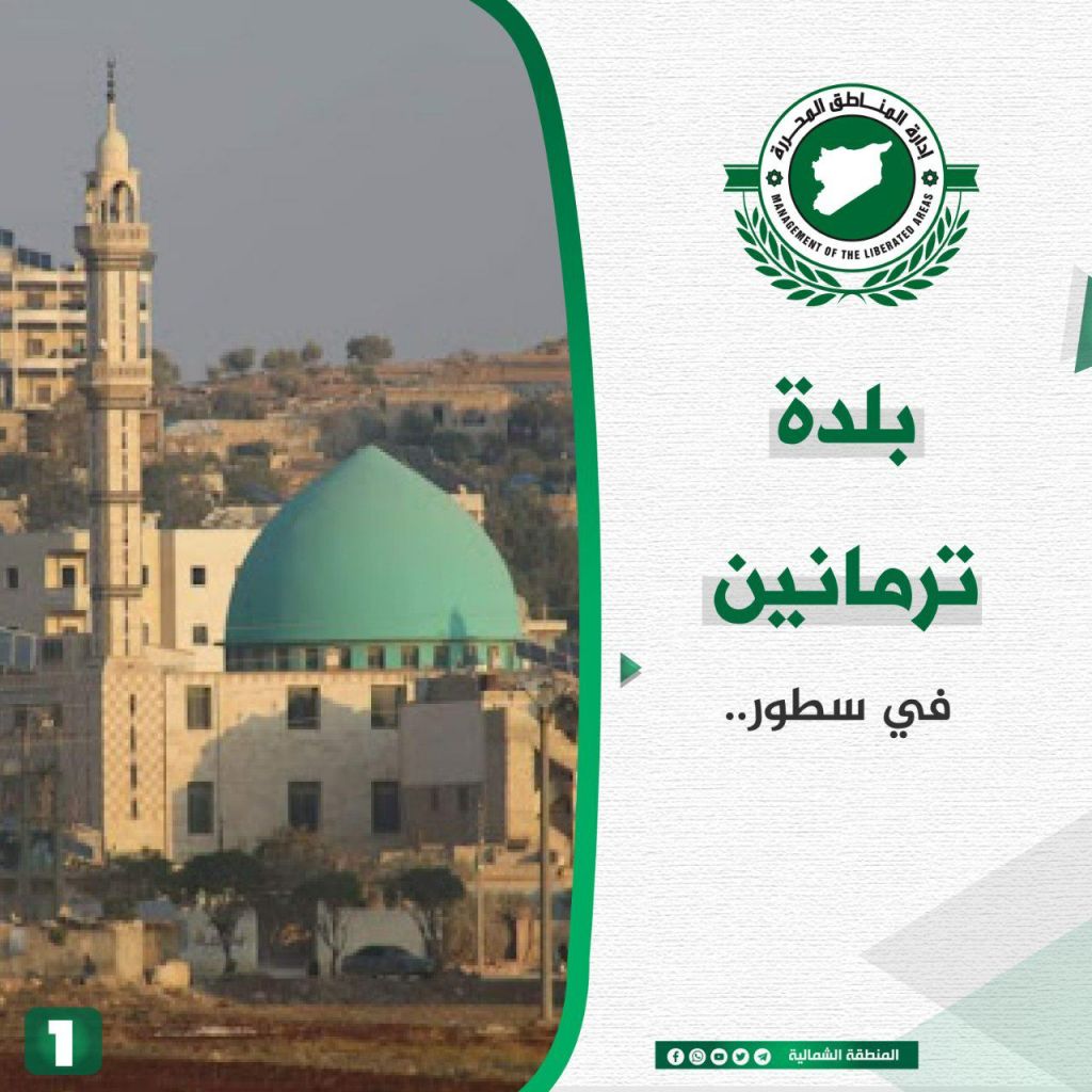
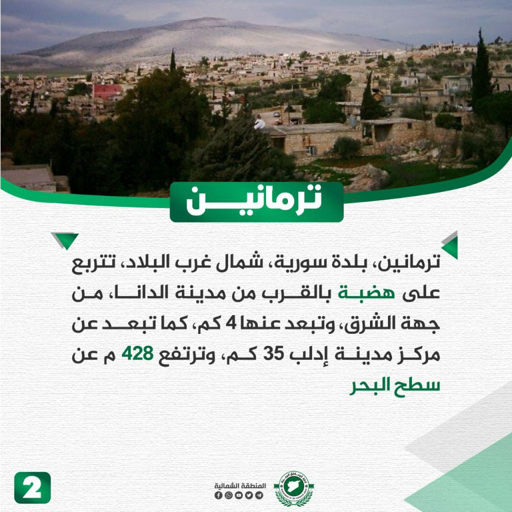
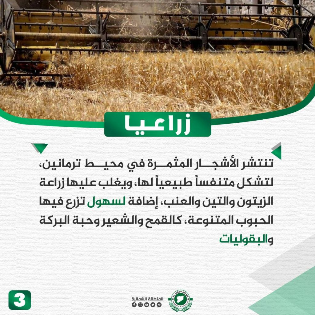

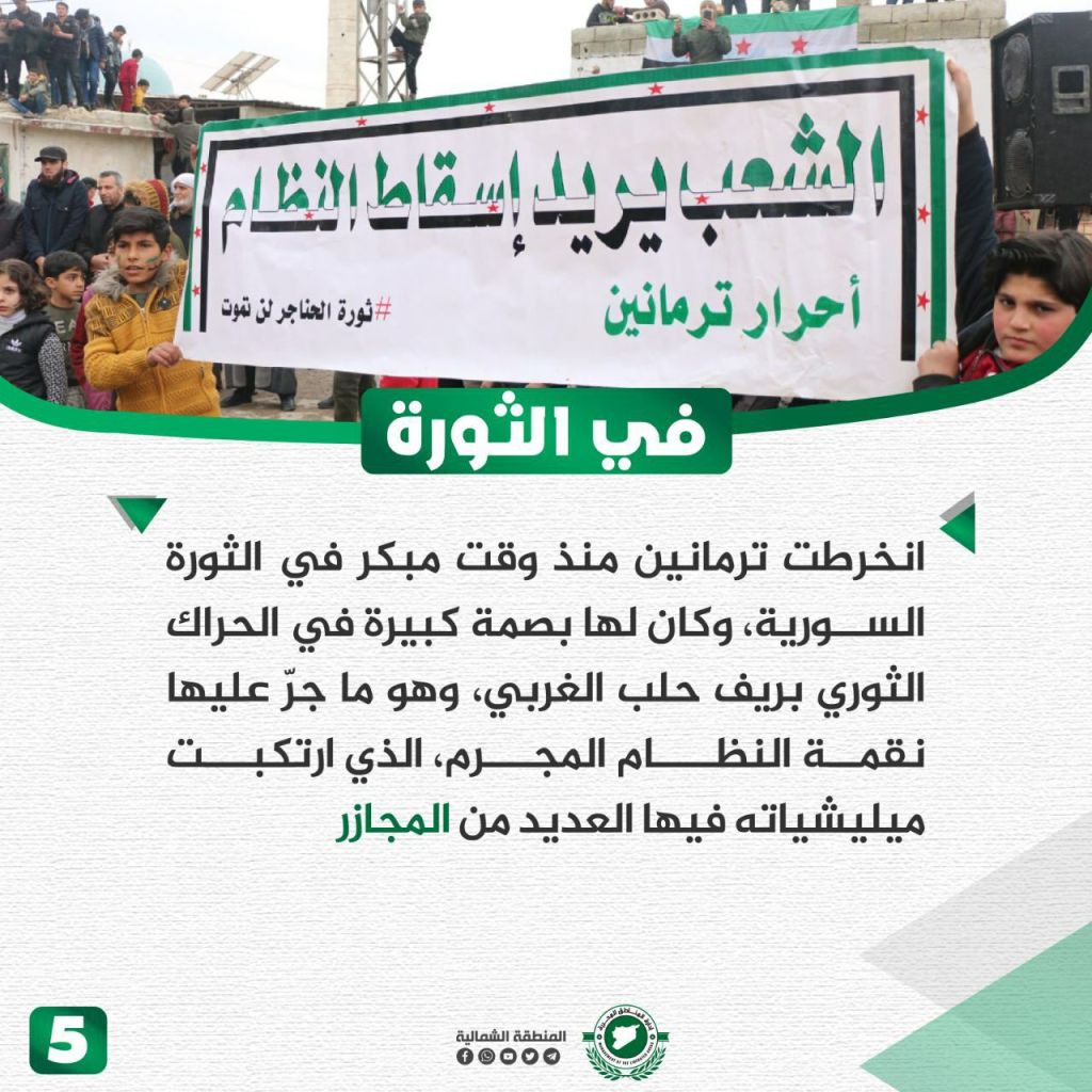
Termanin is a northwest Syrian town located at 428 meters above sea level on a plateau that is 4km away from eastern al-Dana and about 35km away from Idlib. Termanin is surrounded by fruitful trees, growing olive, fig, and grape plants, in addition to wheat, barely, legumes, and grain. Opinions vary on the origin of the town’s name, but most historians believe it is Aramaic, connected to an ancient teacher located in the area. Other ancient landmarks are located there from before the common era, including homes and resting places. During the revolution, Termanin had a large fingerprint on the revolutionary movement in the western countryside of Aleppo, calling for the fall of the regime, clashing with its militias, and experiencing massacres.
The Earthquake

Earthquakes that hit the north of al-Sham over the course of 14 centuries… learn about the most violent:
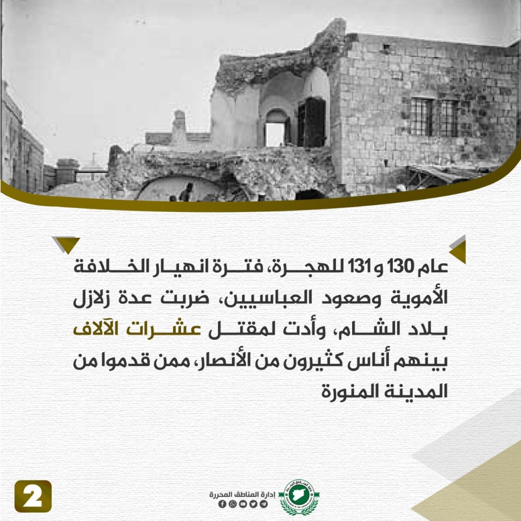
- In 747 and 748 CE (130 and 131 Hijri), during the period of the collapse of Umayyad Caliphate and the rise of the Abbasids, several earthquakes hit the countries of the Levant, killing tens of thousands including many of their supporters who came from Medina.
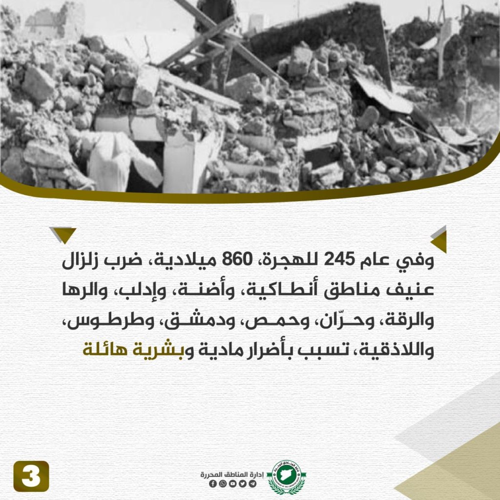
- In 860 CE, a violent earthquake hit the Antakya, Adana, Idlib, Raha, al-Raqqah, Hawran, Homs, Damascus, Tartus, and Latakia regions, causing huge human and material damage.
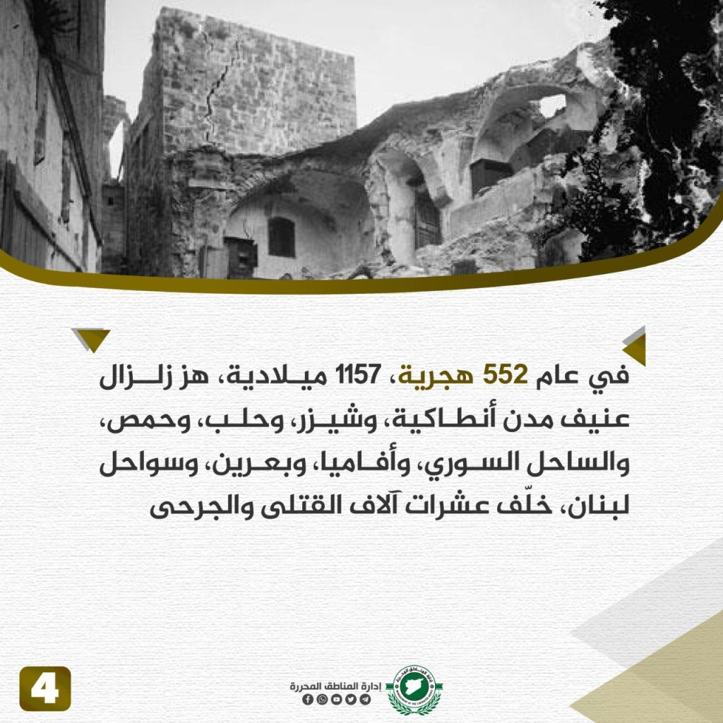
- In 1157 CE, an earthquake hit Antakya, Shiraz, Aleppo, Homs, the Syrian coast, Apamea, Baarin, and the Lebanese coast, leaving tens of thousands dead and wounded.
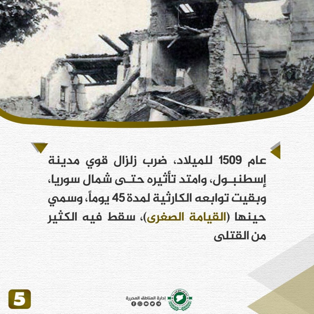
- In 1509 CE, a powerful earthquake hit Istanbul and northern Syria, and its consequences remained for 45 days, naming the period “the small resurrection” and leaving many dead.
- In 1663 CE, a violent earthquake hit Aleppo, Shiraz, Antakya, Damascus and the coastal areas, causing huge damage.
- In 1822 CE, there was an earthquake in Aleppo and Antakya, killing 20,000 people and hundreds of thousands were injured.
Kurin Town
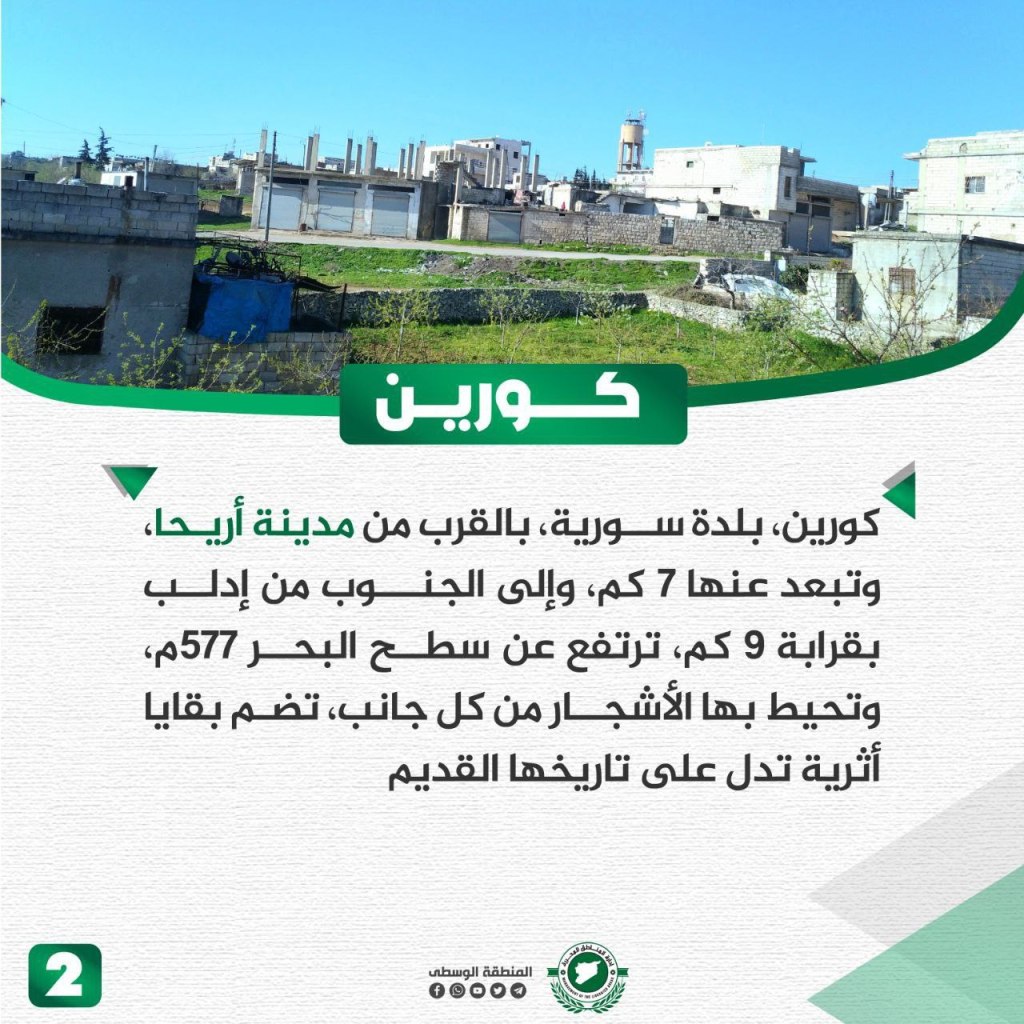
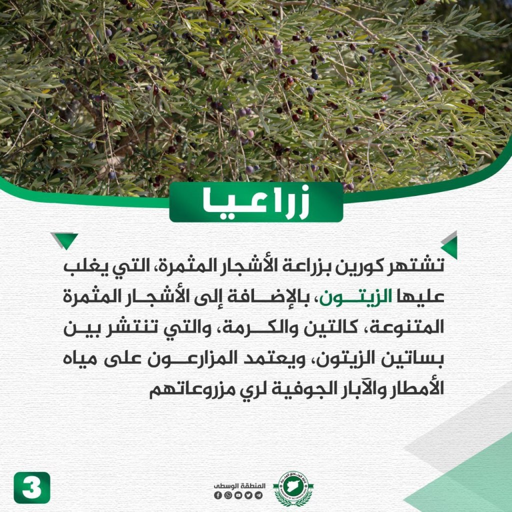
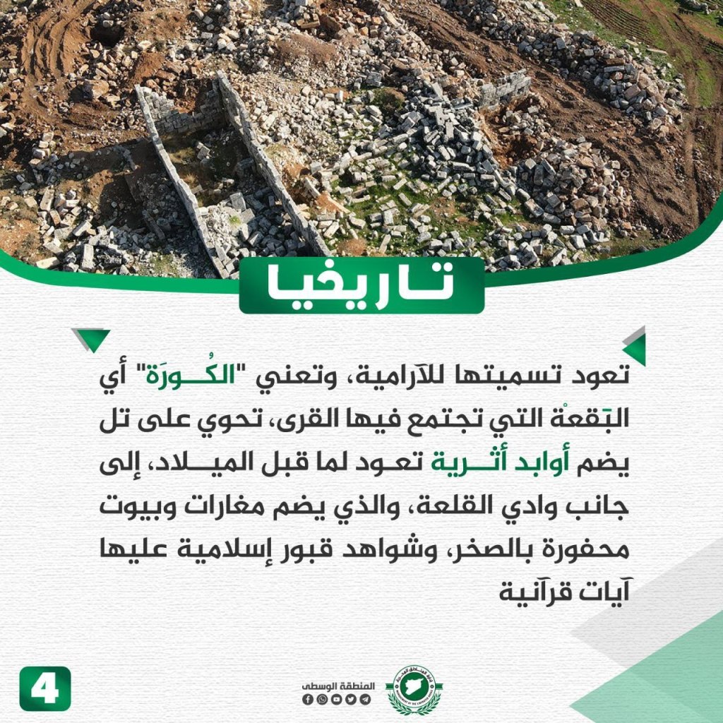
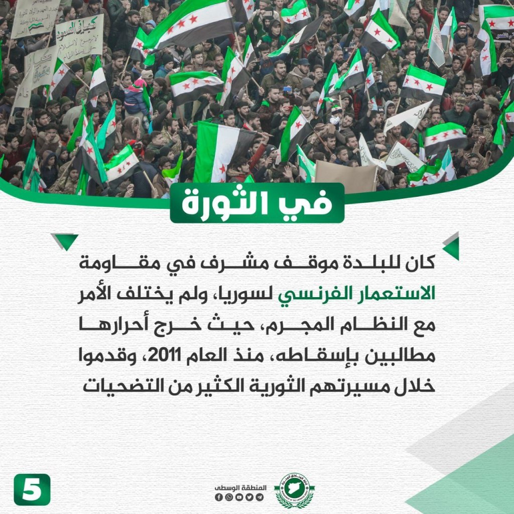
The town of Kurin is located about 7 km away from Ariha and 9 km south of Idlib and sits at 577 meters above sea level. The town is surrounded by ancient trees on all sides reflecting its long history. The residents of Kurin grow crops from a variety of trees, specializing in olives in addition to figs and almonds. The agricultural sector of Kurin relies on rain and well water to grow its crops. The origin of the name Kurin is from the Aramaic “al-Kura,” meaning a spot where villages meet on a hill. It contains archeological artifacts from before the common era. Al-Kura is located near Wadi al-Qala’a that includes homes and caves whose walls contain Islamic engravings referring to Quranic verses. Kurin held an honorable position during the resistance to French colonialism, and this does not differ from its resistance against the criminal regime. Since 2011, the town has been calling for the fall of the regime and throughout the town’s journey its people have made many sacrifices.
Baluon Town

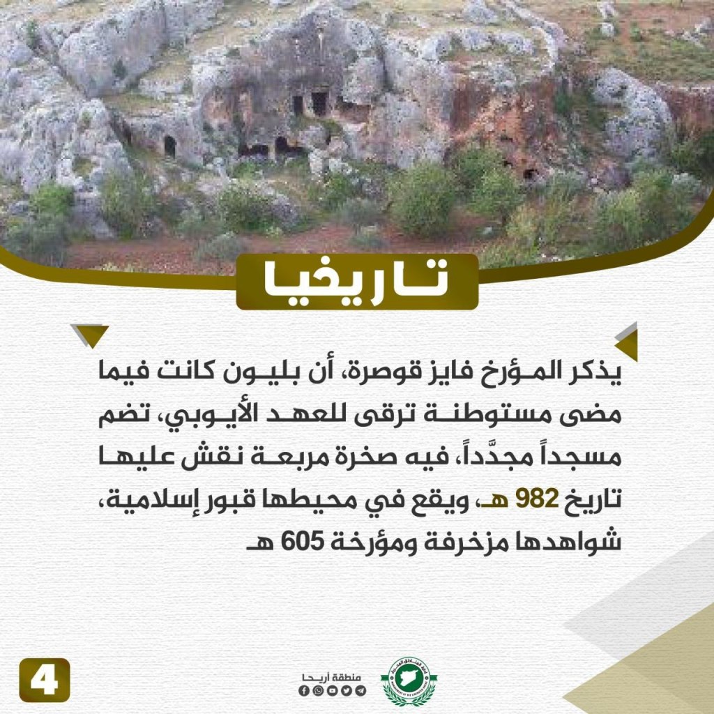

Baluon is a Syrian village located near the peaks of Jabal al-Zawiya, about 18 km from Ariha. The city is surrounded by green nature on all sides, and ancient artifacts are still located there dating back to different centuries. In Baluon, there are different olive groves, in addition to cherry, mahleb, and fig trees. The people of Baluon grow different grains and vegetables and rely on well and rainwater to irrigate crops. The place where water is collected is called “al-Ramat.” The historian Fayez Qusra notes that Baluon was once a settlement dating back to the Ayyubid era. In Balyun, there is a renovated mosque that has a square rock inscribed with the date 982 Hijri (1574 CE). Near the mosque, there are Islamic tombstones and graves dating back to 605 Hijri (1209 CE). During the revolution, the people of Baluon held an honorable position, supporting the protestors and making sacrifices despite the brutality of the Assad regime.
The Most Important Events and Achievements of the Syrian Revolution During the Past 12 Years
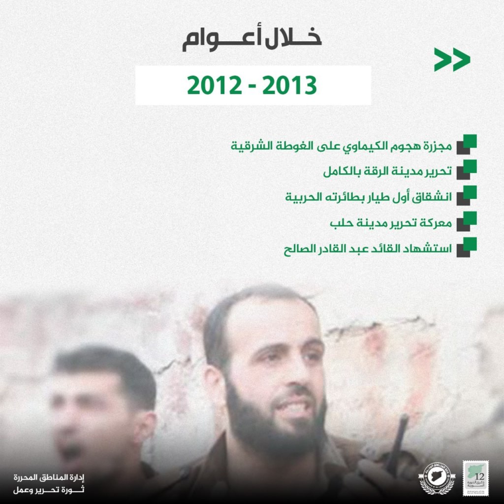

- 2012-2013:
- The massacre of the chemical attack on Eastern Ghouta
- Complete liberation of al-Raqqah
- Defection of the first pilot in his warplane
- Battle to liberate Aleppo
- Martyrdom of the leader ‘Abd al-Qadir al-Salah
- 2014-2015:
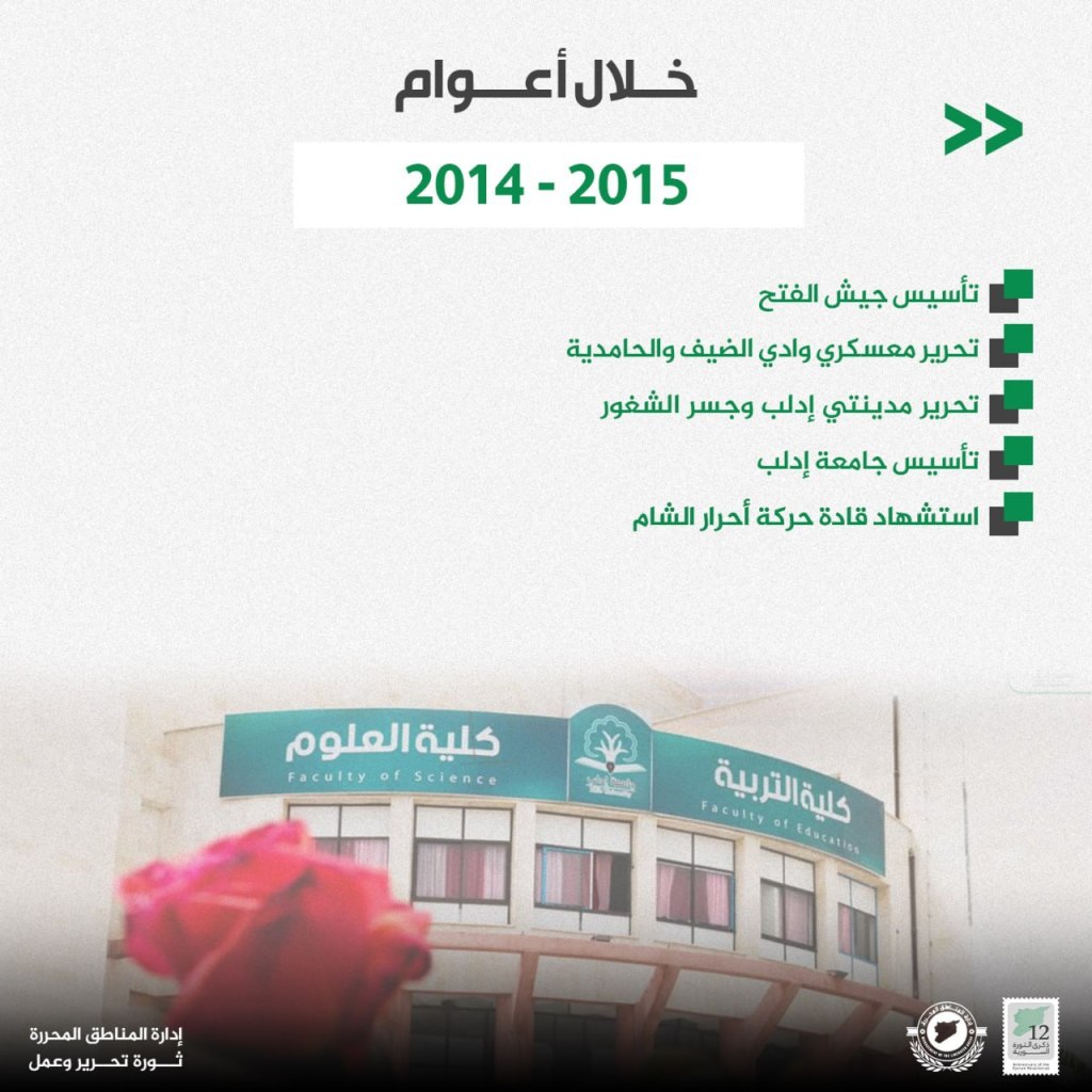
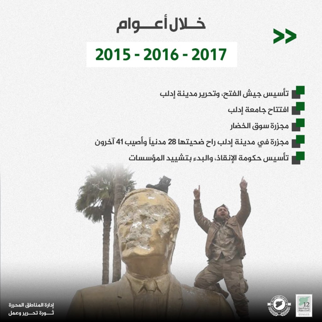
- Founding of Jaysh al-Fatah
- Military liberation of Wadi al-Dhayf and al-Hammadi
- Urban liberation of Idlib and Jisr al-Shughur
- Founding of Idlib University
- Martyrdom of the leaders of Ahrar al-Sham
- 2016-2017:
- Unification of revolutionary factions under Hayat Tahrir al-Sham
- Formation of the Syrian Salvation Government
- Operation Euphrates Shield begins in northern Syria
- SDF controls al-Raqqah
- Chemical attack in Khan Shaykhun
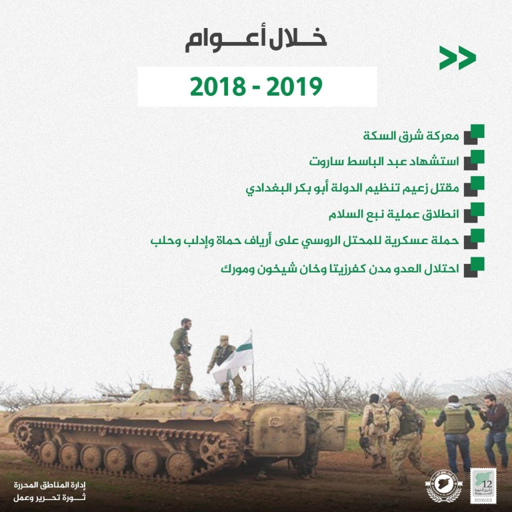
- 2018-2019:
- Battle of Sharq al-Sikkah
- Martyrdom of Abdul Baset al-Sarout
- Killing of the leader of the Islamic State Abu Bakr al-Baghdadi
- Operation Peace Spring begins
- Military campaign against Russian forces in the countrysides of Hama, Idlib, and Aleppo
- Occupation of the enemy of Kfar Zita, Khan Shaykhun, and Morek
- 2020-2021:
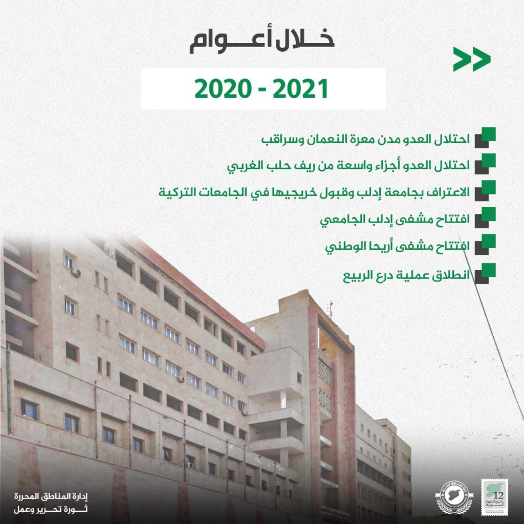
- Enemy occupation of Ma’arat al-Numan and Saraqib
- Enemy occupation of parts of the western parts of the Aleppo countryside
- Recognition of Idlib University and acceptance of its graduates to Turkish universities
- Opening of Idlib University Hospital
- Opening of the National Hospital of Ariha
- Operation Spring Shield begins
- 2022-2023:
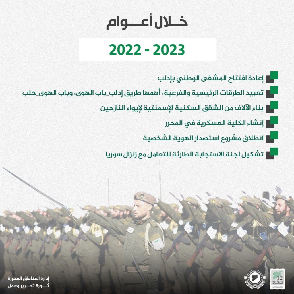
- Reopening of the National Hospital of Idlib
- Paving central and branch roads, the most important of which were the Bab al-Hawa-Idlib and Bab al-Hawa-Aleppo roads
- Building thousands of cement apartments to house the displaced
- Beginning to issue personal identification cards
- Formation of the emergency response committee for the earthquake
The Most Important Events in Jisr al-Shughur Region During the Past 12 Years of the Syrian Revolution

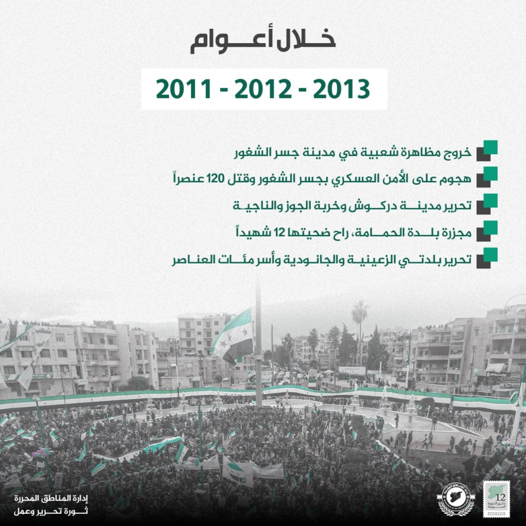

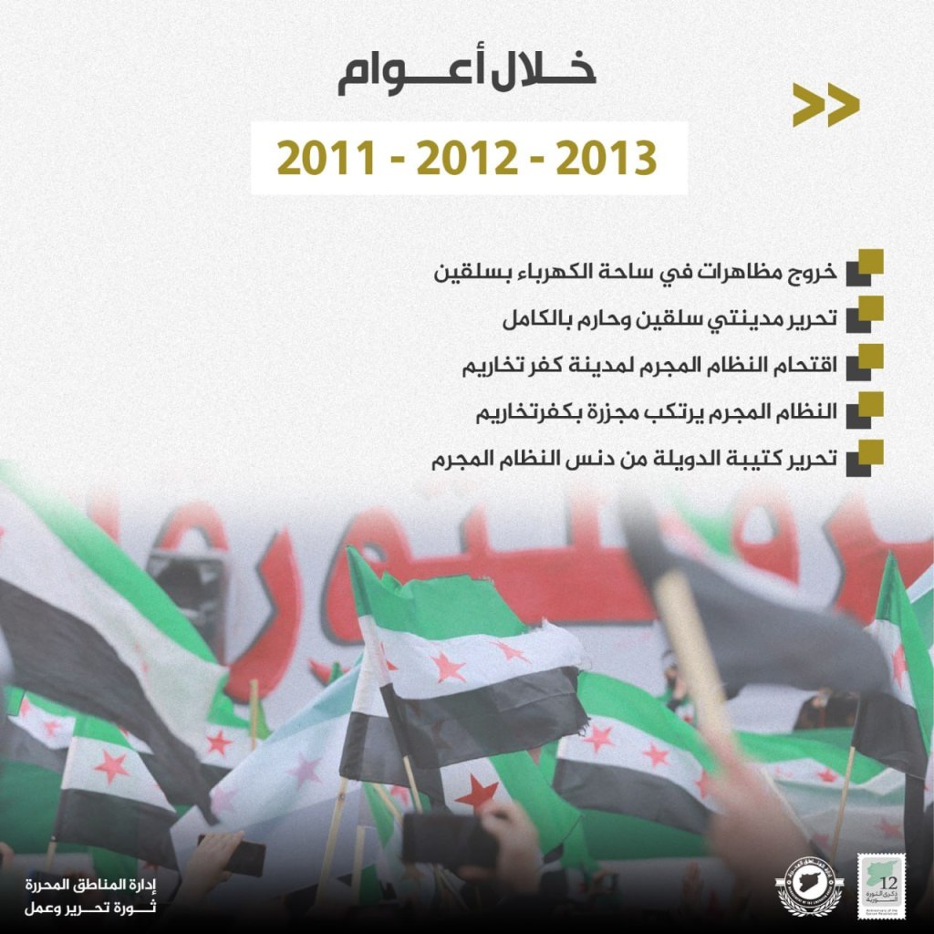
- 2011-2012-2013
- Beginning of popular demonstrations in Jisr al-Shughur
- Attack on security forces in Jisr al-Shughur and the killing of 120 individuals
- Liberation of Darkush, Kharbat al-Juz, and Najia
- Attack on the village of al-Hamamah that killed 12
- Liberation of Zainia and Janudia and the capture of hundreds of items
- 2014-2015-2016
- Attack on Mara’anad that killed 10
- Battle to liberate Kesab on the Syrian coast
- Liberation of Jisr al-Shughur
- Liberation of the Zayzun thermal station
- Attack on the town of Darkush that killed 90
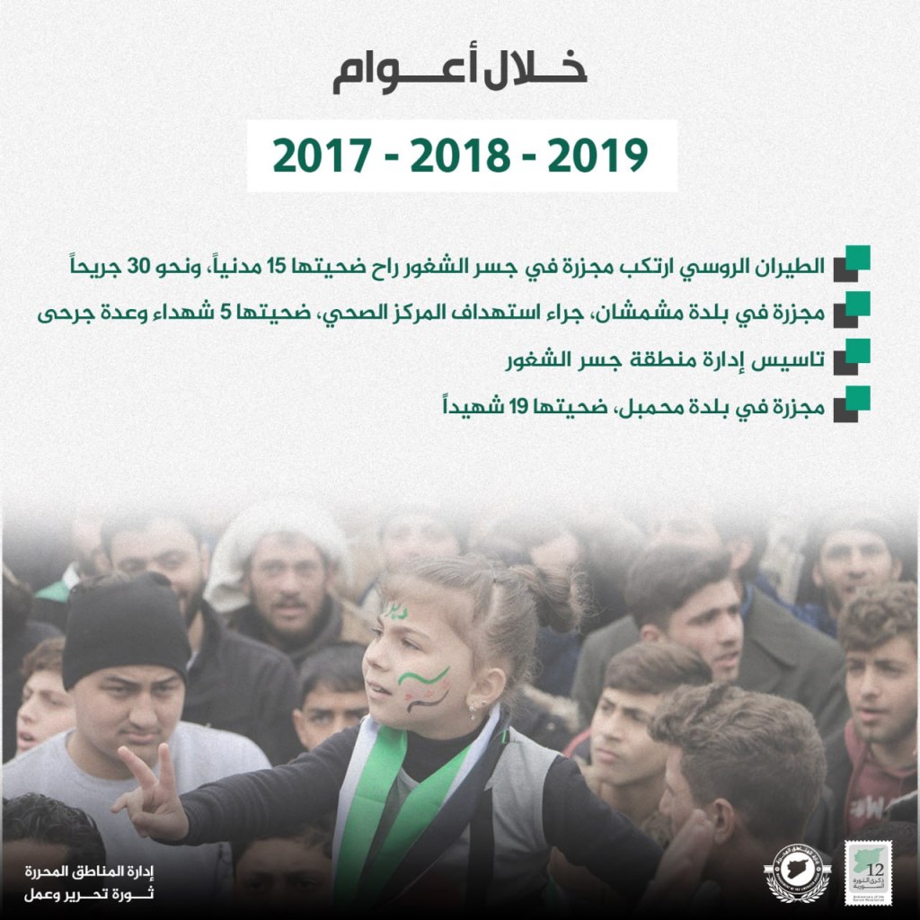
- 2017-2018-2019
- Russian planes launch an attack on Jisr al-Shughur that killed 15 and injured 30
- Attack on the town of Mishmishan targeting the health center that killed 5 and injured others
- Founding the administration of the Jisr al-Shughur area
- Attack on the town of Mahmabil that killed 19
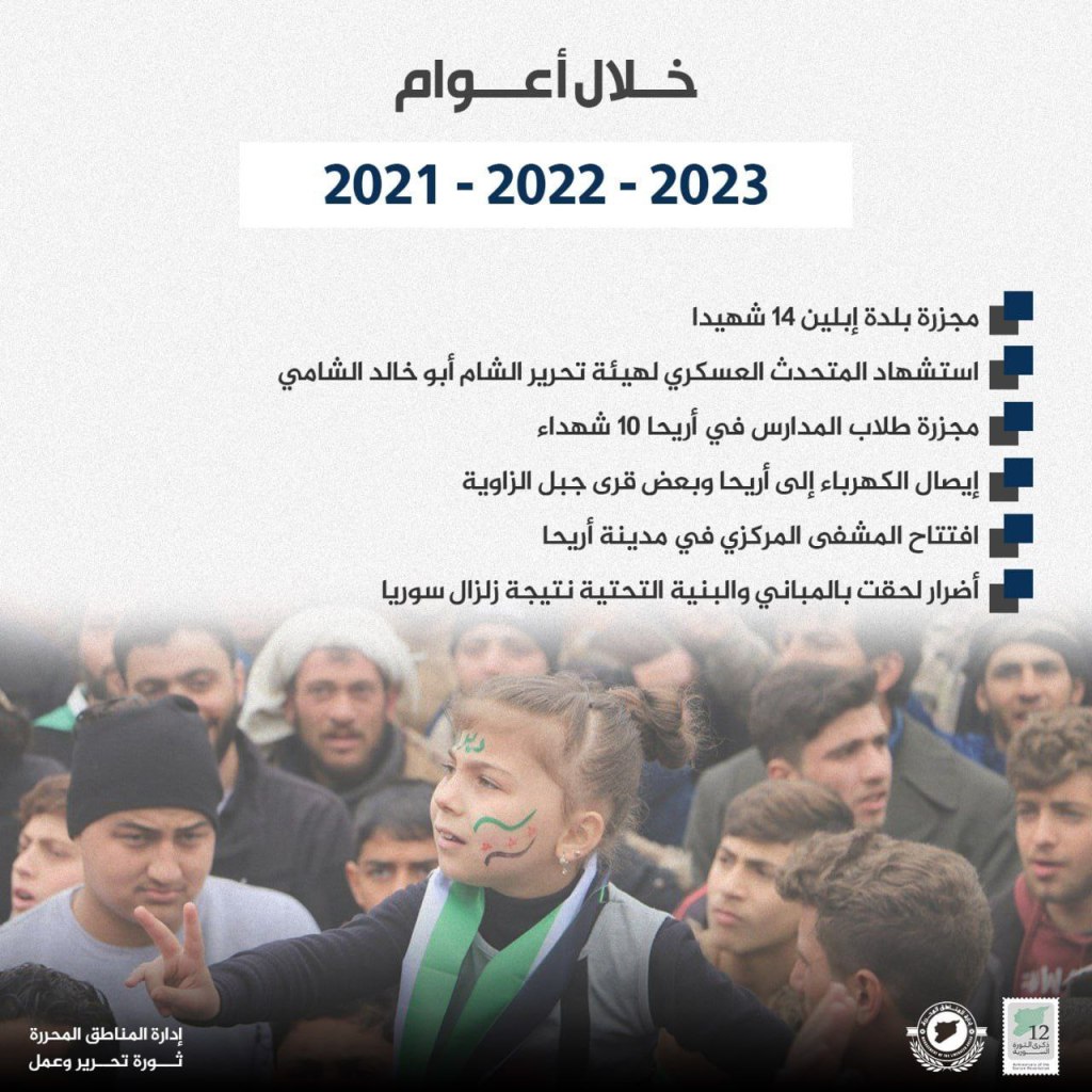
- 2021-2022-2023
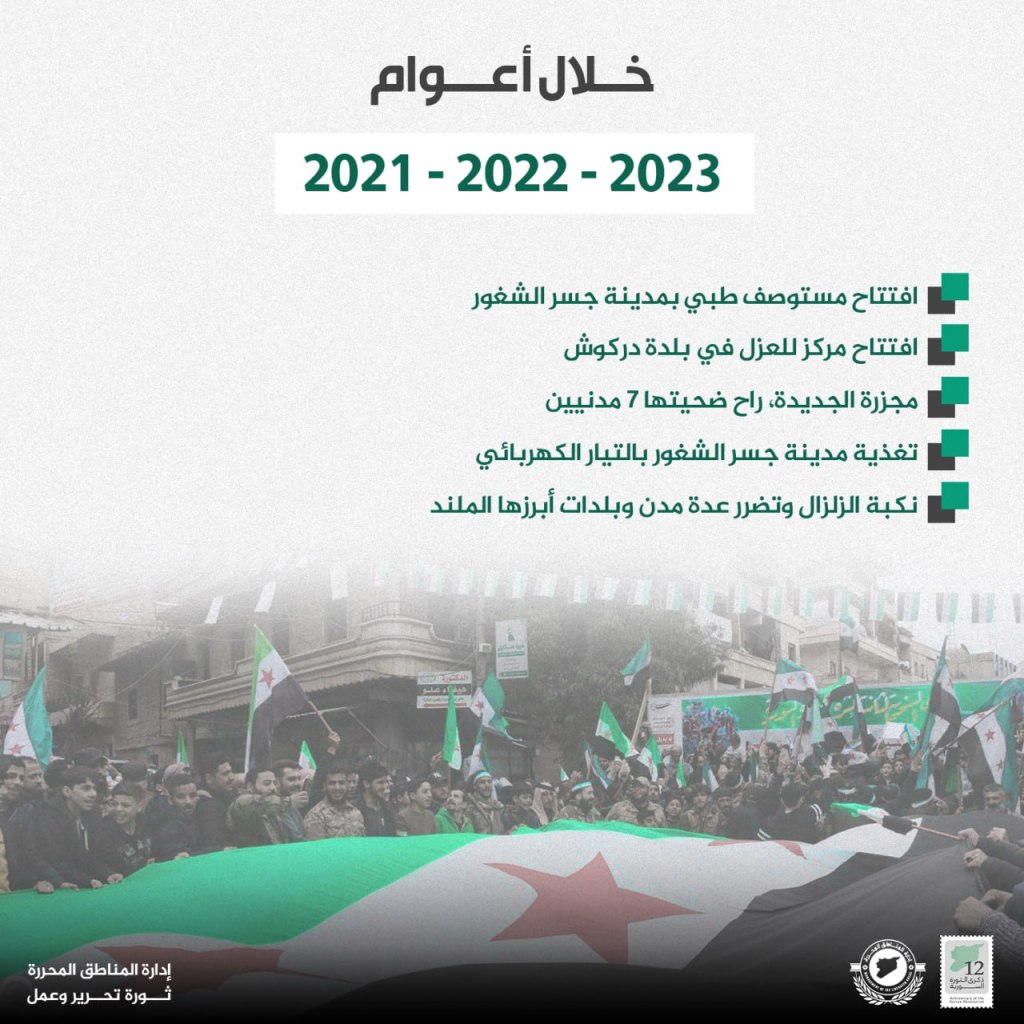
- Opening of a medical clinic in the city of Jisr al-Shughur
- Opening of a justice center in the town of Darkush
- New attack, which killed 7 city residents
- Providing Jisr al-Shughur with electricity
- Tragedy of the earthquake that hit several cities and town, the most notable of which was al-Miland
The Most Important Events in the Harim Region During the Past 12 Years of the Syrian Revolution
- 2011-2012-2013
- Beginning of demonstrations in al-Kahraba’ square in Salqin
- Liberation of Salqin and Harim
- The regime raids Kfar Takharim
- The regime attacks Kfar Takharim
- Liberation of the International Battalion from the regime
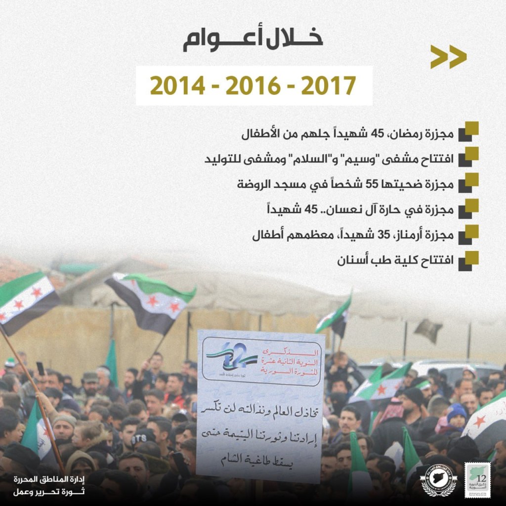
- 2014-2016-2017
- Ramadan attacks that killed 45 including children
- Opening of the Wasim and al-Salam hospitals and the children’s hospital
- Attack that killed 55 in the al-Rudah Mosque
- Attack on al-Hara lane that killed 45
- Attack on Armanaz that killed 35, mostly children
- Opening of the dental school
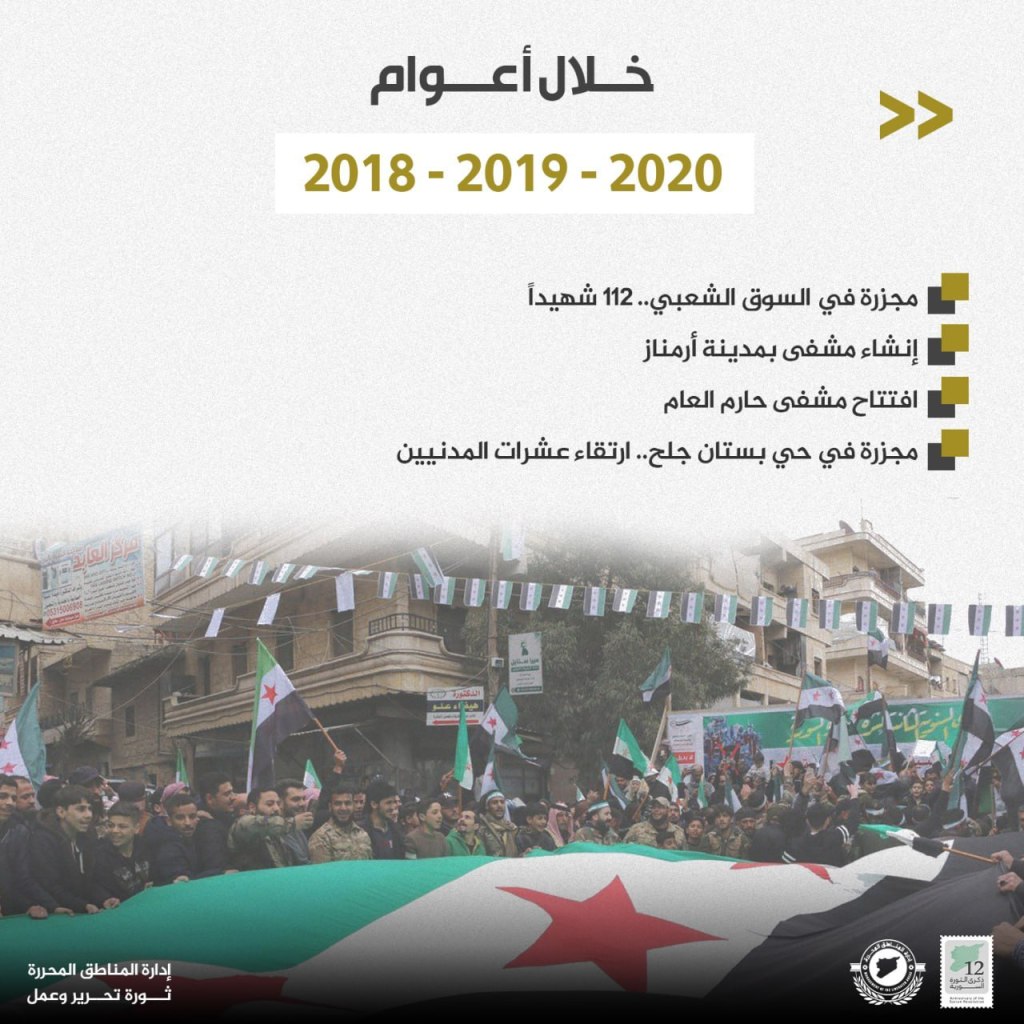
- 2018-2019-2020
- Attack on the Sha’abi Souq that killed 112
- Establishment of a hospital in Armanaz
- Opening of a the Public Harim Hospital
- Attack on the Bustan neighborhood that killed dozens of civilians
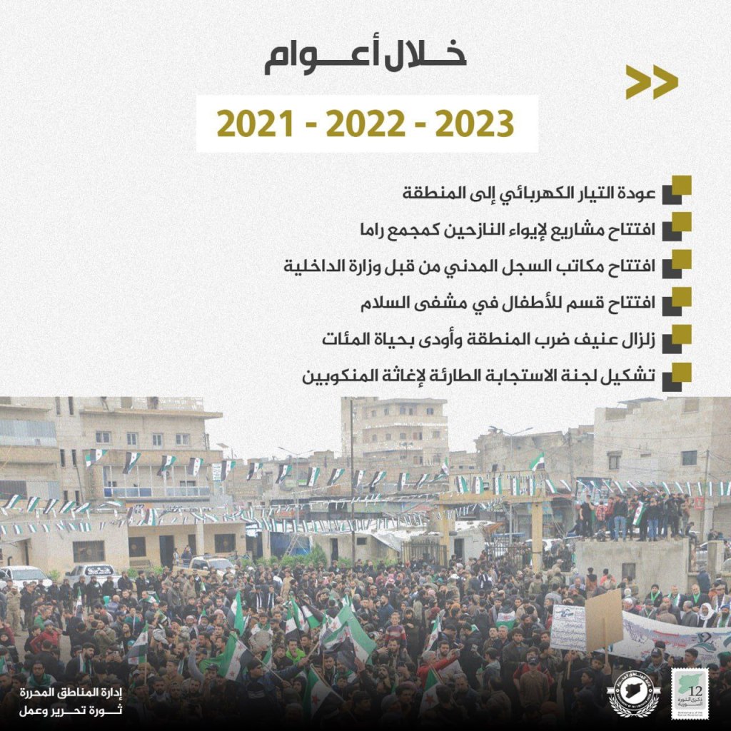
- 2021-2022-2023
- Reestablishment of electricity in the area
- Opening of projects to house the displaced in the Rama compound
- Opening of the civilian record by the Interior Ministry
- Opening of the children’s department in the Salam hospital
- Violent earthquake hits the area and disrupts the lives of thousands
- Formation of the emergency response committee for the earthquake
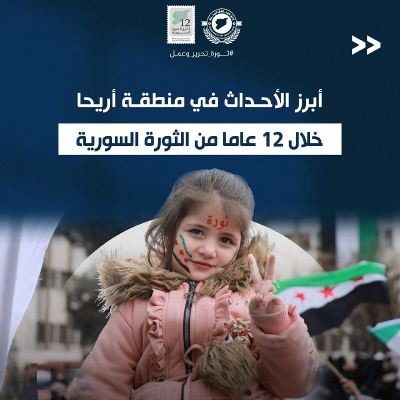
Most Important Events in the Ariha Region During the Past 12 Years of the Syrian Revolution
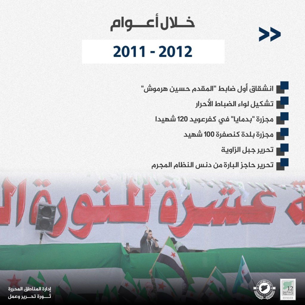

- 2011-2012
- Defection of the first officer, Lt. Col. Hussein Harmush
- Formation of the Liwa’ al-Dhabat al-Ahrar (Free Officers Brigade)
- Badima attack that killed 120
- Kansafra attack that killed 100
- Liberation of Jabal al-Zawiya
- Liberation of al-Bara checkpoint from the regime
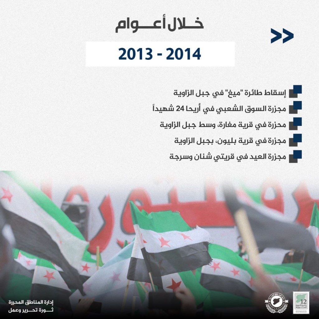
- 2013-2014
- “MiG” plane crash in Jabal al-Zawiya
- Attack on al-Suq al-Sha’abi in Ariha that killed 24
- Attack on Magharah, a village in the middle of Jabal al-Zawiya
- Attack on Balyun, a village in the middle of Jabal al-Zawiya
- Eid attack in the villages of Shnan and Sarjah
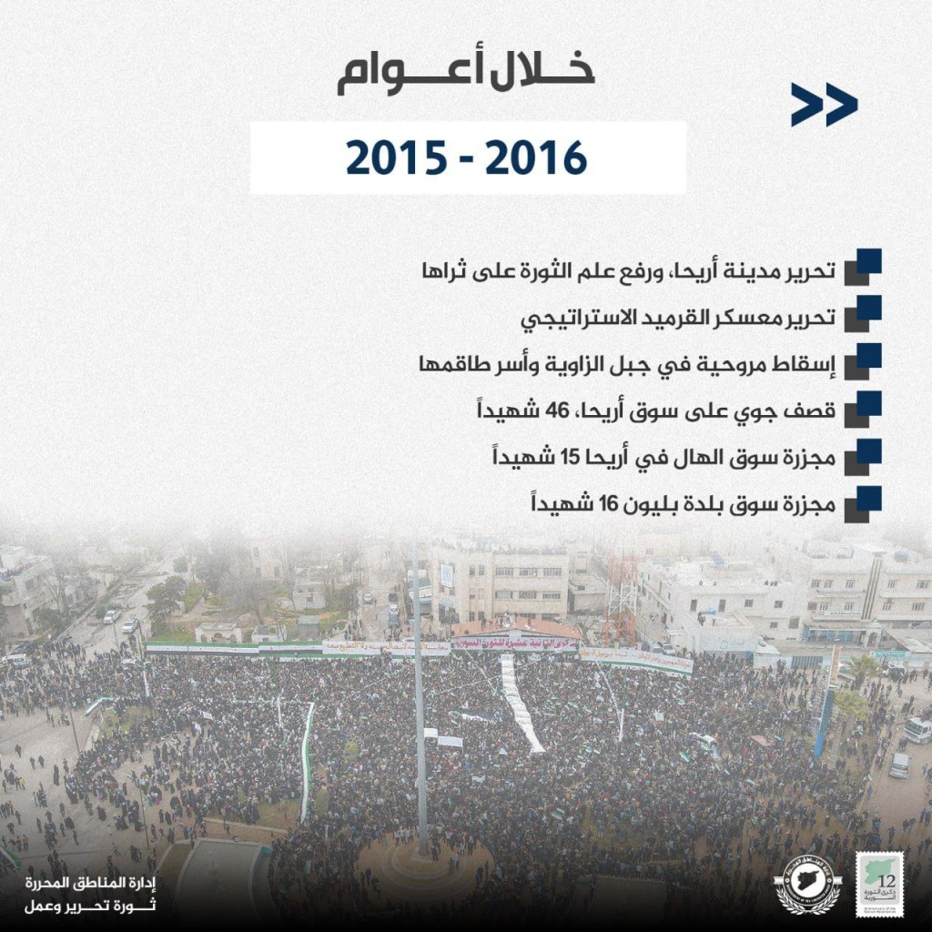
- 2015-2016
- Liberation of Ariha and raising the revolutionary flag
- Liberation of the strategic al-Qarmid camp
- Shooting down a helicopter in Jabal al-Zawiya and capturing its crew
- Bombing of the Ariha market that killed 46
- Attack on al-Hal market in Ariha that killed 15
- Attack on the Balyun market that killed 16
- 2017-2018-2019-2020
- Russian aerial bombing of the Orient hospital in Kfar Nabil
- Russian aerial attack on Mardikh that killed 45
- Bombing of the women and children’s hospital in Shnan by a Russian raid
- Destruction of the Dar al-Hikma hospital in Kfar Nabl due to a Russian raid
- Shooting down a warplane in Jabal al-Zawiya
- Martyrdom of the military leader Abu Ubaydah Kansafra
- 2021-2022-2023
- Attack on the Iblin town that killed 14
- Attack on the military commander for Hayat Tahrir al-Sham
- Attack on students in Ariha that killed 10
- Connecting electricity to Ariha and some other villages in Jabal al-Zawiya
- Opening of the central hospital in Ariha
- Damages to buildings and infrastructure as a result of the earthquake in Syria
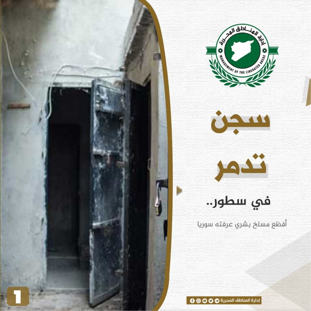
Palmyra Prison: The most horrific human slaughterhouse known to Syria
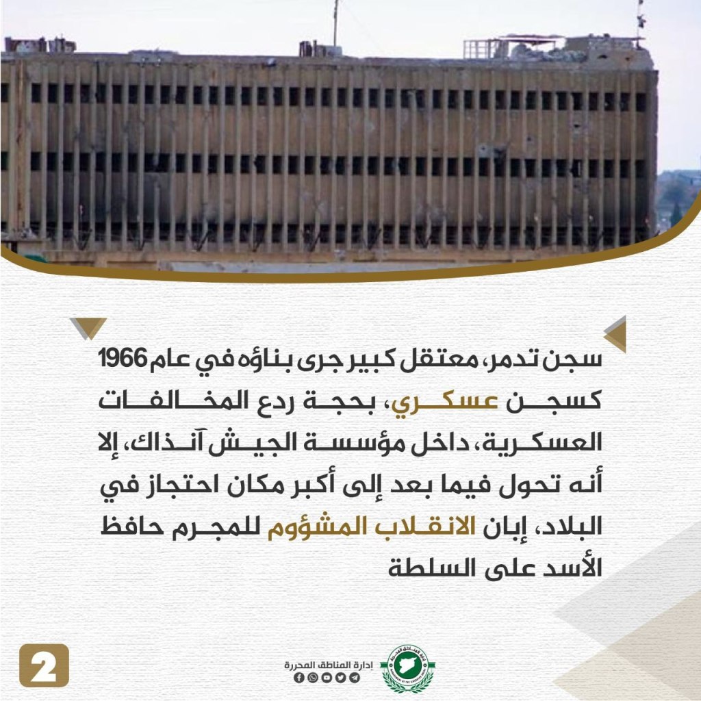
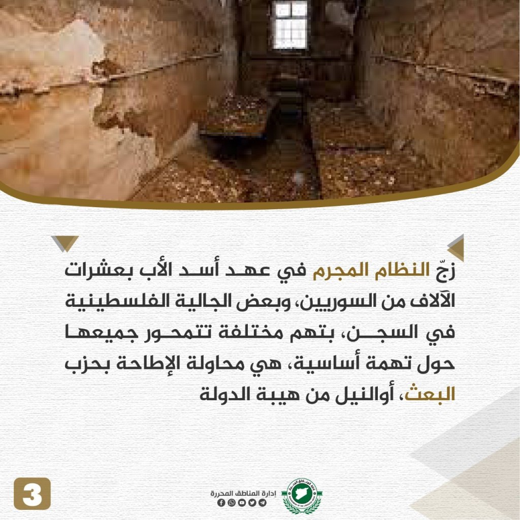
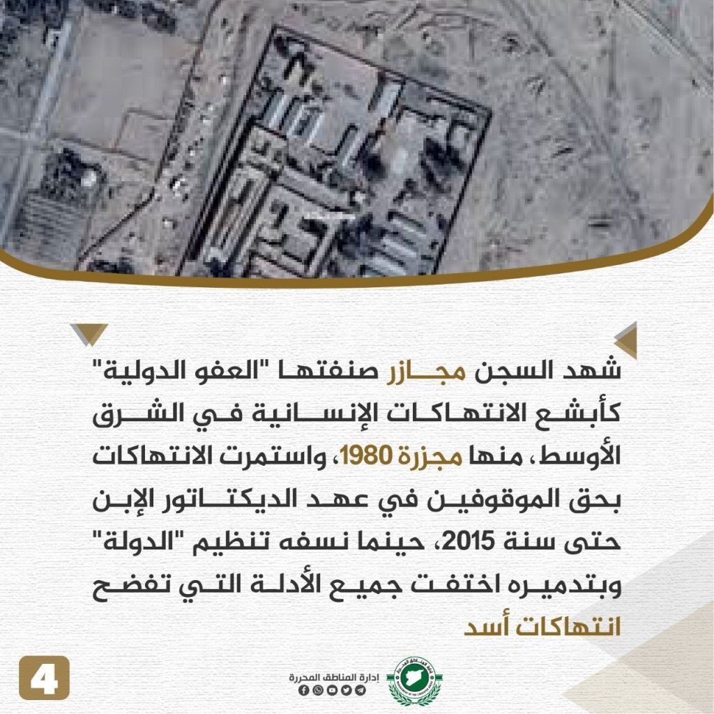
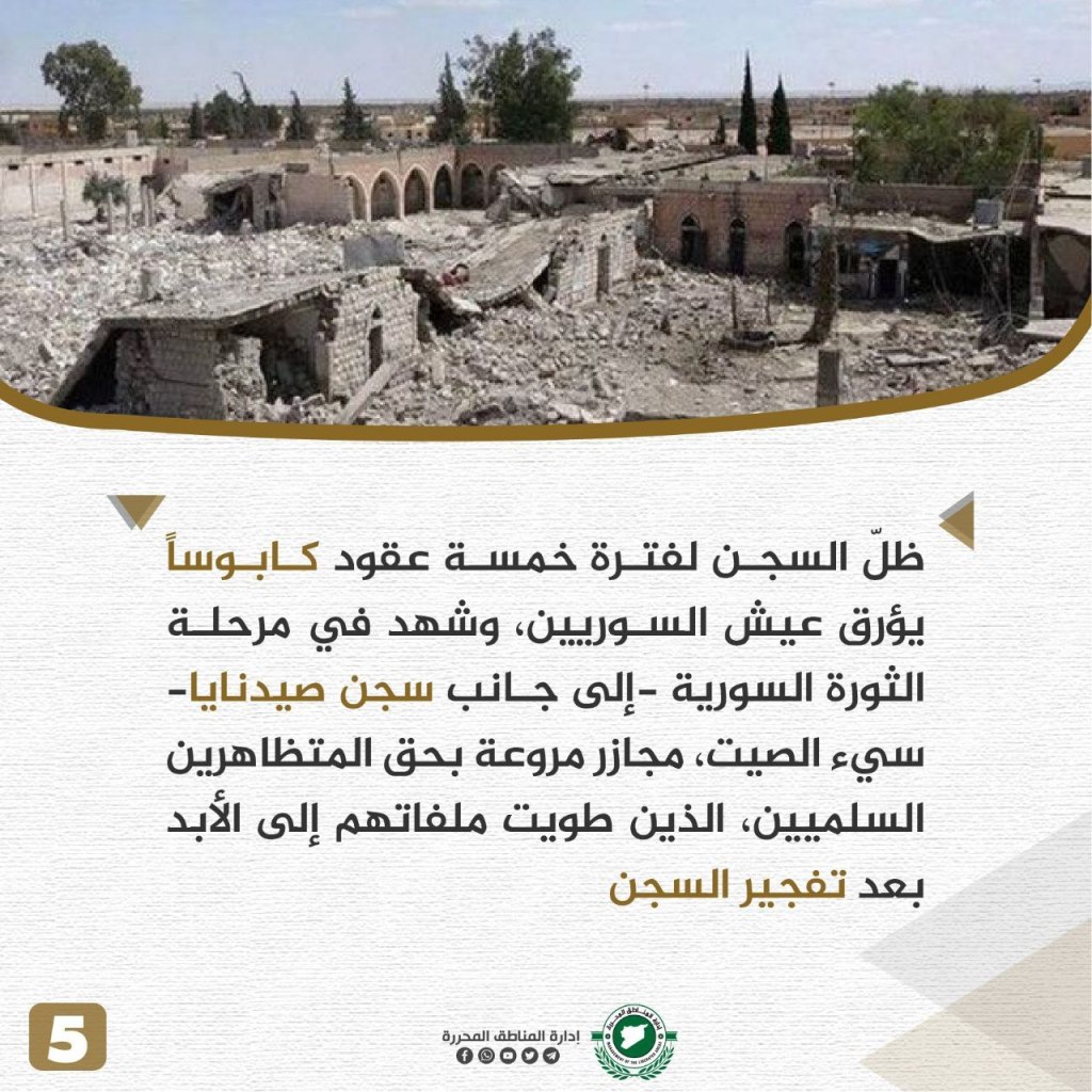
The Palmyra prison, a large prison that was built in 1966 as a military prison under the pretext of deterring military violations inside the army institution at the time, later turned into the largest place of detention in the country during the ill-fated coup of the criminal Hafiz al-Assad. During Hafiz al-Assad’s regime, tens of thousands were imprisoned, some of them Palestinians, on various charges, all centering around a basic charge of attempting to overthrow the Ba’ath Party, or undermining the prestige of the state. The prisoners witnessed massacres that Amnesty International classified as the most heinous human rights violations in the Middle East, including the 1980 massacre. Violations continued against detainees during Bashar al-Assad’s era until 2015, when the Islamic State blew the prison up and destroyed it. All evidence exposing Assad’s violations disappeared. For five decades, the prison remained a nightmare for Syrians, and during the stage of the Syrian revolution – in addition to the notorious Sednaya prison – the Palmyra prisoners witnessed horrific massacres against peaceful demonstrators, whose files were closed forever after the prison bombing.
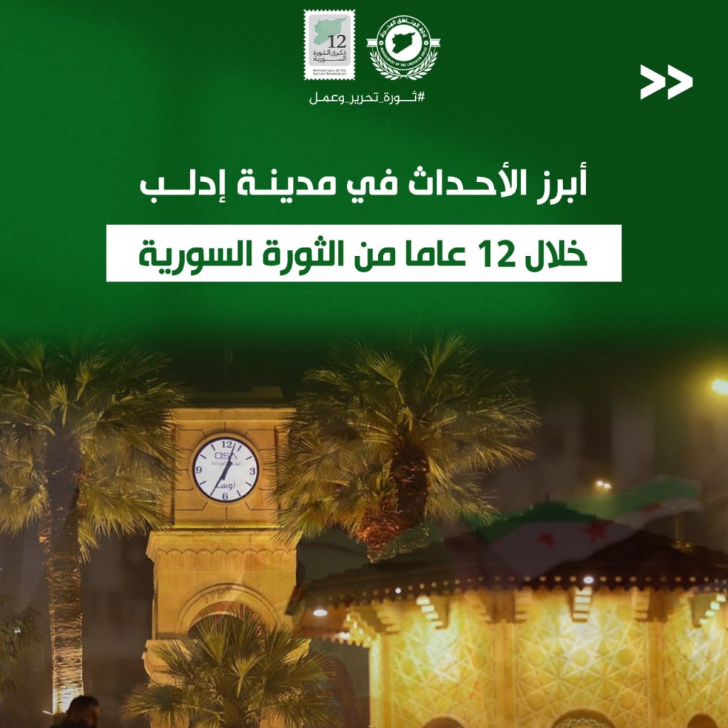
Most Notable Events in the City of Idlib During the 12 Years of the Syrian Revolution
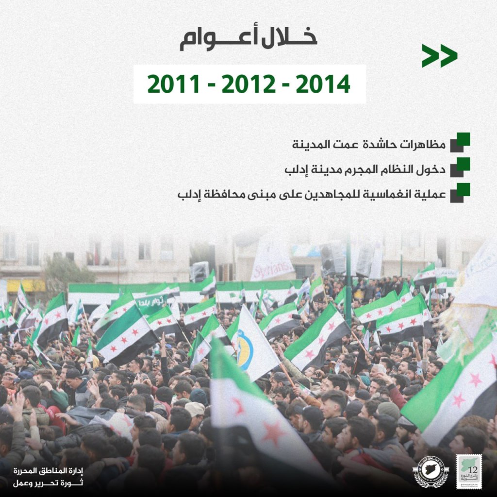

- 2011-2012-2014
- Mass demonstrations swept the city
- The criminal regime came inside Idlib
- The Mujahidin conduct operations on the Idlib Government Building
- 2015-2016-2017
- Founding of Jaysh al-Fatah and liberation of Idlib
- Opening of Idlib University
- Attack on the vegetable market of Idlib
- Attack on the city of Idlib that killed 28 and injured 41
- Founding of the Salvation Government and the beginning of building institutions
- 2018-2019-2020
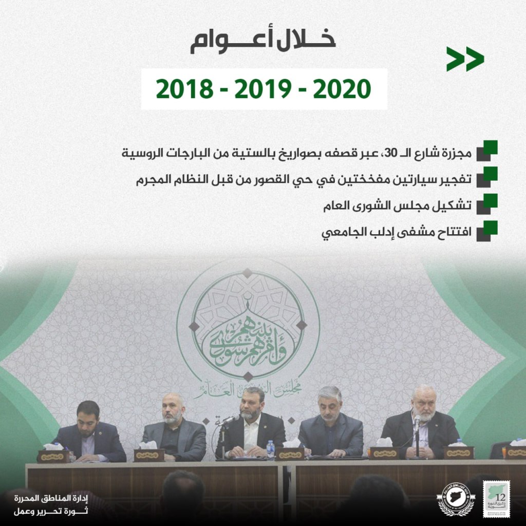
- Attack on 30th street via tactile missile bombings by Russian warplanes
- Explosion of two booby-trapped cars in the Qasour neighborhood caused by the regime
- Formation of the Shura council
- Opening of the Idlib University hospital
- 2021-2022-2023
- Urban revolution begins in the city
- Reopening of the Idlib National Hospital and the Municipal Stadium
- Launching several service projects, including the issuance of personal identification cards
- The earthquake catastrophe that damaged several buildings in the city
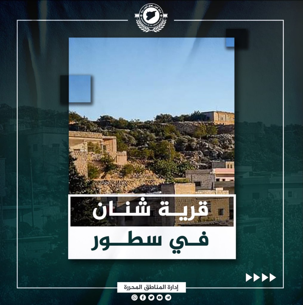
The Village of Shnan
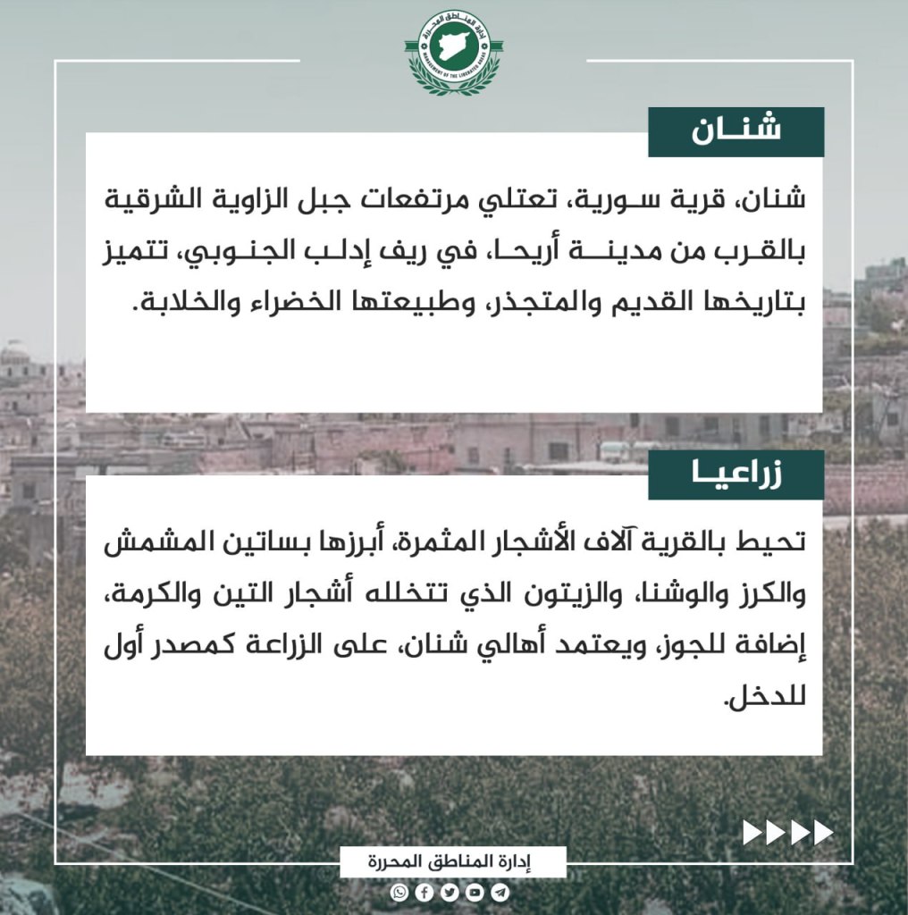
Shnan is a Syrian village that ascends the heights of east Jabal al-Zawiya near the city of Ariha, located in the southern countryside of Idlib. Shnan is most notable for its ancient history and roots, as well as its green and wonderful nature. The village is surrounded by thousands of fruit trees, most notably apricot, cherry, eucalyptus, olive, fig, walnut, and grape vines. The people of Shnan rely on agriculture as a primary source of income. The name of the village is believed to be Syriac in origin, with its history dating back to before the common era. The most notable ancient discoveries in the area are the “Um Sarfus” location, which dates back to the first century C.E., stone-cut wells, and Islamic tombstones of the Ayubian period. The people of Shnan held an honorable position in the Syrian revolution along with the other villages in the Jabal al-Zawiya area. They suffered many casualties, and this is what made them curse the criminal regime and the Russian occupiers.
The Village of Sardin

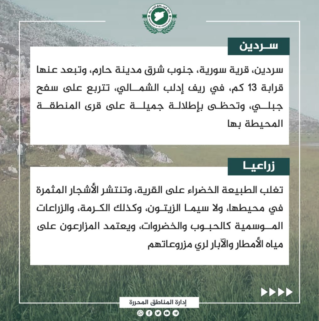
Sardin, a Syrian village, is located on a mountainside 13 km southeast of Harim in the northern countryside of Idlib. Green nature overcomes the village, and fruit trees spread around the area, including olive and almond. Other crops include grains and vegetables. The agricultural sector relies on rain and well water to grow crops. Sardin has a rich history, dating back to before the common era. Located there are Roman caves, which contain wonderful decorations on the walls. There are also the remains of a mosque dating back to the medieval Islamic era. During the revolution, the village received many displaced people from various Syrian regions that were occupied by the militias of the criminal regime in recent years. Its people made tangible contributions to the Syrian revolution since its beginnings.
The Village of Qayqun
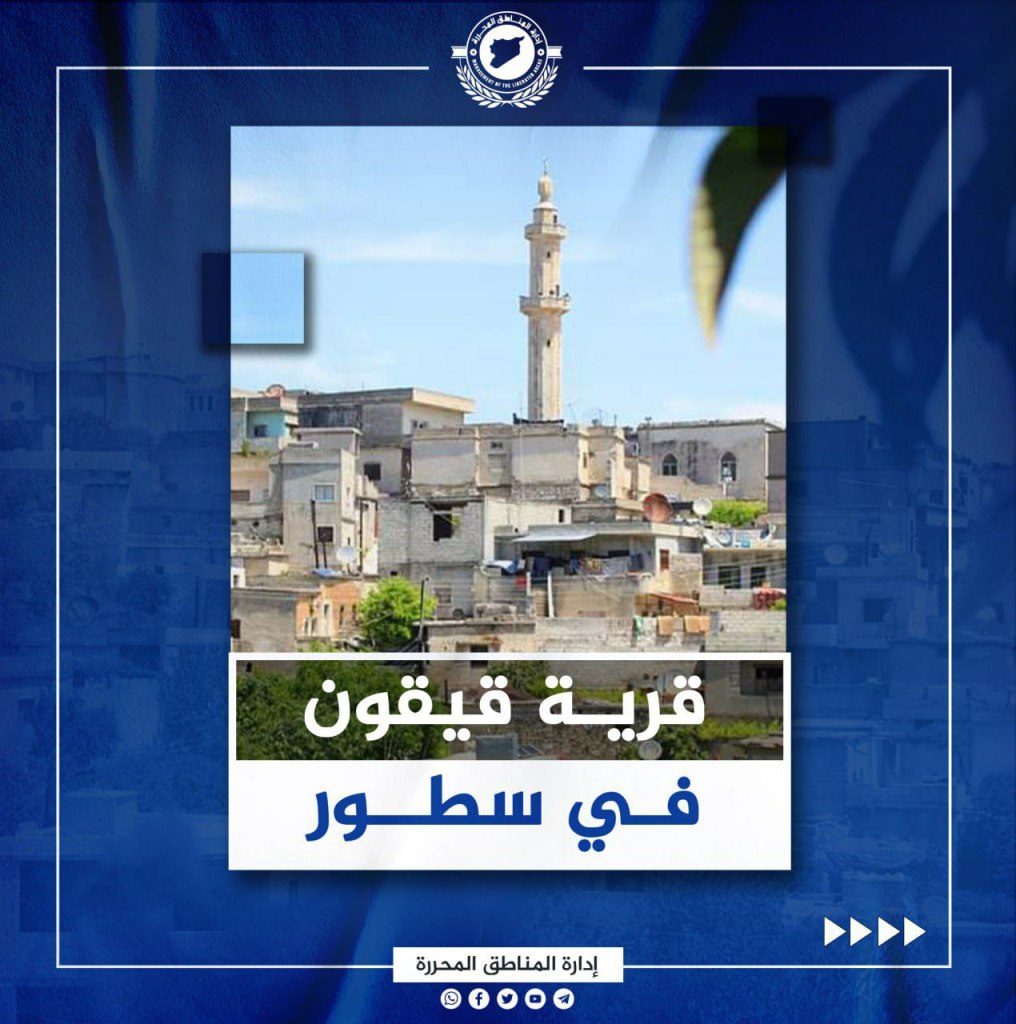

Qayqun, also known as Qaderiyeh, is a Syrian village near the city of Janudiyeh, located 9 km north of Jisr al-Shughur in the western countryside of Idlib. The village is located about 700 meters above sea level and is distinguished by its beautiful green nature and ancient history. Olive trees spread out throughout the village and the residents have taken great care to cultivate them, in addition to orchards of almonds, figs, grapes, apples, and peaches. However, olives are the primary source of income for the village farmers during the season. The older name of the village is Qayqun, while its Arabized version is Qaderiyeh. The village contains remains of Roman wells and an old castle, whose features have disappeared overtime. The castle is currently located along an old trade route that connects Antioch with the Arab countries. During the revolution, Qayqun, was repeatedly bombed by the criminal regime and its Russian allies, leading to several martyrs and wounded falling in 2017 as a result of their honorable position within the Syrian revolution and their involvement in its ranks from its early beginning.
Deir Semaan
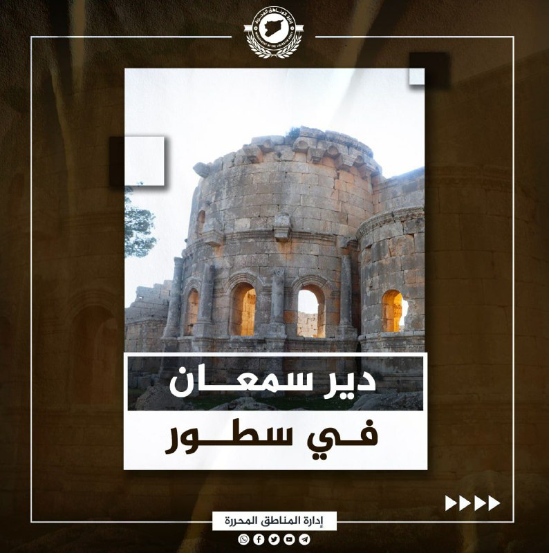
Deir Semaan is a Syrian village located on the peaks of Mount Semaan, northwest of the city of Aleppo, on the road between the cities of Darat Izza and Afrin, previously known as the ancient Qansrin Road. The village is located more than 500 meters above sea level, and many different kinds of crops grow there, including olives, figs, and grapes. The area is distinguished by its limestone rock environment. Some of its residents rely on ranching as a source of income. The village is named after Fort Semaan that was located there, built around 500 years ago. The fort is still one of the most well preserved castles in Syria. The village faced many of the regime’s bombings, leading many of the residents to join the classes of the revolution, as Russian planes targeted them and damaged their possessions.
Sarjah Village
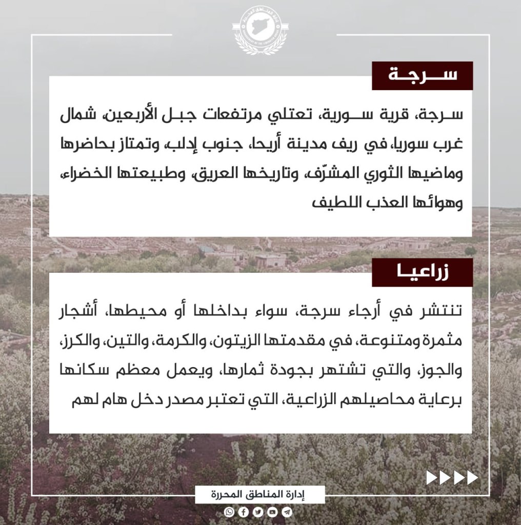
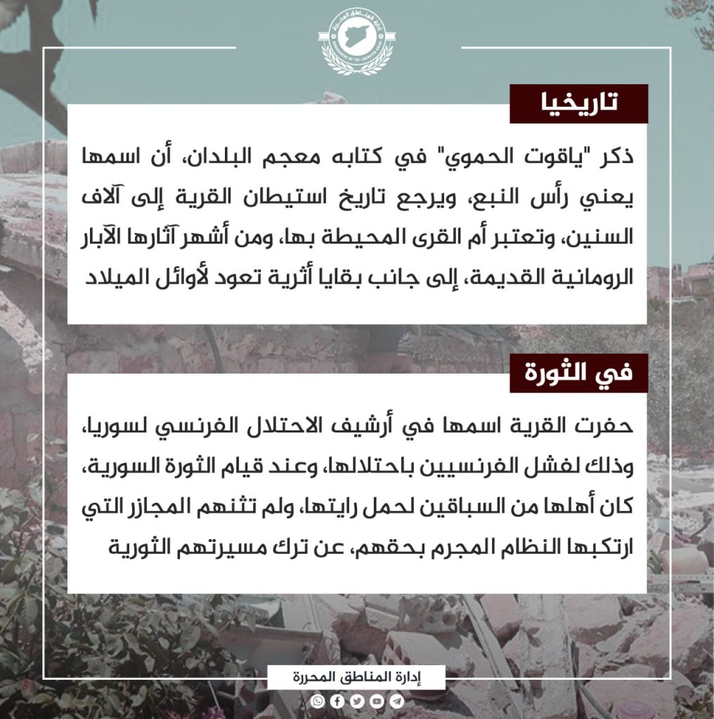
Sarjah, a northwest Syrian village, is located on the peaks of Jabal al-Arba’in in the countryside of Ariha south of Idlib. The village is notable for its honorable revolutionary past and present, in addition to its rich history, green nature, and nice air. Trees spread throughout the village, including olive, fig, grape, cheery, and nut bushes. Most of the residents work in the agricultural sector for income. Yacoub al-Hamawi remembers in his town dictionary that the name Sarjah means “the head of the spring,” dating the settlement of the village back thousands of years. Some of its most famous landmarks include ancient Roman wells that are located next to archeological remains from before the common era. The village later engraved its name in the archives of the French occupation of Syria, and the failure of the French in its occupation. Its people carry that vision, and they were not deterred by the massacres of their rights committed by the criminal regime, leaving them committed to determining their own revolutionary path.
Tal al-Karamah
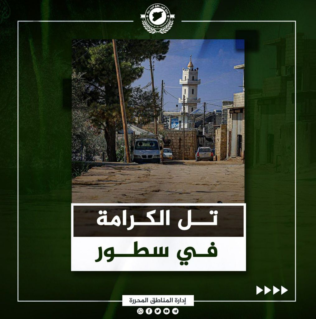
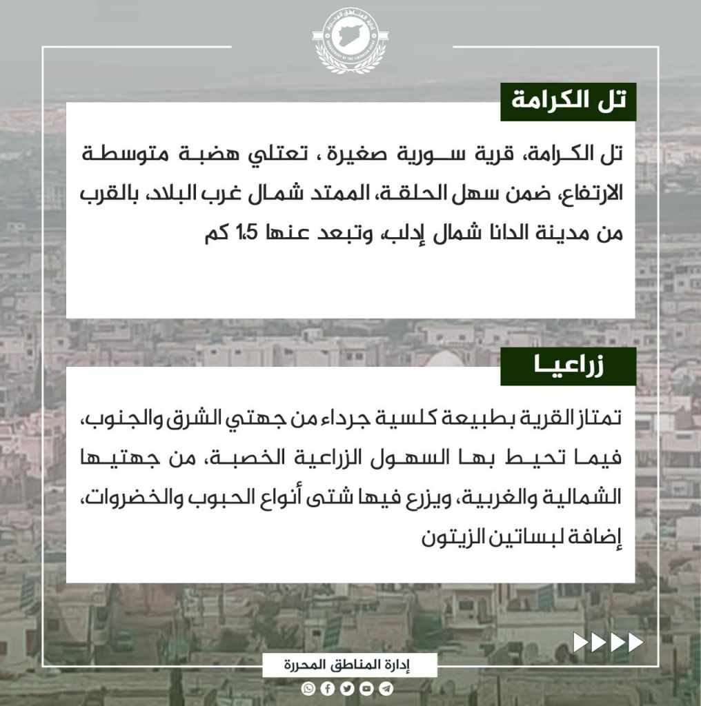
Tal al-Karamah is a small Syrian village that sits at medium altitude within the ring plain extending northwest of the country, 1.5 km away from al-Dana, located north of Idlib. The village is distinguished by its classic nature, barren on the east and the south, while agricultural fields are located to the west and the north. There, different kinds of grains and vegetables are grown, in addition to olive groves. The village was known as “Tal Aqbarin” and was renamed Tal al-Karamah in 1982 after a battle that occurred there in 1119 CE in which the Arabs led by “Ilgazi” defeated the Crusaders led by “Roger.” The village embraces the remains of archaeological sites, including Roman towers and pavement. Several months after the Syrian revolution broke out, the people of the village rose up against the criminal regime, and participated in the demonstrations that took place in addition to receiving tens of thousands of displaced people.
Most Notable Events of the Syrian Revolution in the Month of May

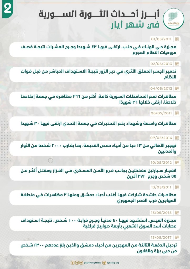
- 5/1/2011: Regime Forces Kidnap about 500 Bodies of Daraa Martyrs
- The regime forces and its Shabiha kidnap the bodies of about 500 martyrs who died during the seven day siege and bombardment of Daraa. Until now their fate is unknown.
- 5/2/2013: The Bayada and Baniyas Massacre
- The regime and its militias committed a massacre against the people of the Bayada in Baniyas, killing 260 civilians, including 36 children and 28 women. The number of dead and missing has reached 700 civilians.
- 5/6/2016: Jaysh al-Fatah liberates Khan Tuman in Aleppo
- Jaysh al-Fatah liberates the strategic Khan Tuman area in the southern countryside of Aleppo, announcing the killing of 150 members of Iranian, Lebanese, and Afghan militants and the killing of others.
- 5/12/2018: The Tarimsah Massacre
- Assad’s gangs and sectarian militias committed a massacre in the city of Tarimsah in the countryside of Hama, leading to the death of over 200 victims due to shelling by tanks, helicopters, and field troops.
- 5/15/2012: Khan Shaykhun Massacre
- In the presence of international observers, 30 people were killed and nearly 100 wounded as a result of direct fire by Assad’s gangs during the funeral of the martyr Ahmed Fatrawy.
- 5/19/2015: The Liberation of the Strategic Mastumah Camp
- Jaish al-Fatah liberated the Mastumah camp, south of Idlib, which is one of the most important areas of the regime forces, and killed dozens of regime officers and members. They also seized light and heavy weapons, and paved the way for the liberation of the entire Syrian province of Idlib.
- 5/25/2011: the Killing of Hamza al-Khatib
- Assad’s gangs handed over the body of the child Hamza al-Khatib, showing brutal signs of torture. Hamza was the first child martyr during the Syrian revolution.
- 5/26/2015: The Houla Massacre
- The militia of the criminal regime committed a horrible massacre in the town of Houla in Homs. 114 people were killed with knives, most of them women and children, and this terrible massacre led to widespread international condemnation.
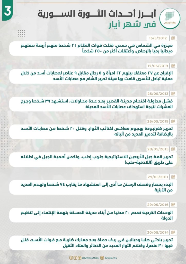
- 5/1/2011:
- The Halak massacre in Aleppo, in which 43 martyrs were killed and dozens were wounded as a result of the helicopter bombings by the criminal regime.
- 5/2/2013:
- The destruction of the ancient suspension bridge in Deir el-Zour as a result of direct targeting by regime forces.
- 5/4/2012:
- Demonstrations spread across Syrian governorates. More than 366 demonstrators on the Friday of Ikhlasna Khalasna, 36 of which were killed.
- 5/6/2011:
- Wide demonstrations and martyrs despite warnings on the Friday of the Challenge in which 30 are killed.
- 5/7/2014:
- Displacement of people from 13 neighborhoods of Homs, where 2,000 people are displaced.
- 5/10/2012
- Two booby-trapped cars explode next to the Military Security Branch in Al-Qazzaz, killing 100 people and wounding 372.
- 5/13/2011:
- Mass demonstrations in Damascus neighborhoods, including three in immigrant areas near the Republican Palace.
- 5/13/2015:
- 40 are killed and 100 are injured as a result of targeting during the al-Ais massacre.
- 5/13/2017:
- Deportation of a third group of over 2,200 displaced people from the Damascus neighborhoods of Barzah and Qabun.
- 5/15/2012:
- Massacre in Al-Shams neighborhood of Homs that killed 21 people, including 4 by firing squad. 250 people were arrested.
- 5/17/2019:
- The release of 27 detainees, including 22 women and 5 men, in exchange for 9 members of Assad’s gangs, through a prisoner exchange operation carried out by Hayat Tahrir al-Sham.
- 5/25/2013:
- Assad forces attempt and fail to storm the city of al-Qusayr several times, yet they killed 29 people and injured dozens.
- 5/26/2019:
- Liberation of Kfar Nabudah by an attack of Kata’ib al-Thuwar, killing 20 members of Assad’s gangs and destroying many of its vehicles.
- 5/28/2015:
- Liberating the strategic summit of Jabal al-Arbayin, south of Idlib, and the important area of the mountain in the Latakia-Aleppo road.
- 5/29/2011:
- The beginning of the siege and bombing of Rastan that killed 74 people and destroyed many buildings.
- 5/29/2016:
- The Kurdish units (SDF) execute 20 civilians in Hasakah on charges of belonging to the Islamic State.
- 5/30/2014:
- Liberation of the towns of Salba and Hayalin in the countryside of Hama after fierce battles with Assad’s forces. 30 members of his forces were killed, while rebels seized ammunition and heavy equipment.
The Most Notable Events of the Syrian Revolution in the Month of June

- 6/1/2011: the Fourth Division militia and other security forces committed a massacre in the Barta neighborhood in eastern al-Rustan in the countryside of Homs, killing 34. The treacherous forces pulled out all the bodies and put them in black nylon bags.
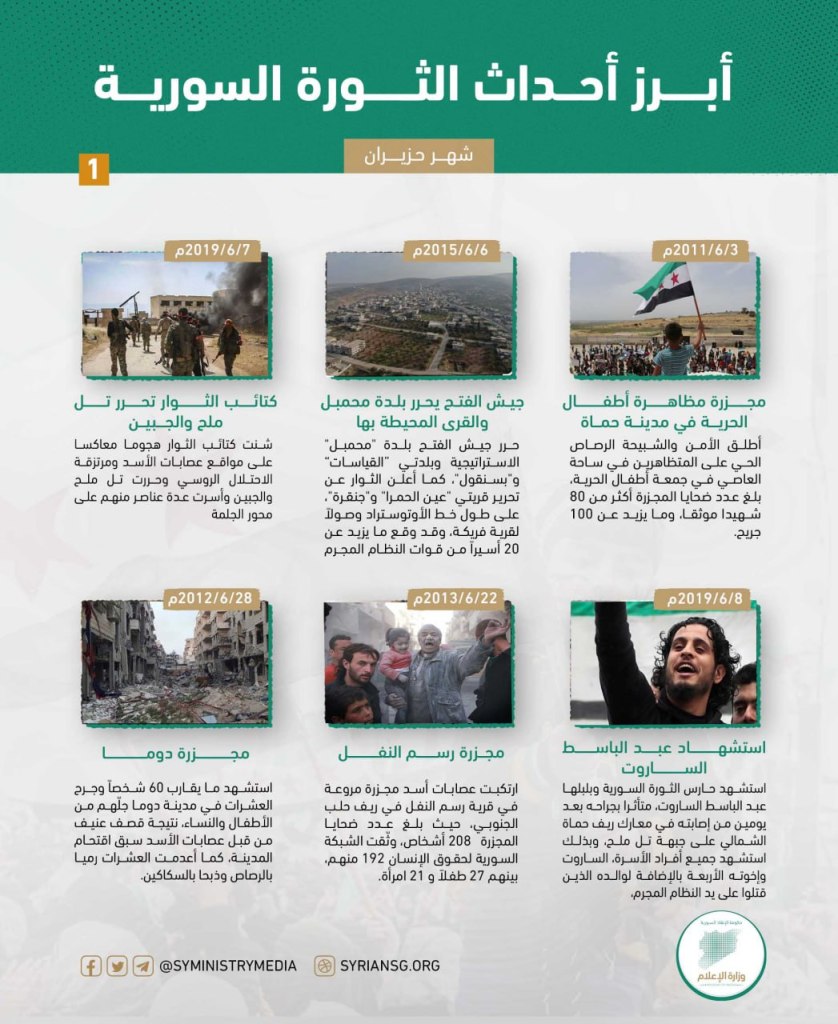
- 6/3/2011: Massacre against the demonstration of “Children of Freedom” in Hama
- The security and Shabiha forces fired live rounds at the protestors in the Ami Square during a gathering of the Children of Freedom. The massacre left more than 80 martyrs and over 100 injured.
- 6/6/2011: The rebels liberated the city of Jisr al-Shughour from the the military security detachment, killing nearly 120 of Assad’s security forces, while prior to the liberation, and over the course of three days, the detachment members targeted demonstrators and mourners, as a result of which 38 people were killed.
- 6/9/2011: On this day, Lieutenant Colonel Hussein Harmoush defected from al-Assad’s gangs, after what he saw of criminality and brutality against the Syrian people, to form the central part of the Free Syrian Army, which embraced all those who defected from the Assad regime.
- 6/4/2012: On this day, many soldiers announced their defection from the Dumayr military airport in the city of Dumayr, located in the countryside of Damascus, influencing Assad’s gangs to conduct a heavy bombardment on the city.
- 6/6/2012: Factions of shabiha and security forces stormed the town of al-Qubeir in the countryside of Hama, committing a massacre that led to over 100 deaths, among them 35 families, the majority of whom were women and children who were slaughtered and burned in their homes.
- 6/11/2012: The 743rd Rocket Battalion, the 72nd Brigade, and the leaders of the 26th Division in Homs granted the soldiers and officers of the battalion a qualitative discharge and the freedom to go home or join the Free Syrian Army.
- 6/20/2012: The pilot, Hassan Marei Al Hamada, defected from his MiG-21 warplane after he received orders from the criminal Assad regime to bomb civilian villages in Daraa, so he crashed his plane into the land.
- 6/22/2012: Assad’s air defenses shot down a Turkish fighter east of the Mediterranean sea, after it penetrated Syrian air space, as a result, an urgent NATO meeting was requested.
- 6/25/2012: Six officers and 33 soldiers defected from Assad’s gang army and arrived on Turkish lands.
- 6/26/2012: Nearly 280 soldiers defected from Assad’s army on the state road between Damascus and Aleppo, and they clashed with Assad’s gangs and were able to bring down a helicopter and damaged three tanks near the city of Saraqib.
- 6/28/2012: Duma massacre
- Nearly 60 people were martyred and dozens were injured in the city of Duma, many of whom were women and children, as the result of heavy bombing by Assad’s gangs, who had already stormed the city and executed dozens by shooting them dead and stabbing them with knives.
- 6/30/2012: the Geneva conference was held, resulting in the issuing of the “One Geneva” statement, which called for an end ot the violence in Syria, the release of detainees, the guarantees to the rights of demonstration and free expression, and Syria’s transition to a new political phase leading to free elections. However, on the ground, the regime continued to pursue a military solution.
- 6/2/2013: Eight soldiers from Assad’s gangs are killed by a car bomb near the security center in the Jubur neighborhood of Damascus.
- 6/22/2013: Rasm al-Nafl massacre
- Assad’s gangs committed a horrendous massacre in the village of Rasm al-Nafl in the southern countryside of Aleppo, producing 208 victims. The Syrian Network for Human Rights documented 192 of them, including 27 children and 21 women.
- 6/25/2013: Assad’s gangs fired four missiles from the Vehicle Administration adjacent to the city of Arbin, at the neighborhood of the Sino Mosque and Arbin Square. Eight martyrs, including four children and a woman, were killed as a result, and dozens were wounded.
- 6/14/2014: The criminal regime forces carried out a barrel and rocket bombing on a large gathering in the center of the city of Andan in the northern countryside of Aleppo killing 20 people and injuring dozens, in addition to burning most of the commercial area.
- 6/6/2015: Jaysh al-Fath liberates the town of Muhambal and its surrounding towns
- Jaysh al-Fath liberated the strategic town of Muhambal and the villages Bsanqul and al-Qayasat. They also announced the liberation of Ain al-Hamra and Junqerah, located on the way to the village of Furaykah, and the taking of 20 prisoners from the regime’s forces.
- 6/6/2016: Abu al-Harith al-Diri carried out a suicide operation on groups of Assad’s army and occupying Russian forces in the Khan Tuman warehouses area to stop the fierce attack on the area at the time.
- 6/25/2016: The Russian planes cluster bombed the al-Iman Mosque in the center of al-Quweyah, Deir el-Zour, killing 70 (including 25 children) and injuring 100.
- 6/28/2016: The battle to liberate al-Meleh and Handrat began, with the goal of returning the areas lost by the revolutionaries. The revolutionaries began attacking the north of al-Meleh and they liberated it in addition to other villages after a bloody battle with the regime forces and its militias.
- 6/30/2017: The Lebanese army raided the tents of Syrian refugees in the border area of Arsal and arrested hundreds of civilians from their tents after beating and abusing them, accusing them of drug trafficking and belonging to the Islamic State.
- 6/7/2019: Revolutionary battalions liberate Tal Meleh and Tal Jabin
- Revolutionary battalions carried out a military attack on the positions held by Assad’s gangs and the Russian occupation forces and liberated Tal Meleh and Tal Jabin and took a number of their members prisoner.
- 6/8/2019: Abd al-Basat al-Sarout is martyred
- The guard of the Syrian revolution Abd al-Basat al-Sarout was martyred after succumbing to his pain two days after he was wounded in the battles of the northern Hama countryside on the Tal Meleh front. His entire family, including his four brothers and his father, were killed by the criminal regime.
- 6/18/2019: the room of the operations of al-Fath al-Mibayn announced the beginning of a new state in the military operations against Assad’s gangs in the countryside of Hama, leading to a violent battle on the Liberated Areas’s villages of al-Jalmah, al-Jadidah, al-Shaykh Hadid, and Kafr Hud.
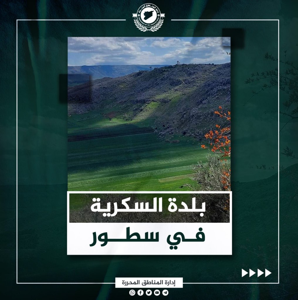
al-Sokkariyeh Town
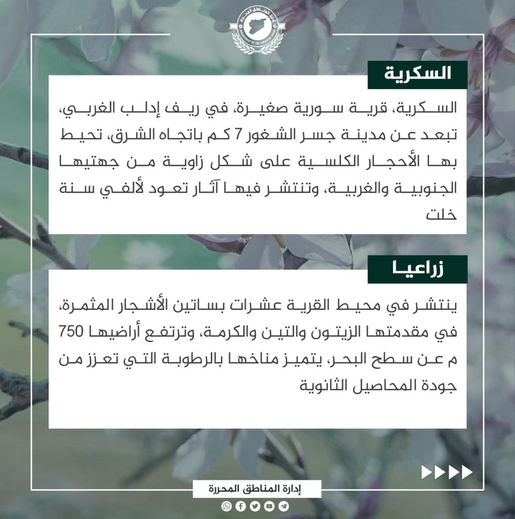
The town of Sokkariyeh is located in the western countryside of Idlib, about 7 km from the city of Jisr al-Shughur to the East. The village is surrounded by classical rocks in angular shapes on its southern and western sides. The rocks are 1,000s of years old. Dozens of orchards are spread throughout the area continuing fruit trees. The most notable trees are olives, almonds, and figs. The town is located about 750 meters above sea level and it is very humid.
The ruins of Sokkariyeh date back to the second century BCE, most notably the caves that were used for housing. People settled the caves at that time because of its location near fresh water springs, which were a main reason for establishing civilizations in the past. The most famous of these bodies is the Durra Spring. During the Great Syrian Revolt, the village was called “Breaking the Enemy” during the 20th century CE because the French were defeated on its borders at the hands of revolutionaries who joined the revolutionary Shaykh Ibrahim Hanano. During the modern Syrian revolution, the grandchildren followed the example of their forefathers, and joined the ranks of the revolution since its inception.
The Town of al-Sahharah
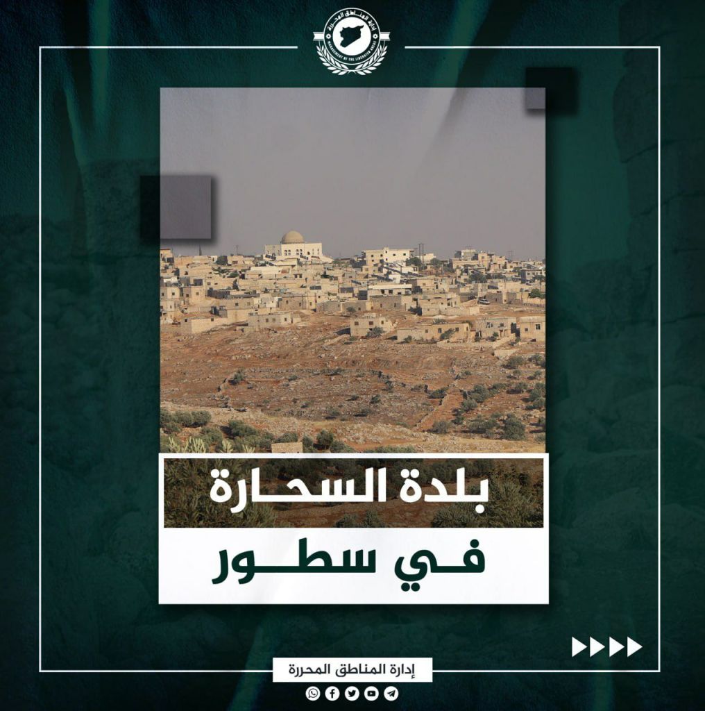
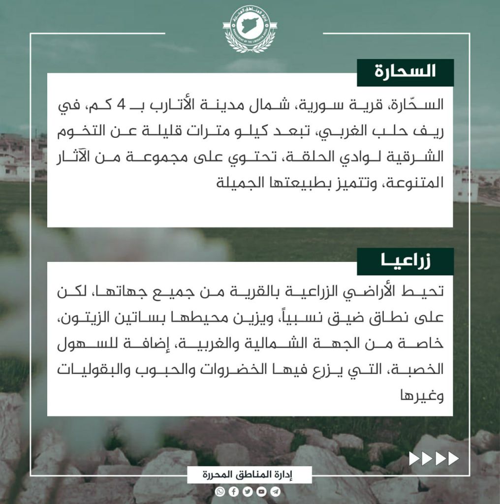
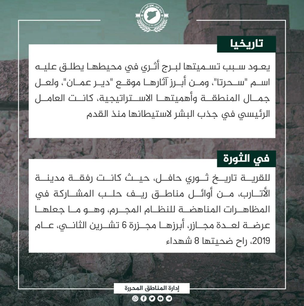
al-Sahharah is a Syrian village located 4 km north of the city of Atarib in the western Aleppo countryside, a few kilometers from eastern Wadi al-Halqa. The village contains various antiquities and is characterized by its natural beauty. Agricultural lands surround the village on all sides, but on a small scale. Olive groves surround the village to the north and west, while vegetables, grains, and legumes grow on the east and southern sides. The town’s name is al-Sahharah due to an ancient tower in its surroundings with the name “Sahharta” and one of its most notable antiquities is the location “Deir Amman” for its beauty and strategic important, as it was principal factor in attracting humans to inhabit it since ancient times. The village has a deep revolutionary history with its relationship with Atarib, and was one of the first areas in the countryside of Aleppo to participate in the demonstrations against the regime and faced several massacres, including the November 6, 2019 massacre that led to eight martyrs.
The Town of Bsanqul
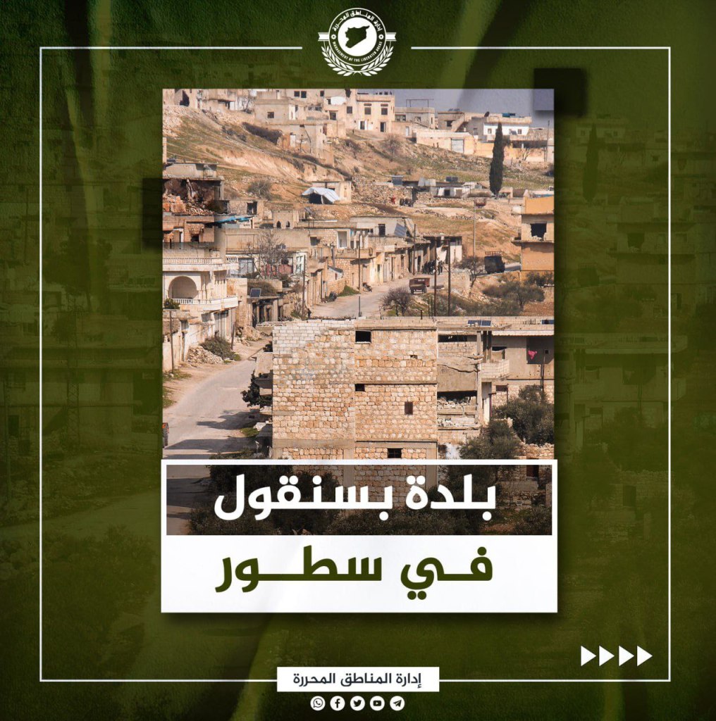
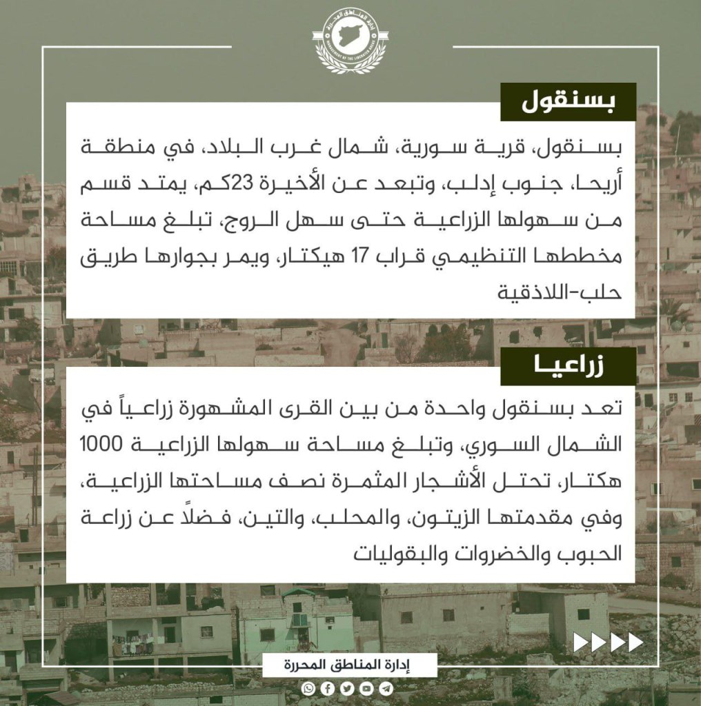
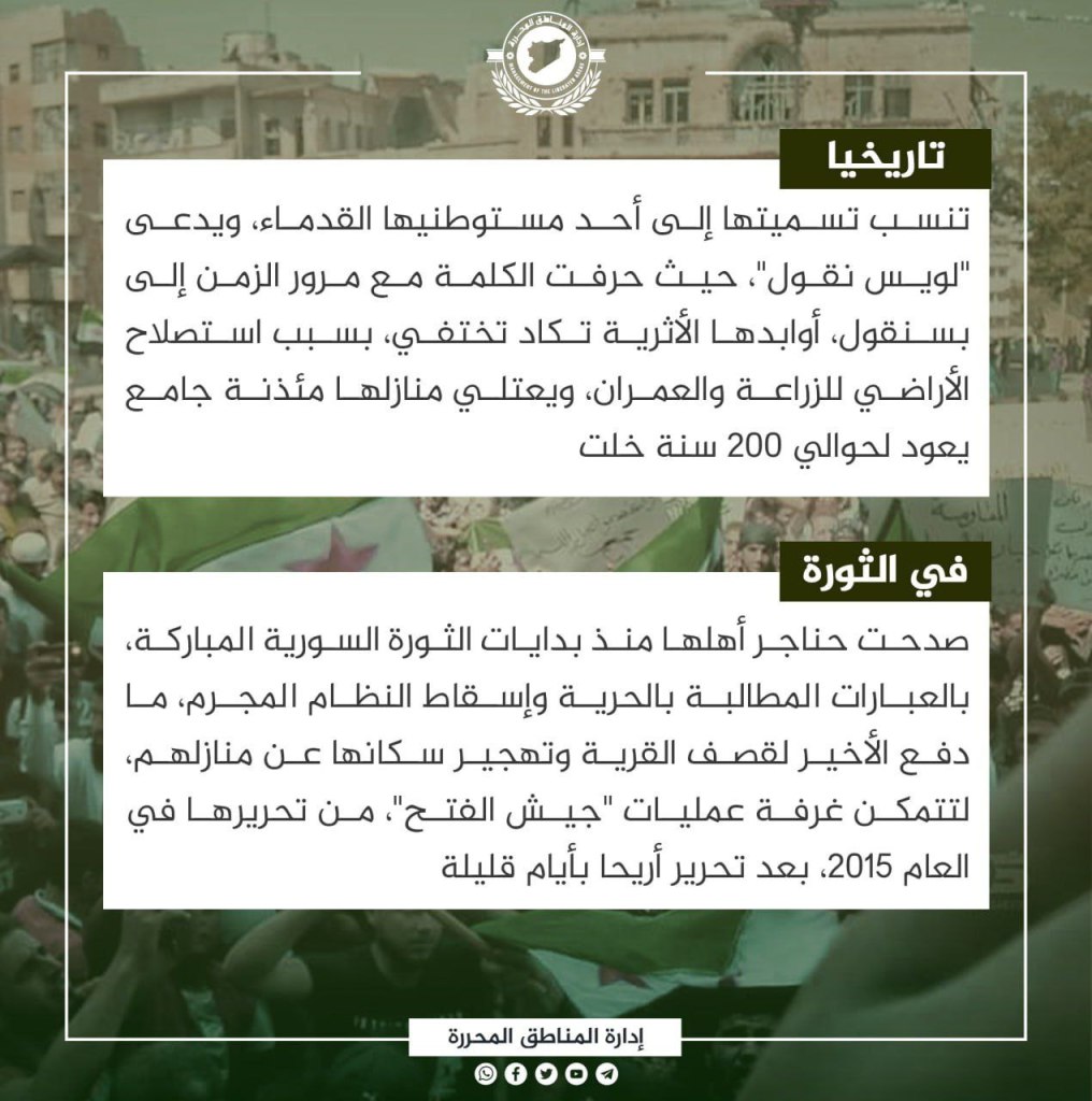
Bsanqul is a Syrian village in the northwest part of the country and is located in the Ariha District about 23 km south of Idlib. The city was planned for about 17 hectares between agricultural lands and the al-Roj Plain, and passes by the road between Aleppo and Latakia. Bsanqul is one of the famous agricultural villages in northern Syria, and has fields that expand 1,000 hectares. Fruitful trees cover half the area, including olive groves, mahlab, and figs, in addition to grain, vegetable, and bean plants. Bsanqul’s name is one of its ancient settlers, Louis Nicol, and the word was changed overtime to Bsanqul. The village’s archeological ruins are almost disappearing because of land reclamation for agriculture and urbanization. A minaret of a mosque dating back almost 200 years rises near the village. During the revolution, the people of Bsanqul participated in the demonstrations since their inception, asking for freedom and the fall of the criminal regime. As a result, they faced bombings of the village and their homes. Jaysh al-Fatah liberated the village in 2015, after liberating Ariha in just a few days.
The Town of al-Nayrab
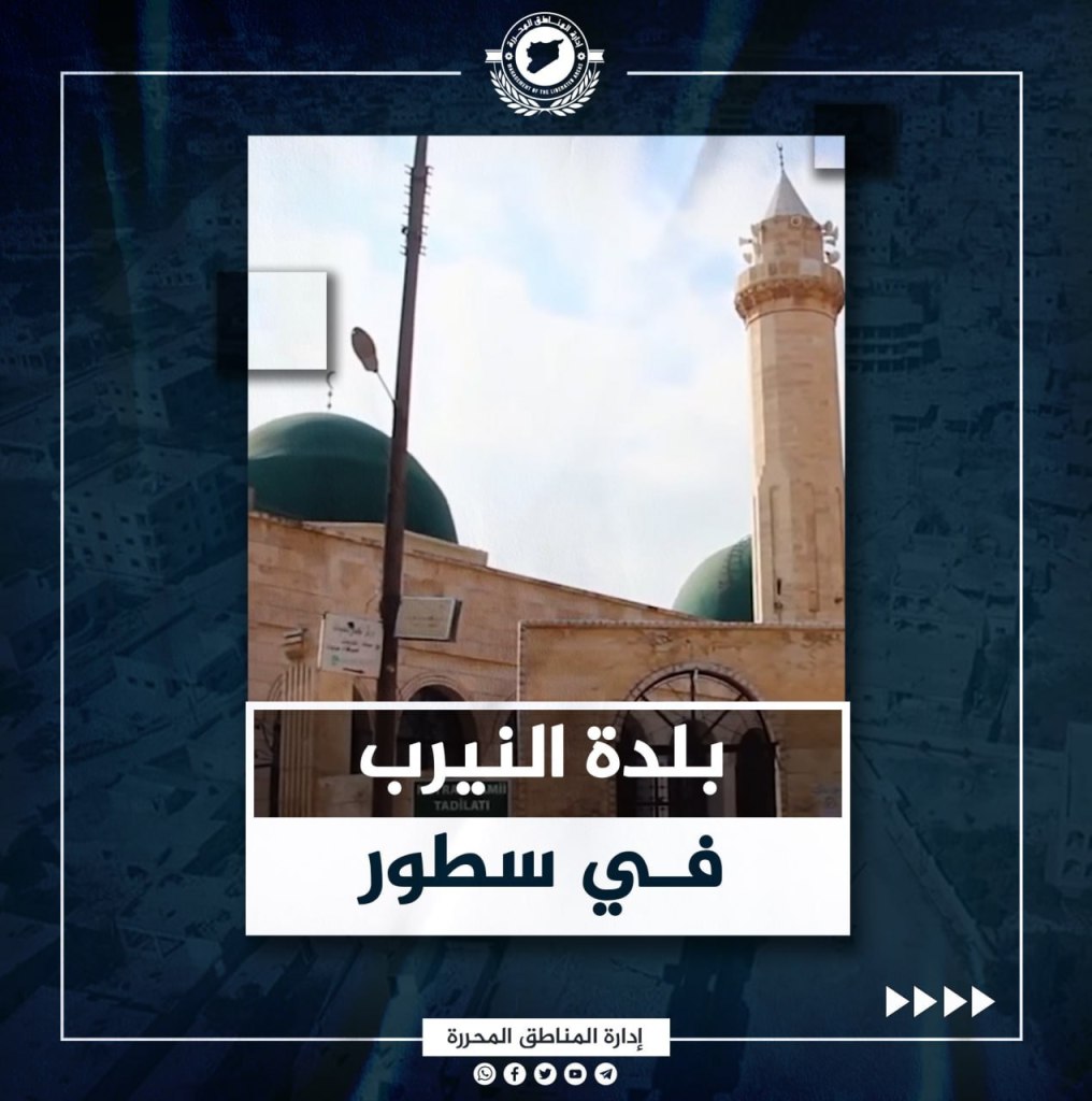
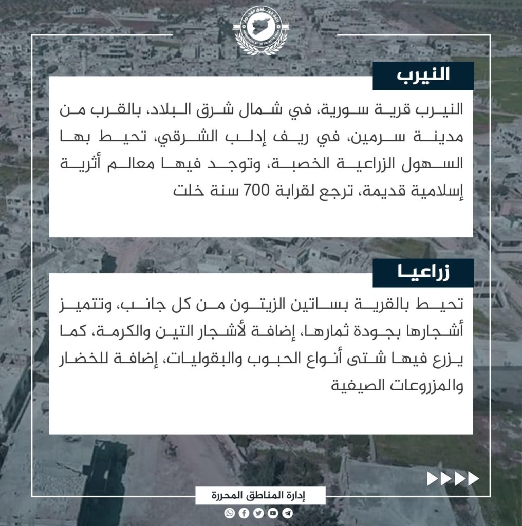
al-Nayrab is located in northwest Syria, near the city of Sarmin in the eastern countryside of Idlib. The town is surrounded by lush agricultural plains, and ancient Islamic archeological sites dating back 700 years are located inside the town limits. Orchards are located on all sides of the town, distinguished by trees with large quantities of olives, figs, and almonds growing on them. Different kinds of grains, beans, and summer vegetables are also grown there. In the middle of al-Nayrab’s ancient streets is a mosque, built in a unique dipping method and considered amongst most archeological sites as the oldest in the area, dating back to the Abbasid Caliphate. Arabic script that was written on the door of one of its rooms is now incomprehensible as a result of its exposure to erosion with the passage of time. The people of Nayrab were integrated into the classes of the blessed Syrian revolution from its beginnings, and suffered from the constant bombings carried out by the criminal regime, which occupied the village in 2020. However, the al-Fatah al-Mubin factions quickly recaptured it.
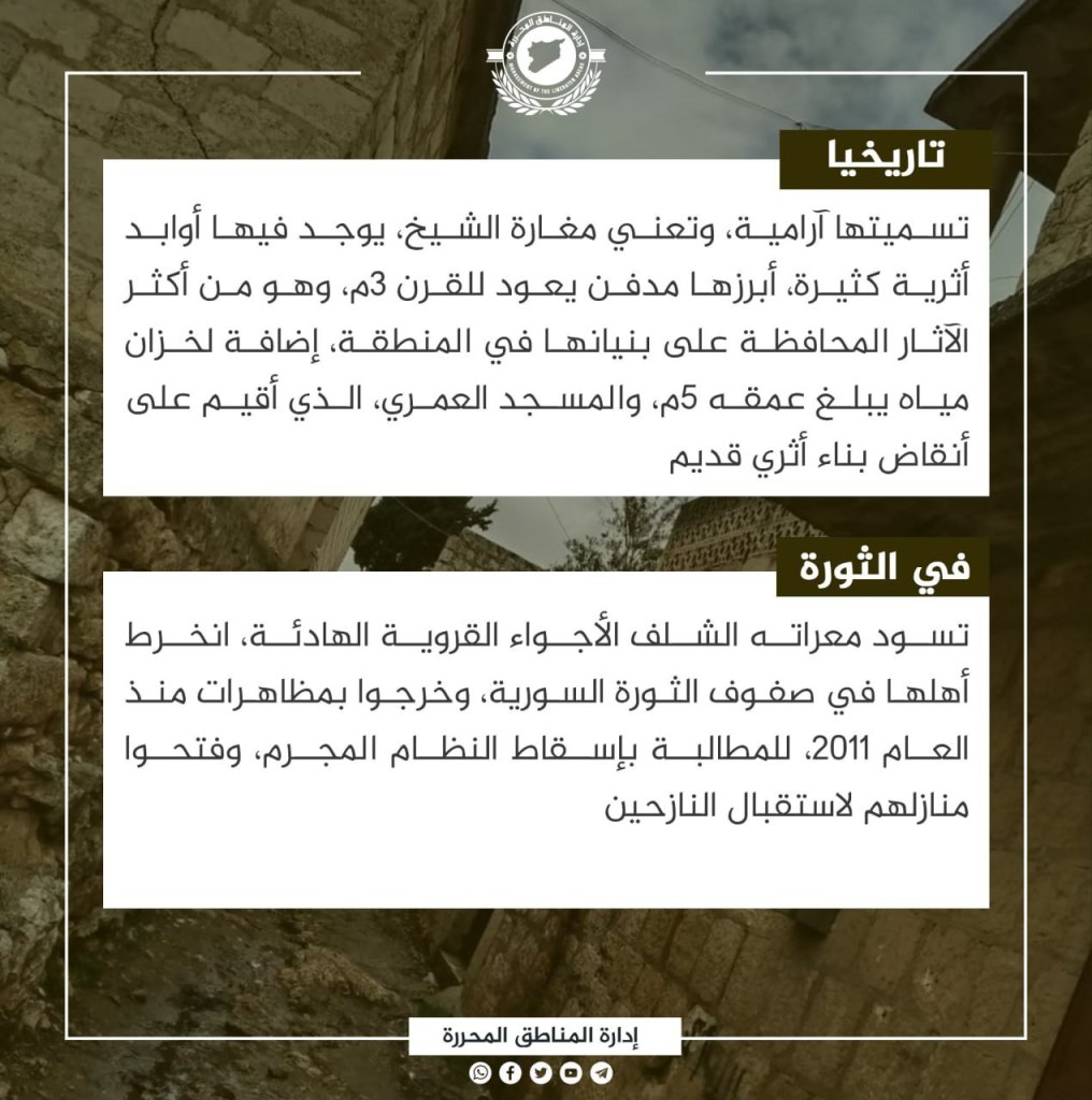
Ma’arat al-Shalaf
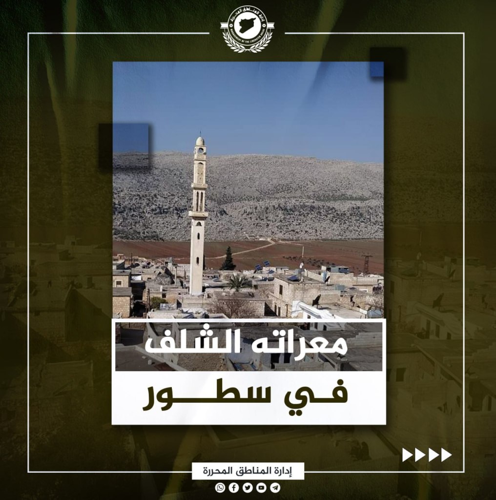
Ma’arat al-Shalaf is a Syrian village in the northwest part of the country. It is located at the meeting points of the Summaq and al-Dweila villages, 12 kilometers southeast of Harim in the northwest countryside of Idlib. The village is surrounded by limestone rocks on one side, interspersed with olive trees, and fertile agricultural plains on the other. In these, grains, legumes, and vegetables are grown, in addition to wild thyme, which receives great attention from farmers.
Ma’arat al-Shalaf’s name is Aramaic in origin, and means “The Sheikh’s Cave.” In the town, there are many ancient monuments, most notably a cemetery from the third century C.E, which is one of the most well preserved ancient monuments in the region, in addition to a water tank with a depth of five meters, and the ‘Umari Mosque, built on top of archeological remains. During the revolution, Ma’arat al-Sharif has prevailed in a quiet, rural atmosphere, while its people have joined the risks of the Syrian revolution. They have joined demonstrations since 2011 to demand the overthrow of the regime, and have opened their homes for the displaced.
The Village of Beftamun
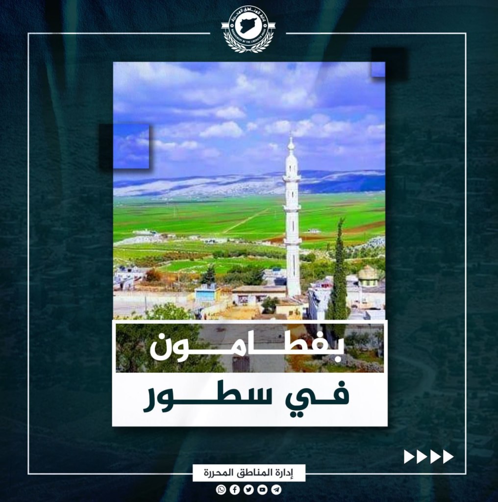

Beftamun is located 11 kilometers east of the Jisr al-Shughour in the western countryside of Idlib. It is distinguished by its fertile agricultural plains to the east. It also is surrounded by dozens of archeological sites. The southern ends of the al-Roj Plain extend east of Beftamun, in which various types of grains, legumes, and vegetables are grown, in addition to olives and figs.
Beftamun’s name is Syriac in origin, and refers to a land rich in water. In the town, there are many rock-cut monuments such as caves and water wells with various inscriptions, which are the most visible monuments in the region.
Like many of Idlib’s villages, the people of Beftamun supported the revolution since its beginnings and participated in demonstrations calling for the overthrow of the regime. The village also hosted dozens of displaced families, increasing the regime’s resentment of the village over the last 12 years.
The Town of al-Janoudiyah
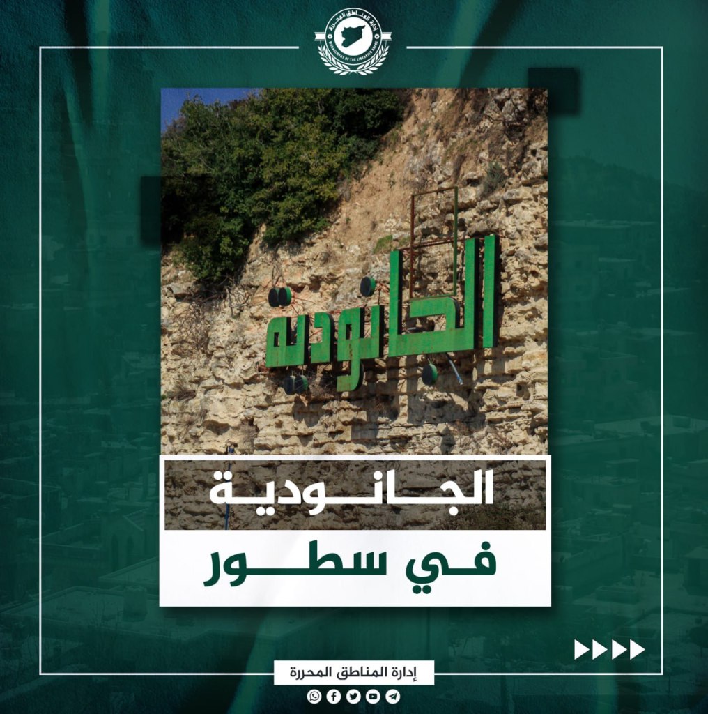
Al-Janoudiyah is located about 8 kilometers from Jisr al-Shughur on a hill that is about 650 meters above sea level. The town is distinguished by its beautiful nature, its ancient archeological sites, and its fresh water spring. The people of Janoudiyah grow a variety of grain and vegetable crops. Most of the agricultural lands are dedicated to olive cultivation, while cedar and pine trees grow there. The waters of the Abyad and Bakfla rivers are the most important sources of irrigation.
Al-Janoudiyah is Syriac in origin, referring to water-rich land. The land includes a group of rock-cut monuments, which are the most visible ancient monuments in the region. The sites are most notably caves, inscriptions, and wells. The people of the town participated in the Syrian revolution since its beginning, and the bombings and massacres did not prevent them from the path of the revolution, including the massacres committed by the Russian occupier’s planes in 2015, which killed nearly 70 of its residents.
Ma’arat al-Ikhwan


Ma’arat al-Ikhwan is a Syrian town in the northwest of the country, close to Ma’arat Misrin. It is located in the northern Idlib countryside, about four kilometers away from the city in a lush red environment through which runs the railway connecting Aleppo to Latakia. The village is distinguished by its soil, which is rich in minerals and contains groundwater. It is also distinguished by its seasonal agriculture, which includes vegetables such as potatoes, and grain such as wheat and nigella, in addition to its olive crop. Its name was mentioned in the dictionary book of Yaqut al-Hamawi under the name “Martahwan,” which meant the administrative center. It stretched from Mount al-Halqa until Bayt al-Ra’s. Its other name was mentioned in the poetry of Hasan Bin Thabit. During the revolution, the town embraced thousands of IDPs from various regions in Syria, who were forced by the regime’s war machine to leave their cities and towns. It also greatly contributed to the revolutionary movement against the Captagon regime.
Kafr Jalis
Kafr Jalis is a Syrian village located in the northwest of the country close to Ma’arat Misrin in the northern Idlib countryside about five km from Idlib. It is surrounded by agricultural land from all sides, and has a unique monument on its southern side. Kafr Jalis is known for its richness in mineral salts, which makes it capable of growing trees, especially olive trees, which surround its buildings from all sides and decorate the gardens of its homes. It is interspersed with figs and grapevine bushes, in addition to some summer plantings such as vegetables. Its name is Syriac, as “Kafr” means farm and “Jalis” means a stable place, or a quiet and stable farm. A monument dating back to the third century A.D. was found in its vicinity. It is 175 cm tall, 60 cm wide, and 47 cm thick. During the revolution, as with the rest of the Idlib countryside, the residents of Kafr Jalis had a strong presence. Russian planes committed a massacre against its inhabitants in 2016, which led to the deaths of six of its residents. It has taken in tens of thousands of displaced people inside and around the village.
The Village of Qarqour
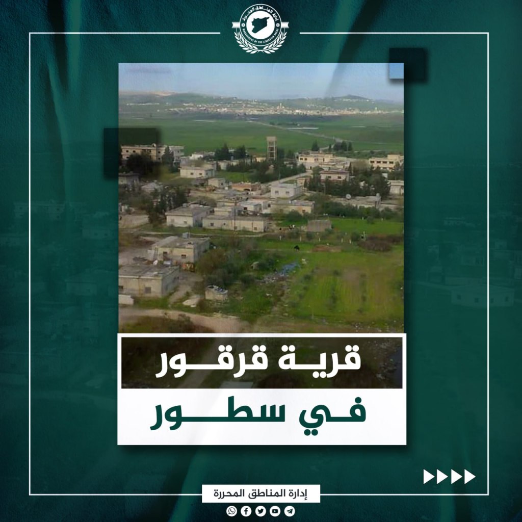

Qarqour is a Syrian village located north of the al-Ghab plain in the northwestern Hama countryside. Its basalt threshold formed a natural barrier to the flow of the Orontes River, which led to the formation of large southern swamps before they were blown up and removed in the early sixties of the last century by German and Italian companies. The soil of the village, like that of the other villages in the al-Ghab plain, is considered among the richest soil in the north of Syria in its mineral elements that make it arable for agriculture. In addition, its agricultural production is boosted by the passing of the Orontes River through it. It is known for cultivating various grain products, especially flour, cotton, sugar beet, and greens. Qarqour, also known as “Qirqur” and “Qirqar,” was mentioned in new Assyrian sources as the location of an ancient battle in 853 B.C. between the Assyrian army and an alliance of eleven local kingdoms under the leadership of Hadadzayd of Damascus. The residents of the village participated in the Syrian revolution since its beginning, and they were forcibly displaced after the village was occupied by regime militias until August 7, 2015, when it was freed by “Jaysh al-Fatah” forces, in which the enemy suffered heavy losses in lives and equipment.
Village of Mar’ayan
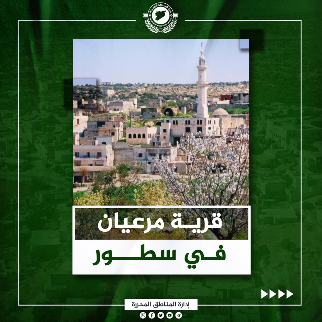
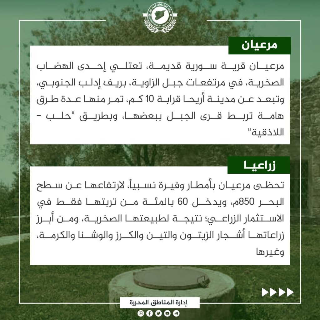
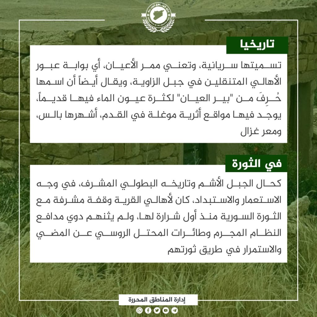
Mar’ayan is an old Syrian village on the rocky plateaus in the heights of Mount al-Zawiya in the northern Idlib countryside 10 km away from the city of Ariha. Several important roads connecting the mountain villages pass by it, and it is on the Aleppo-Latakia pathway. Mar’ayan enjoys relatively abundant rainfall, as it lies 850m above sea level, and only 60% of its soil is invested in agriculture as a result of its rocky nature. Its most prominent growths are olive trees, figs, cherries, vines, Alushna berries, and others. Its name is Syriac, and means the corridor of notables, as it is the transit gate of families moving in Mount al-Zawiya. It is also said that its names derives from “Bir al-Ayyan”, for the many springs that were there in the past. It contains ancient archeological sites, the most famous of which are Bales and Ma’ar Ghazal. Like the Ashm Mountain, and its honorable, heroic history in confronting colonialism and tyranny, the residents of the village had an honorable stand with the Syrian Revolution from its first spark, and were not deterred by the sound of the regime’s cannons and the planes of the Russian occupiers in continuing in the path of their revolution.
The Village of al-Hamamah
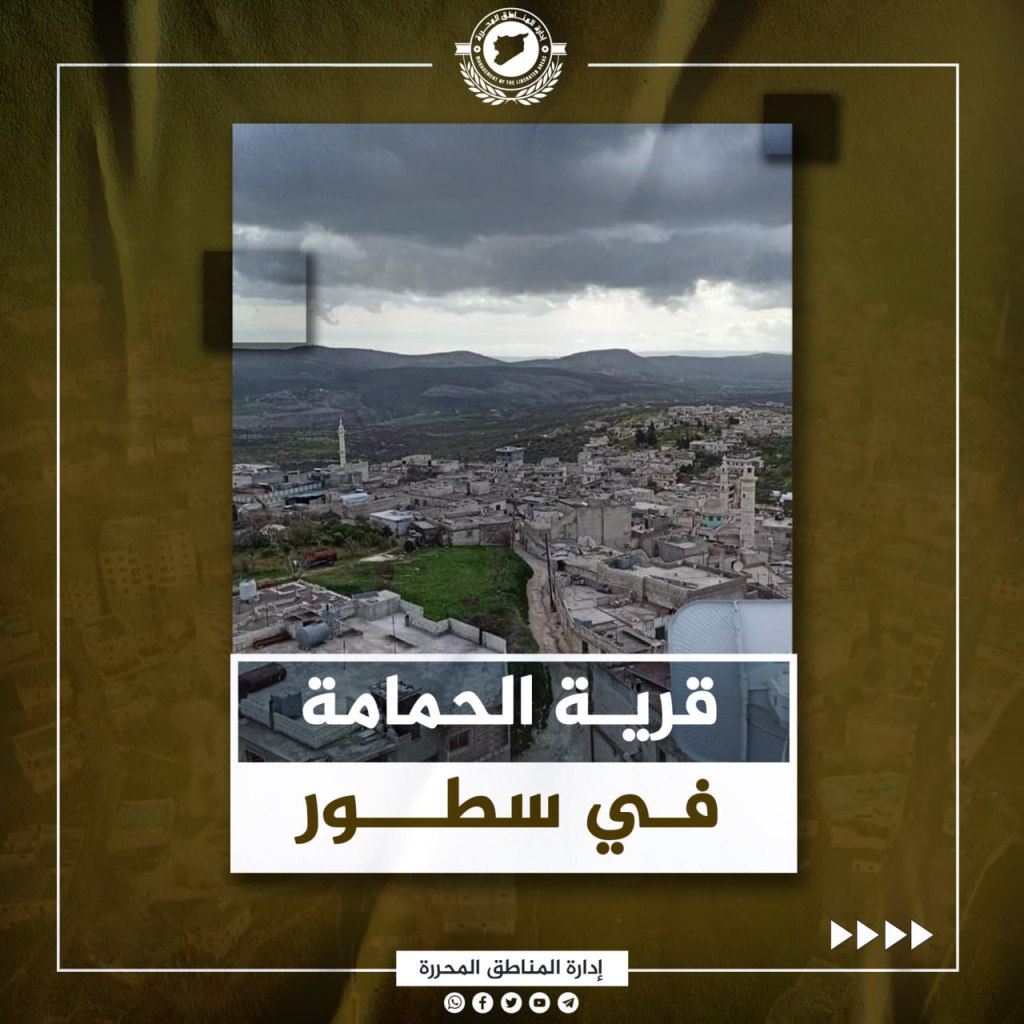

al-Hamamah, a Syrian village, is fifteen kilometers northeast of Jisr al-Shughur in the western Idlib countryside. It is known for its distinguished location in the middle of fertile agricultural plains, and its beauty is increased by the al-Asi (Orontes) River, which penetrates its eastern plains. al-Hamamah is distinguished agriculturally by the large number of olive, fig, and grape orchards in its surroundings, as well as its seasonal agriculture, for which the locals depend on the river for irrigation. All kinds of livestock, especially sheep and cows, are also raised in the village. What distinguishes the village the most is its location in the basin of the al-Asi, and among the bodies of water in the region it is considered the most beautiful, especially because it is an archeological landmark whose roots go back to before the common era. As is the case in Jebel al-Asham and its historic, honorable history in confronting colonialism and tyranny, the residents of the village had an honorable stand with the Syrian revolution from its first sparks, and the sounds of the regime’s cannons and the Russians’ airplanes did not deter her from continuing on the path of their revolution.
The Village of Qalb Lawzah

Qalab Lawzah is a Syrian village located on the foothills of the Barisha mountain northeast of Harim in the western Idlib countryside roughly seven kilometers away from the city. It is distinguished by its richness in archeological remains. Its soil consists of limestone rocks, outside of its southern face. Olive orchards interspersed with fig trees and vines surround the village, growing in soil full of hard rocks. Its farmers rely on water from rains and subterranean wells to water their crops and orchards. Its name is associated with an archeological building called Lawzah palace, which dates back to the fifth century. The palace was built with architectural methods from ancient Syria, which the Europeans adopted to build the Notre Dame Cathedral in Paris in the eleventh century. The Syrian regime was unsuccessful at inciting sectarianism within the village, and its residents came out repeatedly demanding the downfall of the leader of the Captagon criminal gangs, refusing the attempts at Arab normalization and supporting the recent peaceful movement of the people of al-Suwayda.
Town of Chagurite
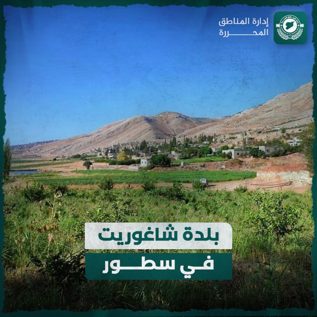
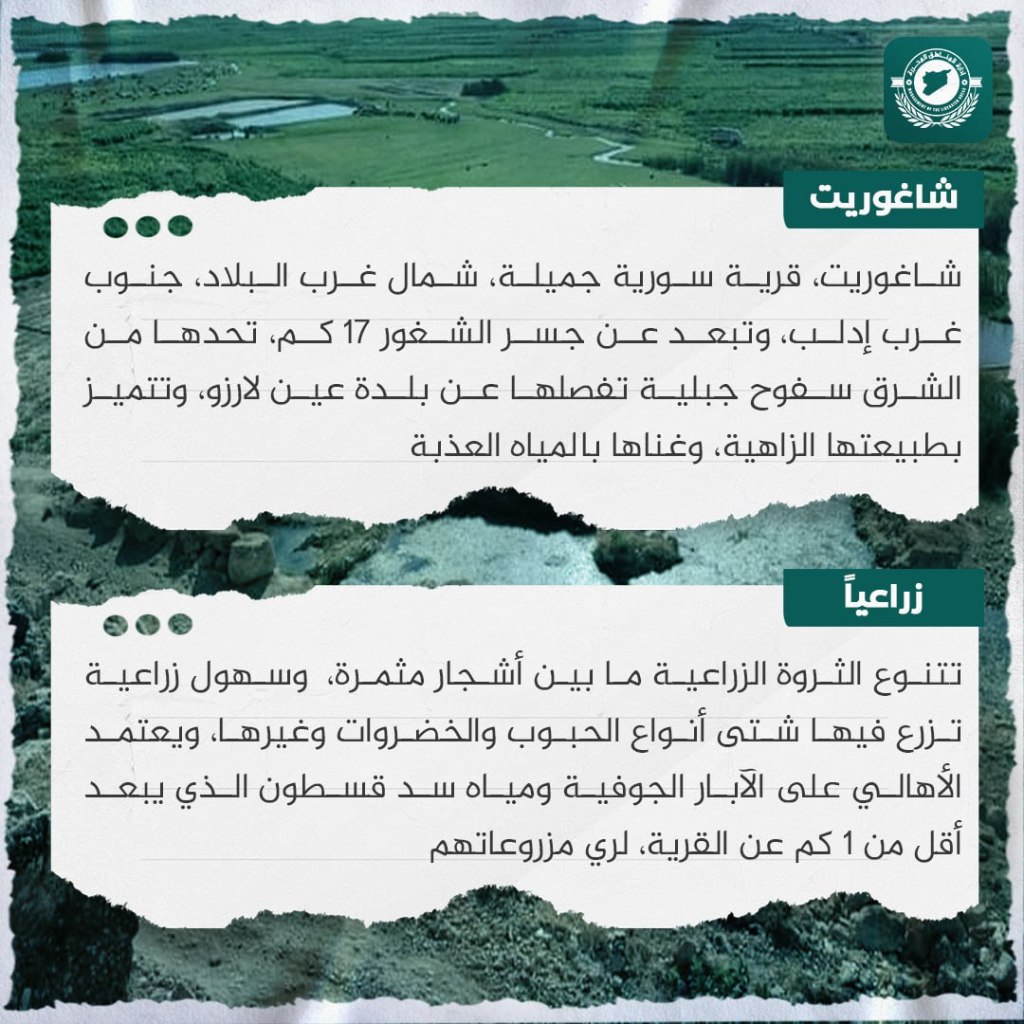
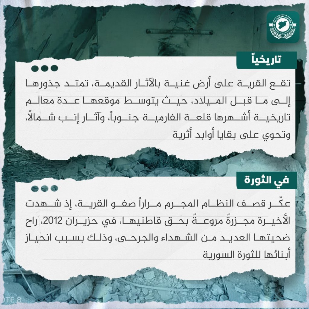
Chagurite, a beautiful village in Syria, is located in the northwest of the country, southwest of Idlib. It is located 17 kilometers away from Jisr al-Shughur, and is bordered to the east by mountain slopes which separate it from the village of Ayn Larzo. It is distinguished by its bright nature and its richness in freshwater. Its agricultural richness is distributed among fruitful trees and its agricultural plains, in which various types of grains, greens, and other products are grown. To water their agricultural products, its residents rely on underground wells and water from the Qastun Dam, which is located less than one kilometer from the village. The village is located on land rich in ancient archeological relics. Its roots extend to before the Common Era, as its location is in the middle of a number of historic milestones, the most famous of which include the al-Faramiya castle to the south, Inb relics to the north, and contains the remnants of archeological sites. The criminal regime’s bombings repeatedly disturbed the peace of the village. The village witnessed a horrible massacre against its residents in June 2012 in which many victims were killed and wounded because of its residents’ alignment with the Syrian Revolution.
Village of Balmis

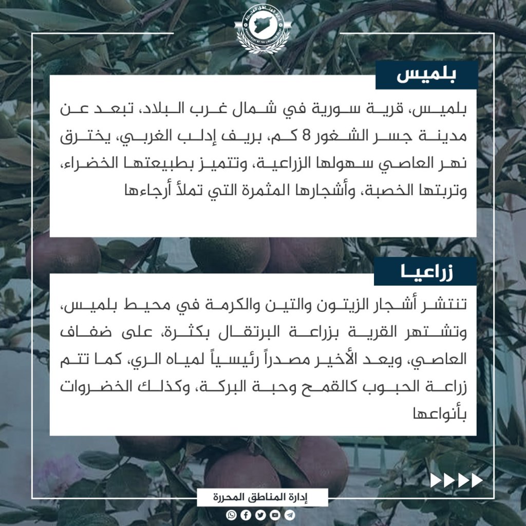
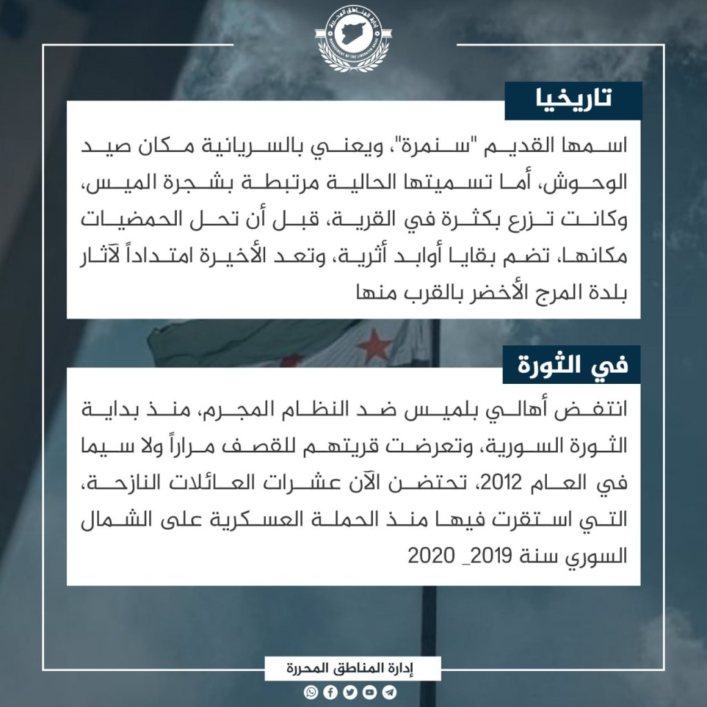
Balmis, a Syrian village in the northwest of the country, is 8 km away from Jisr al-Shughur in the western Idlib countryside. The Orontes River runs through its agricultural plains, and it is distinguished by its green nature, its fertile soil, and the mature trees which fill it. Olive trees, figs, and vines are spread throughout Balmis’ surroundings, and the village is famous for growing large quantities of oranges on the banks of the Orontes, which is considered the primary source of irrigating waters. Grains such as wheat and black seed are also grown, in addition to a variety of greens. The ancient name of the village is “Sinmara”, which in Syriac means a place for hunting monsters. Its current name is connected to May trees, which had grown bountifully in the village before the citrus trees replaced them. It contains the remnants of archeological remains, which are considered an extension of the ruins in the nearby village of al-Marj al-Akhdar. From the beginning of the Syrian revolution, the residents of Balmis pounced on the criminal regime. Their village was repeatedly exposed to shelling, especially in 2012, and currently shelters dozens of displaced families which have settled there since the military campaign against northern Syria in 2019-2020.
Ma’arat al-Nu’man: An Abandoned City
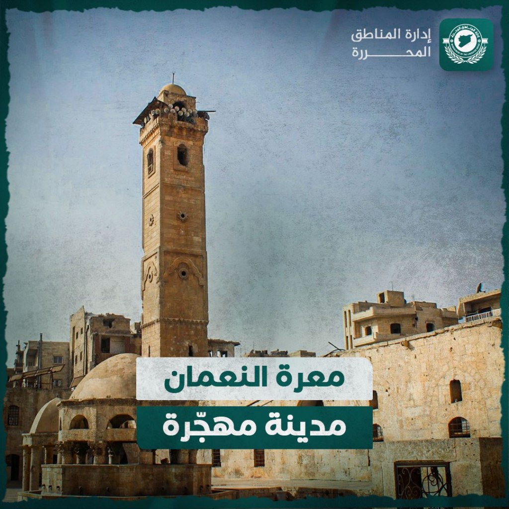

Ma’arat Nu’man, an old Syrian city in the northwest of the country in the southern Idlib countryside, is considered an incubator of dozens of villages, cities, and towns, the most prominent of which includes Kfar Nabil, Kfar Uma, Jirjinaz, and Talamnis. It is 500m above sea level, and the M5 highway passes through it. It is one of the most prominent cities in Idlib. In Yaqout al-Hamawi’s book Mu’ajam al-Buldan, its name is said to be connected to Nu’aman al-Tanukhi. Its history goes back to before the common era, and it passed centuries in prosperity. However, it suffered from many wars, the most famous of which were the Crusader campaigns. A museum is located in the city which describes much of its ancient history. Right from the outbreak of the Syrian revolution in the spring of 2011, the residents of Ma’arat al-Nu’man revolted against the regime. Their rebels were able to liberate their city in October 2012 and continued liberation operations until their liberated Camp Wadi al-Deif in mid-December 2014. After its liberation, Ma’arat al-Nu’man was exposed to many regime bombing campaigns taking revenge on the residents for their positive role in the revolution. It witnessed a number of massacres, such as the Suq Massacre in 2019, and at the end of November 2020 the regime occupied the city with Russian aerial support after they adopted a scorched earth policy.
Saraqib: A Deserted City

Saraqib, a Syrian city, is located in the eastern Idlib countryside. The “M4” and “M5” highways pass through it, and a few villages and towns are attached to it, the most important of which are Ma’ardbasa and Afs. Its residents exceed 50,000 people, and it is located 363m above sea level. The history of Saraqib’s prosperity goes back to the Ayyubid period, in which it belonged to Saramin, and it became a district center in February 1933. It was surrounded by the ancient kingdoms of Hazraq and Ebla. It is distinguished by a special dress for women called a kandura, which is made from silky satin, and is hundreds of years old. Saraqib’s residents came out in demonstrations against the government regime, and were able to liberate their city in the end of 2012 after they gained control of the Ma’mal al-Zayt checkpoint and a communications barracks. After its liberation it became an incubator for the revolution and the rebels. In revenge against its residents, the regime bombed Saraqib with thousands of shells and explosive barrels, in addition to bombing its neighborhoods in 2018 with toxic chlorine gas. The greatest surprise came when it was defeated at the hands of the regime and the Russian occupiers in 2020, after a violent battle fought by its residents in defense of it.
Khan Shaykhun: A Deserted City
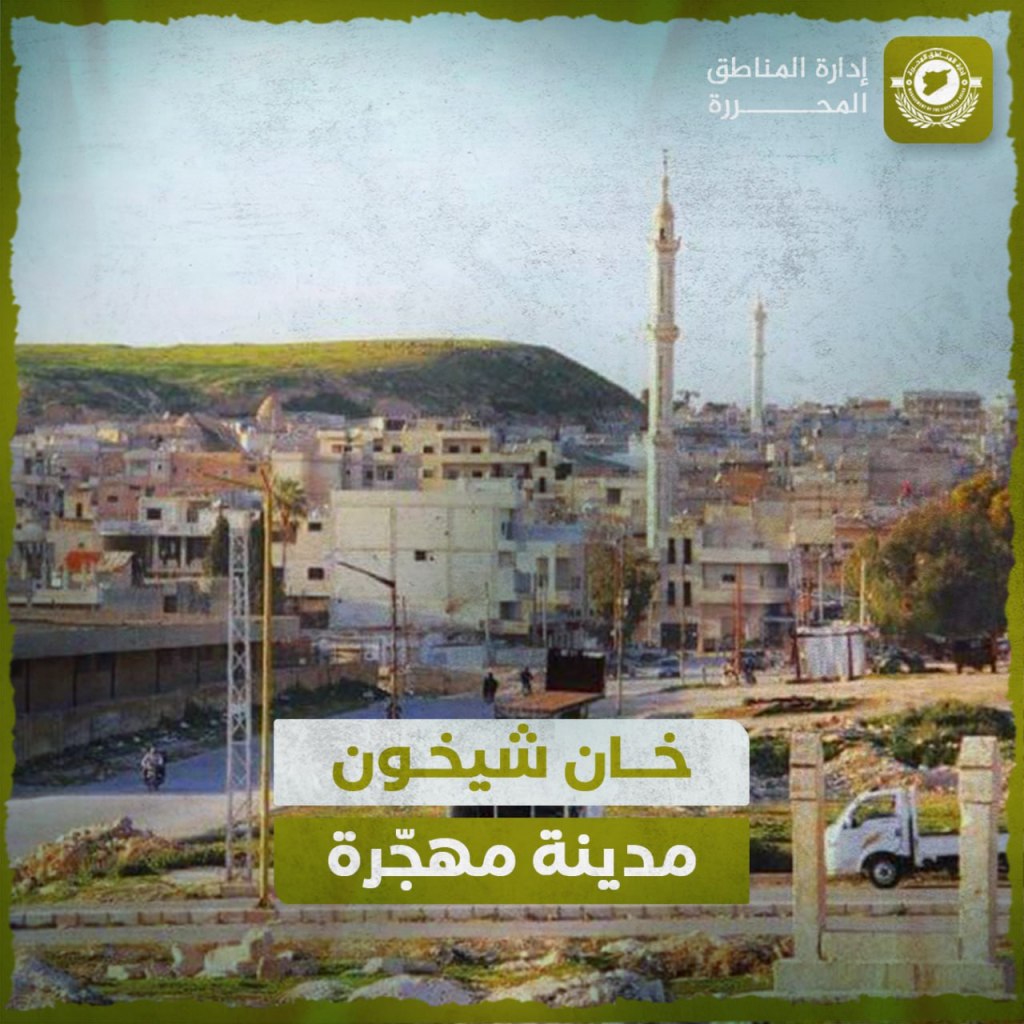
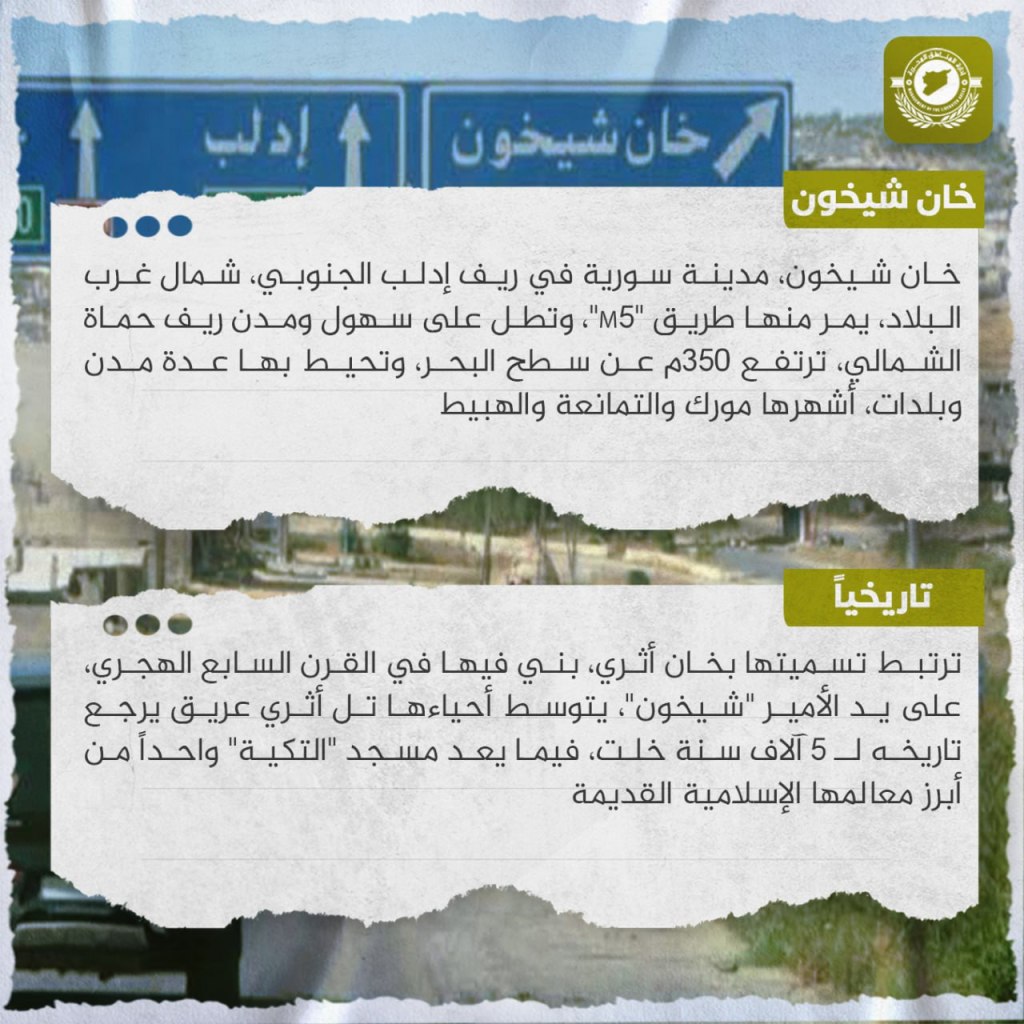
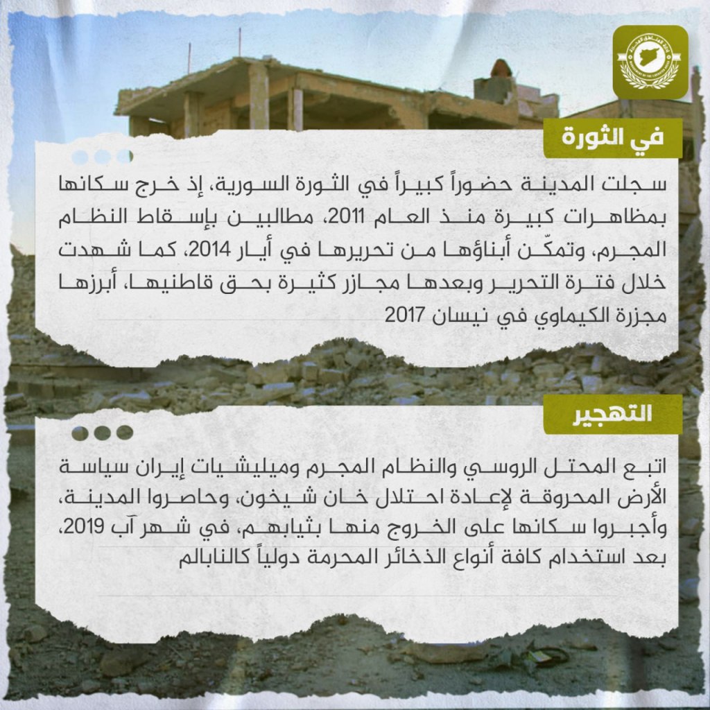
Khan Shaykhun, a Syrian city in the southern Idlib countryside, is located in the northwest of the country. The “M5” road passes through it, and reaches through the plains and cities of the northern Hama countryside. It is 350 meters above sea level, and is surrounded by a number of cities and towns, the most famous of which are Murak, al-Timana’ah, and al-Habit. Its name is linked to an ancient khan, which was built there in the seventh century hijri by the Emir “Shaykhun.” An ancient archeological mound is located in the middle of its neighborhoods, which dates back to five thousands years ago, and the al-Takiya mosque is considered one of its most prominent ancient Islamic features. The city recorded a great presence during the Syrian revolution, and its residents staged large demonstrations since 2011 calling for the fall of the criminal regime. Its residents were able to liberate it in March 2014, and during its liberated period, and afterwards, it witnessed many massacres on its residents, the most prominent of which was the chemical massacre in April 2017. The Assad regime, Iranian militias, and the Russians adopted a scorched-earth policy in order to retake Khan Shaykhun. They besieged the city and in August 2019 they forced its residents out with only the clothes on their backs after using all sorts of internationally forbidden ammunition, such as napalm.
Village of Batiya in History

Batiya, a Syrian village, is located northwest of the town of Azmarin, and administratively belongs to Salaqin the Harim region in the western Idlib countryside, nine kilometers away from it. Its western agricultural fields penetrate into the Orontes river, which separates it from Turkey. The village is known for growing olives, figs, grapes, and grains, in addition to the greens which grow in abundance on the banks of the Orontes, which is considered to be a primary source of agricultural water. Some of the village’s residents work in ranching and fishing in the river. Its name indicates an overnight stay, as it was the first rest stop for ancient travels from Iskandaron. The growth of the village goes back to the end of the Ottoman period, however the period of its original settlement dates back to between the second and fourth centuries. The village’s residents participated in demonstrations opposing the regime, and would gather with the residents of neighboring villages and towns in Salaqin. Their village embraced hundreds of Syrian displaced persons, and it was one of the villages that was hit by the February 6 earthquake, which led to losses in income and homes.
Kfar Nabil: An Abandoned City
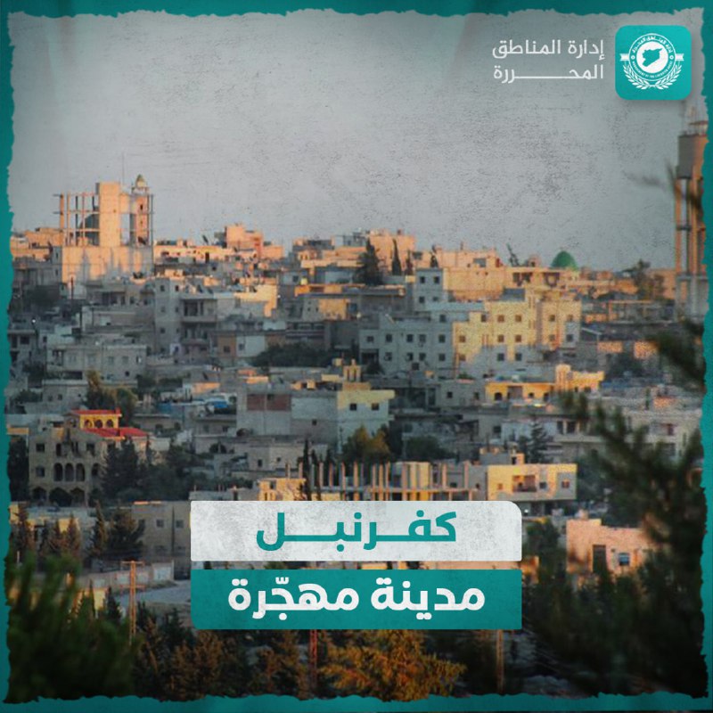
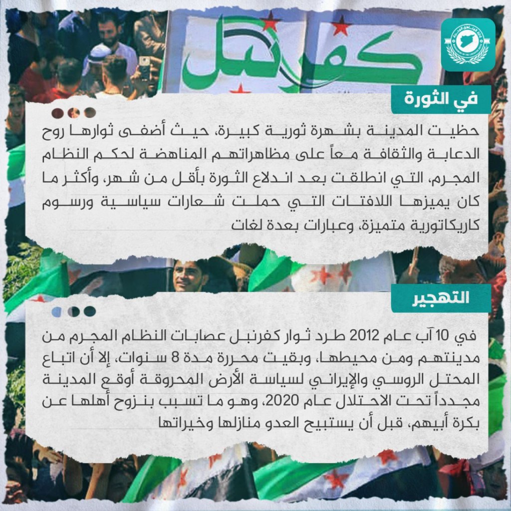
Kfar Nabil, a Syrian city located south of Mount al-Zawiya in the southern Idlib countryside is attached to Ma’arat Nu’aman, from which it is five kilometers away to the west, and is considered an administrative center for a number of villages and twins, the most famous of which include Has, Safuhan, and Ma’arat Haramah. It is 665 meters above sea level, and is described as one of the top Syrian cities in the fields of culture and education. Its name is Syriac and means a farm of nobles. It contains a number of ancient archeological sites, the most famous of which are the residential caves carved out of hand-cut rock, its Great Mosque, whose minaret was built back in the Mamluk period, and the al-Arba’in Mosque, as well as the sites of Rabia and Shanshrah in its vicinity. The city enjoyed great revolutionary fame, as its revolutionaries added a sense of shared humor and culture to their demonstrations opposing the regime, which were launched less than a month after the outbreak of the revolution. What distinguished it the most were its banners, which carried political slogans and fantastic artistic caricatures, as well as slogans in a number of languages. On August 10, 2012, the rebels pushed out the regime gangs from their city and is vicinity, and it remained free for eight years up until the Russian and Iranian occupiers adopted a scorched earth policy and the city was placed once again under occupation in 2020, which caused the displacement of its entire population, before the enemy seized their homes and resources.
Kafr Rumah: An Abandoned City
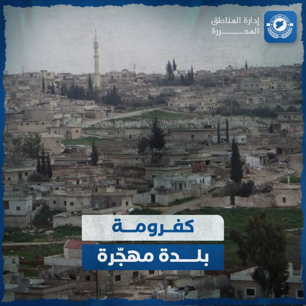

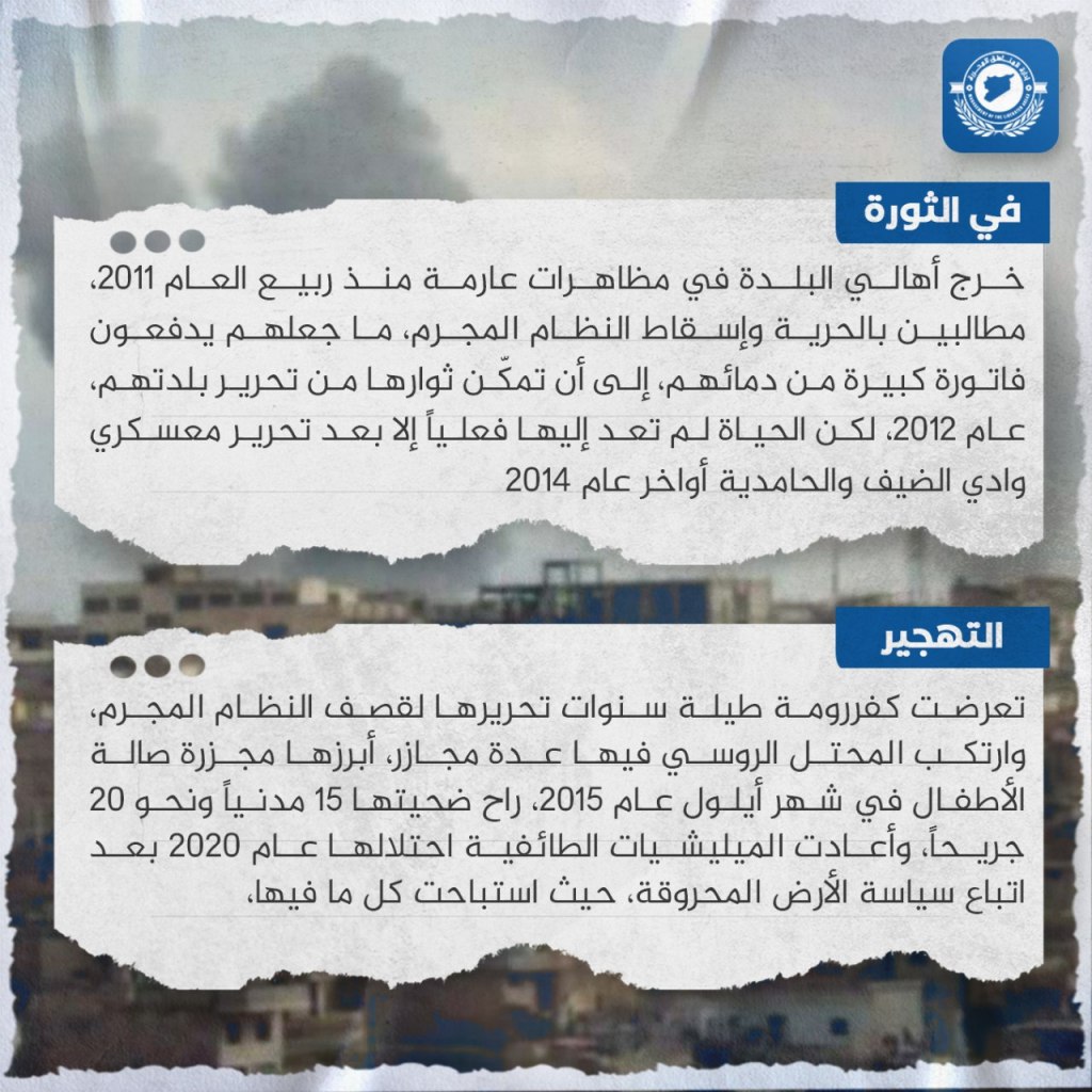
Kafr Rumah, which is written with a shaddah over the “r”, is a Syrian village located west of Ma’arat Nu’man in the southern Idlib countryside, less than one kilometer away from it. It is located 540 meters above sea level, and encompasses 3,000 hectares. There is an ancient water well called “al-Ram” in it, which is sometimes used for agriculture. Its current name is Syriac for “Rumah Farm”. Inside the village are four kilometer-long crypts which were hand-carved from the rock and extend eastward to the fortress of Ma’arat Nu’man, in addition to the ruins of “Hanak”, and a large fort built 800 years ago, which is distinguished by its large mosque, and was built on the ruins of an ancient building. It includes many famous archeological sites, the most famous of which is Dardurin. The residents of the village went out in huge protests starting in the Spring of 2011, demanding freedom and the downfall of the regime, which in turn caused them to pay a high cost in blood in order for its rebels to liberate their village in 2012. However, life did not really return to it until the liberation of the Wadi al-Deif and al-Hamediya camps in the end of 2014. Throughout the years of its liberation Kafr Rumah was exposed to regime shelling, and the Russian occupiers perpetrated a number of massacres, the most of all was the Massacre of the Children’s Hall in September 2015, whose casualties reached 15 civilians killed and around 20 wounded. The sectarian militias reoccupied the village in 2020 after adopting a scorched-earth policy in which they burned down everything inside it.
Tal Mardikh: An Abandoned Village
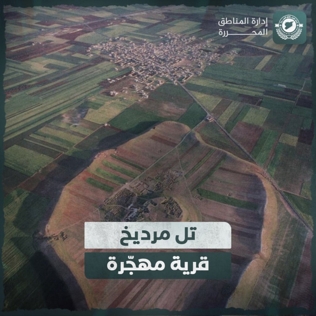
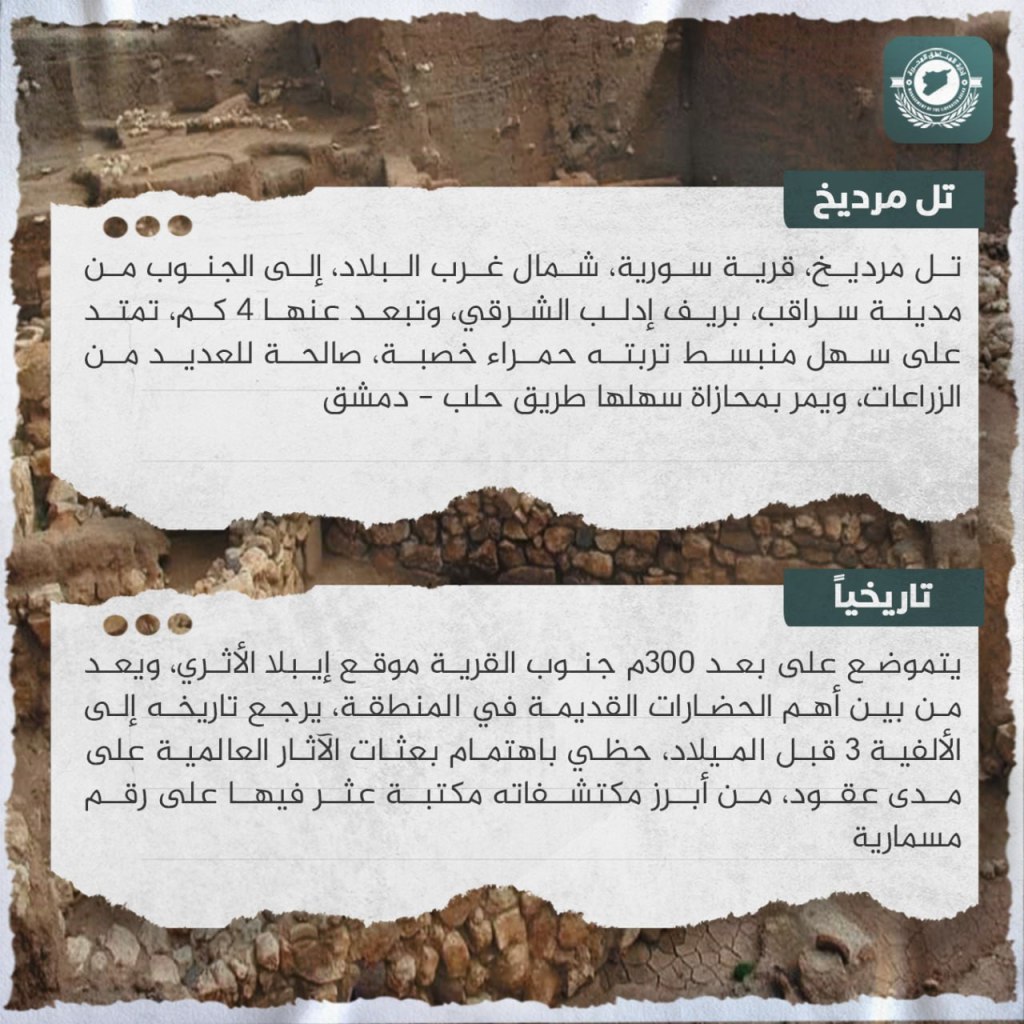
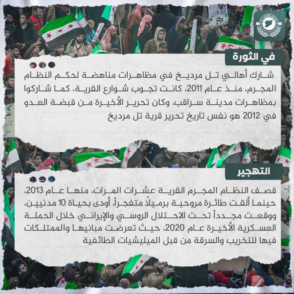
Tal Mardikh, a Syrian village located in the northwest of the country, is four kilometers south of the city of Saraqib in the eastern Idlib countryside. It stretches across a flat plain with fertile, red soil suitable for many crops, and the Aleppo-Damascus road passes along its plain. The Ebla archeological site, which is considered to be among the most important ancient civilizations in the region, is located 300 meters south of the village. Its history goes back to the third century before the common era, and the site has attracted the attention of global archeology researchers for decades. Among its most prominent excavations is a library in which cuneiform numbers were found. The residents of Tal Mardikh participated in demonstrations opposing the regime from 2011, which roamed the streets of the village in addition to participating in demonstrations in Saraqib, whose eventual liberation from the grasp of the regime in 2012 came on the same date as the liberation of Tal Mardikh. The regime bombed the village dozens of times, including in 2013, when a drone stopped explosive barrels which took the lives of ten civilians, and in the military campaign of 2020 it was put again under Russian and Iranian occupation, when its buildings and properties were looted and destroyed by sectarian militias.
Jarjanaz: An Abandoned City
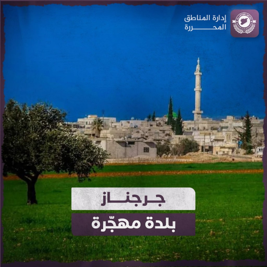
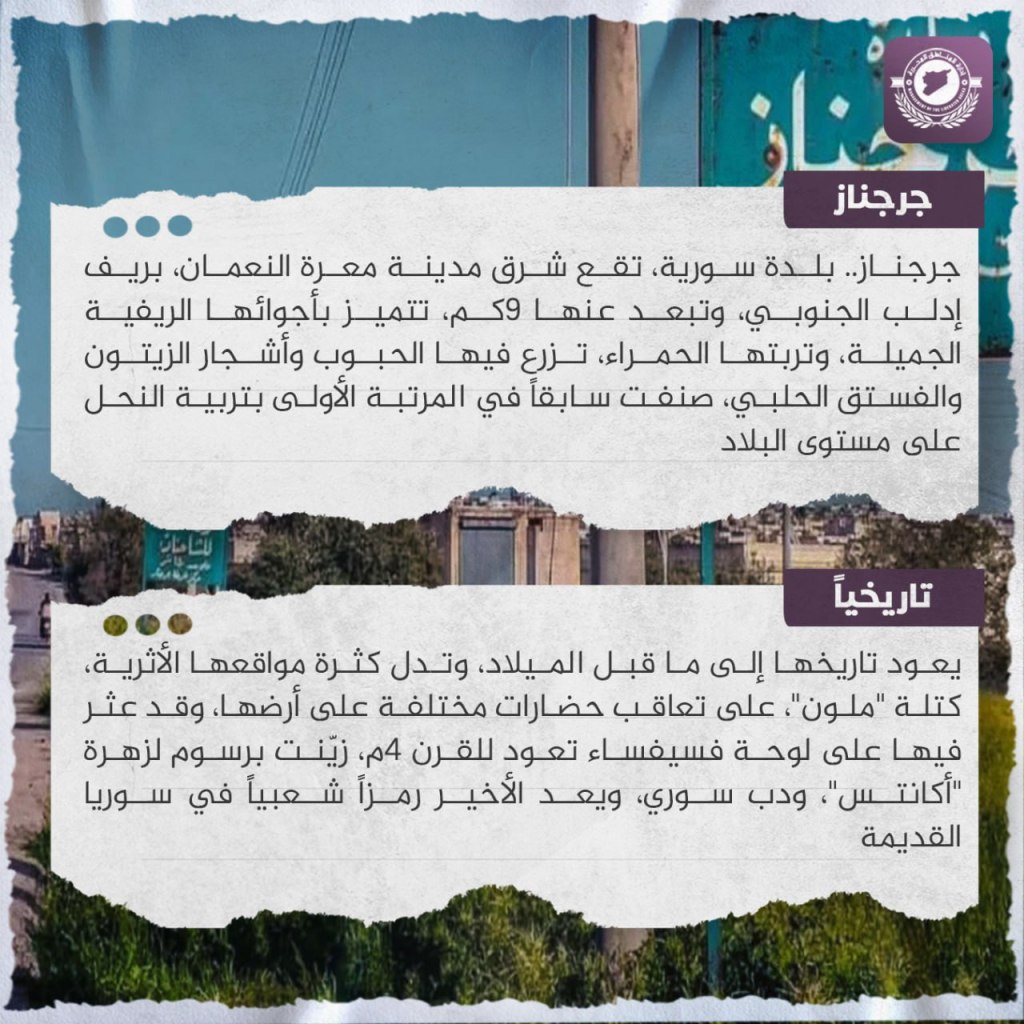
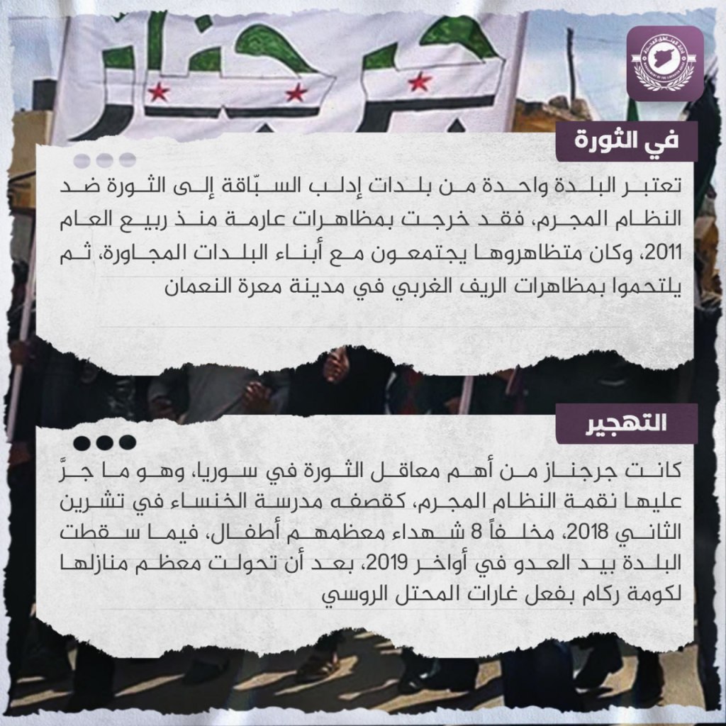
Jarjanaz: A Syrian town, located east of Ma’arat Nu’aman in the southern Idlib countryside, nine kilometers away from the city. It is distinguished by its beautiful countryside atmosphere and its red soil, in which grains, olive trees, and pistachios are grown. It was previously ranked first nationally in its beekeeping. Its history goes back to before the common era, as is evidenced by the abundance of archeological sites, including the “Malun” cluster, which indicate a succession of different civilizations lived on its land. A mosaic wall dating to the fourth century C.E. was found in it, decorated with an inscription to the glory of “Acanthus,” and a Syrian bear, and the latter is considered a popular symbol in ancient Syria. The town is considered as one of the earliest to rebel against the criminal regime, and went out in overwhelming demonstrations from the spring of 2011. Its protestors would join with the residents of neighboring towns, then join demonstrations of the western countryside of Ma’arat Nu’aman. Jarjanaz was one of the most important strongholds of the revolution in Syria, which is what drew upon it the revenge of the regime, such as when it bombed the al-Khansa’ school in 2018, leaving eight people dead, most of them children. The town fell to the hands of the enemy in the end of 2019, after most of his houses were turned into piles of rubble due to the raids of the Russian occupation.
Morek: An Abandoned City
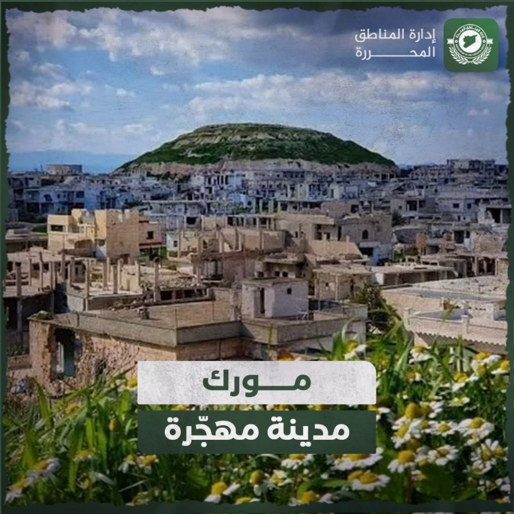
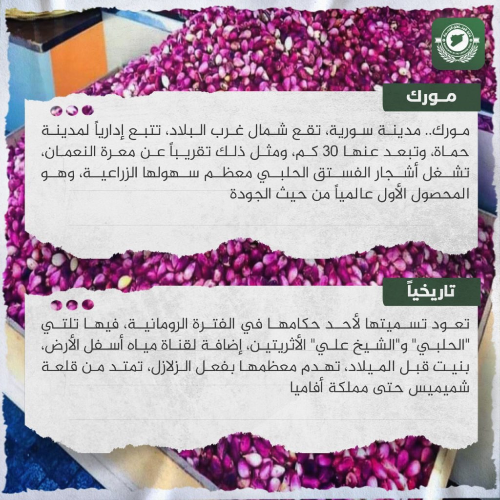
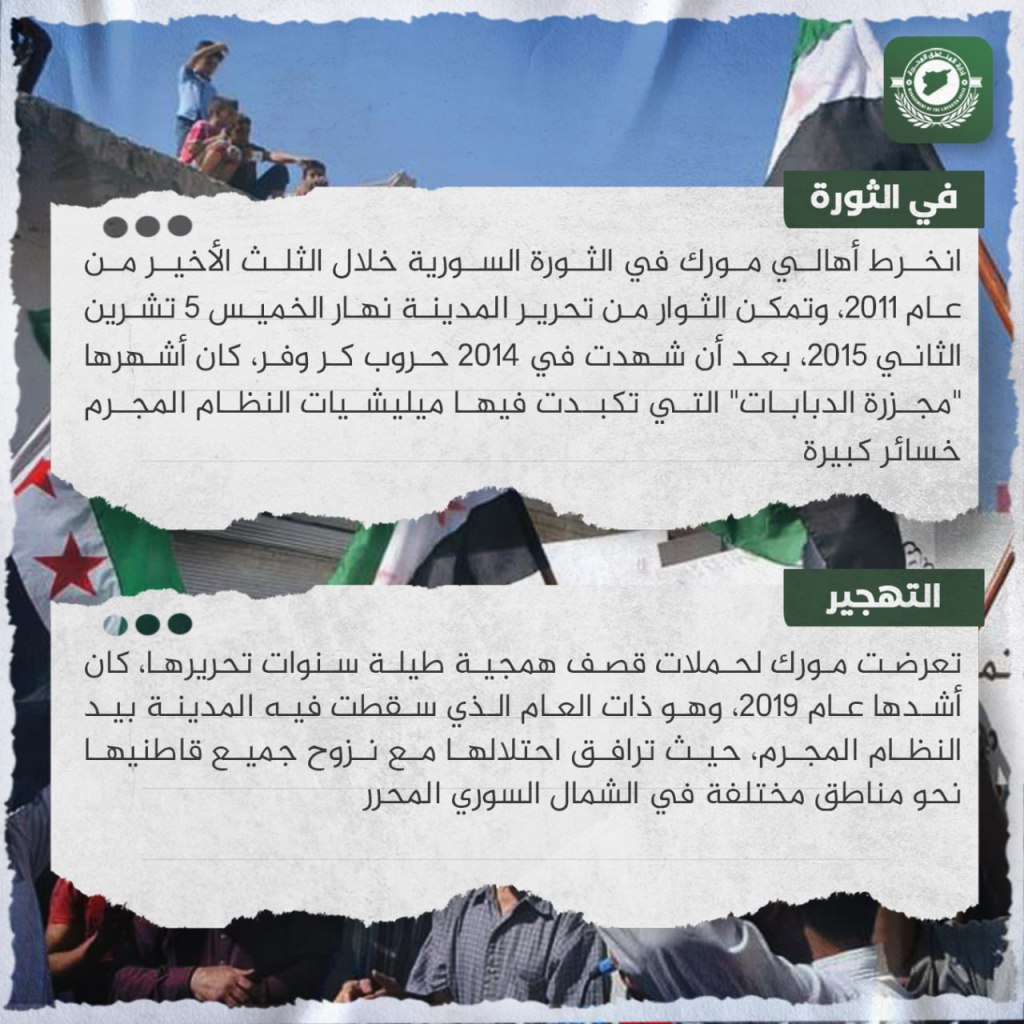
Morek… a Syrian city located in the northwest of the country which is administratively affiliated with Hama, and is 30 km away from it. It is also close to Ma’arat al-Nu’aman. Pistachio trees occupy most of its agricultural land, and they are first-class worldwide in terms of their quality. Its name goes back to one of its rulers during the Roman period. The “al-Halabi” and “Sheih Ali” archeological hills are located in it, in addition to underground water channels built before the common era. Most of it has been destroyed during earthquakes, extending from Shmemis Castle to the Kingdom of Apamea. The residents of Morek became involved in the Revolution in the last third of 2011. Rebels were able to liberate the city on Thursday, November 5, 2015, after 2014 witnessed attack and retreat battles, the most famous of which was “The Massacre of Tanks,” in which regime militias took huge losses. Morek was exposed to savage shelling campaigns throughout its years of liberation, the worst of which was in 2019, the same year that the city fell into the hands of the regime. Its occupation was accompanied by the displacement of all of its residents towards various regions in liberated northern Syria.
Andan: An Abandoned City
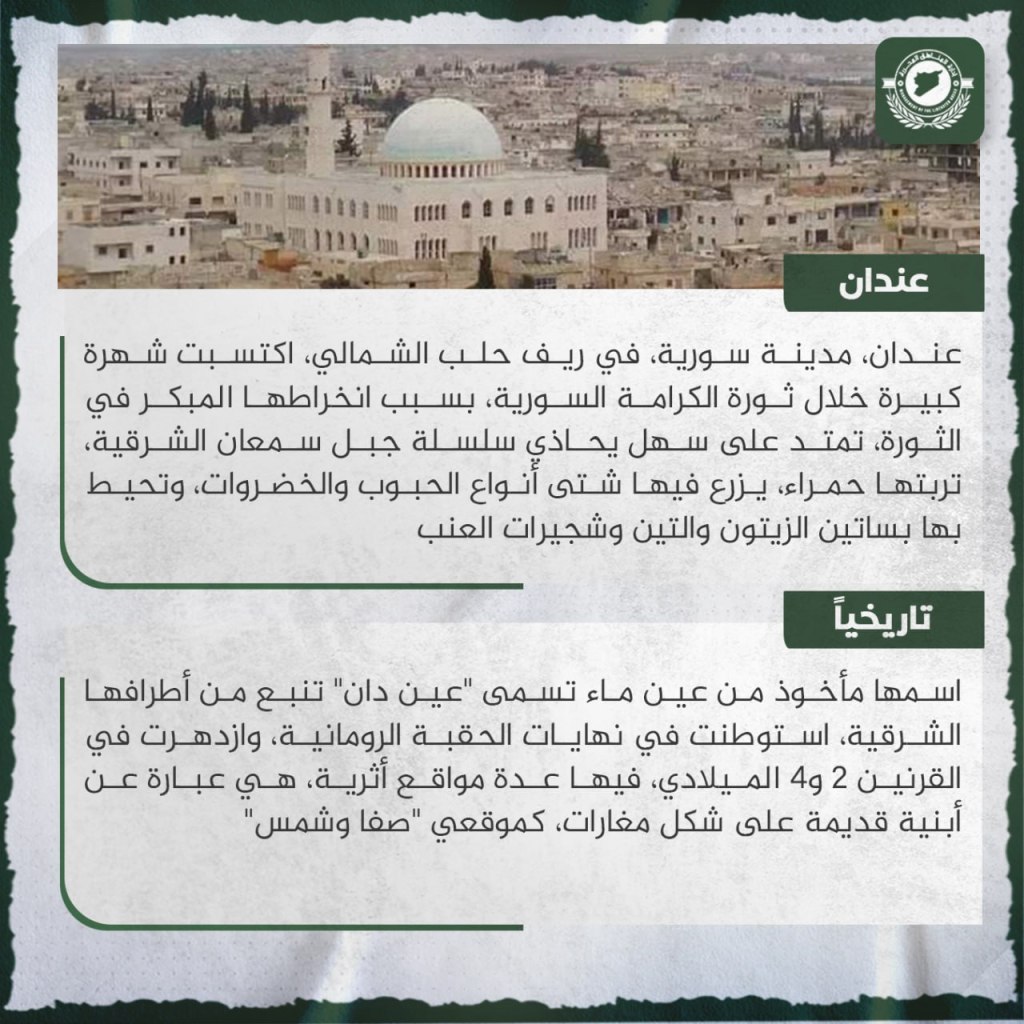

Andan, a Syrian city in the northern Aleppo countryside, earned great fame during the noble Syrian revolution because of its early involvement in the revolution. It is located on a plane extending along the eastern Mount Simeon range. It has red soil upon which a wide variety of grains and vegetables grow. It is surrounded by olive and fig groves and grape vines. Its name is taken from a water spring called ‘Ayn Dan’ which flows from its eastern side. It was occupied at the end of the Roman era, and flourished during the second and fourth centuries C.E. It has a number of archeological sites containing ancient buildings in the forms of caves, such as the ‘Safa’ and ‘Shams’ sites. Andan is considered one of the first cities which rebelled against the regime. Its residents supported the Syrian revolution in August 2011, when its streets were crowded with shouts calling for freedom and the fall of the leader of the captagon regime. Rebels liberated it in May 2012 after gaining control of the “Haritan-Andan” roadblock. The city was exposed to many aggressions from the regime, the most criminal of which occurred at the beginning of the 1980s, when security agents stormed iron orders from Hafez Assed after he besieged it on all sides. The regime reoccupied it in February 2020 after Russian planes leveled most of its buildings.
Kfar Zita: An Abandoned City
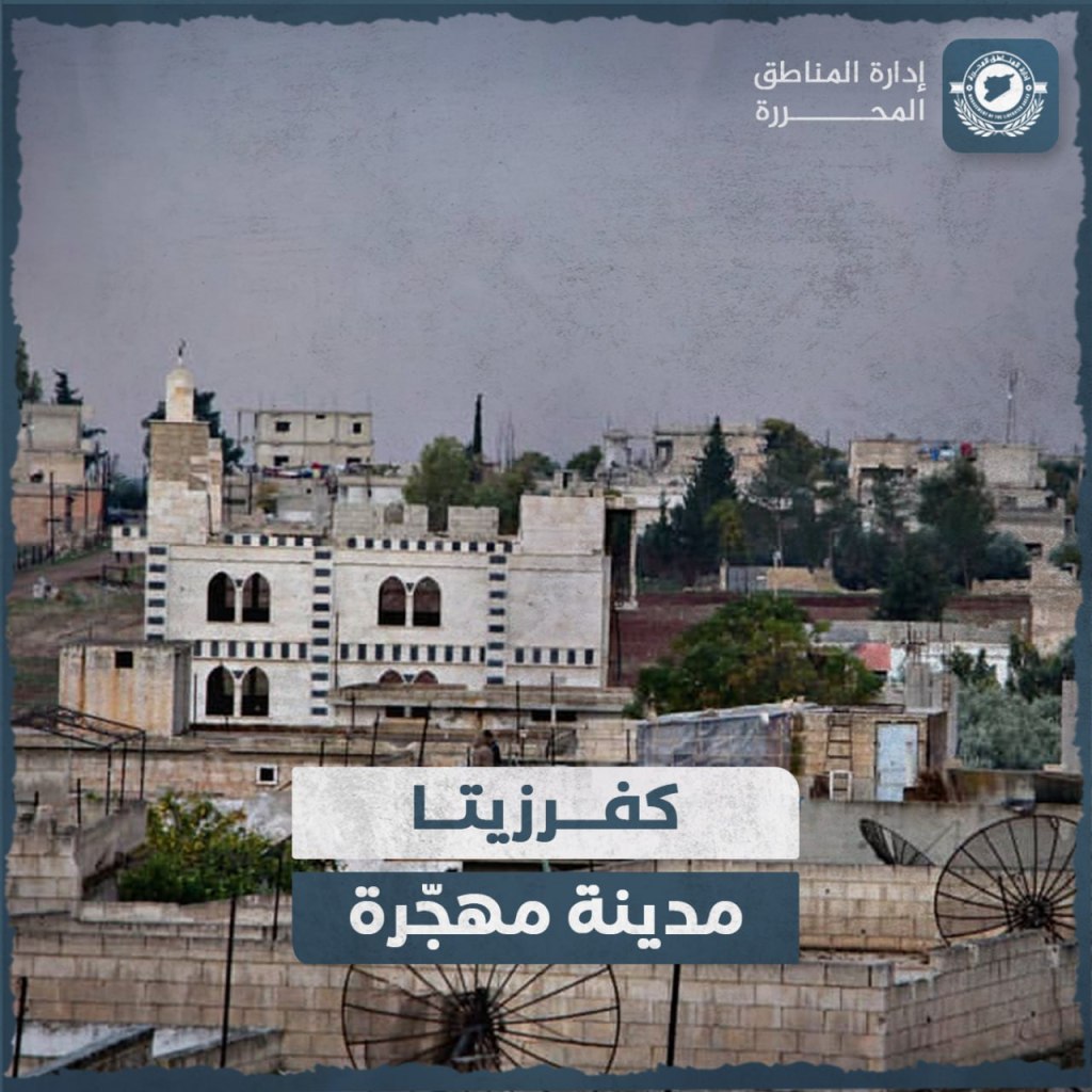
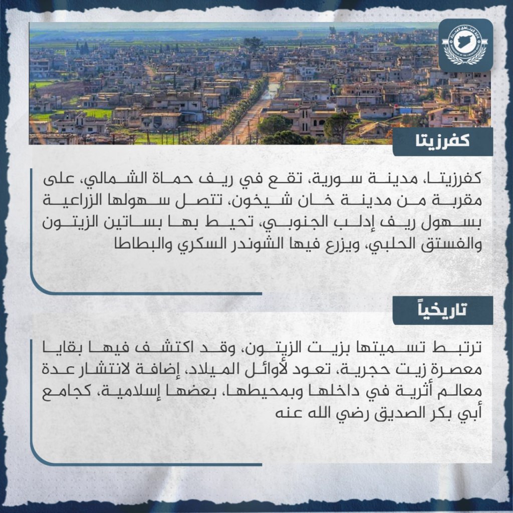

Kfar Zita is a Syrian city located in the northern outskirts of Hama close to Khan Shaykhoun. Its agricultural fields stretch to the territory of the southern Idlib countryside. It is surrounded by olive and pistachio orchards, and it grows sugar beets and potatoes. Its name is tied to olive oil, as the remnants of a stone oil press dating from the beginning of the common era were discovered in it, in addition to the presence of a number of archeological monuments within and outside of the city, some of which are Islamic, such as the Abu Bakr al-Sadiq mosque. The residents of Kfar Zita participated in revolutionary demonstrations from the spring of 2011 in which they called for the fall of the criminal regime and accountability of its security apparatus, which had suppressed demonstrations all over the country. Its rebels were able to liberate it in February 2012. The city was exposed to dozens of air and ground attacks, and to bombings with poisonous chemical gasses in 2014 and 2016, in addition to violent Russian bombings during the regime’s campaign in 2019, which resulted in the occupation of the city and the cruel expulsion of its occupants before the militias took refuge in it.
Hayan: An Abandoned City

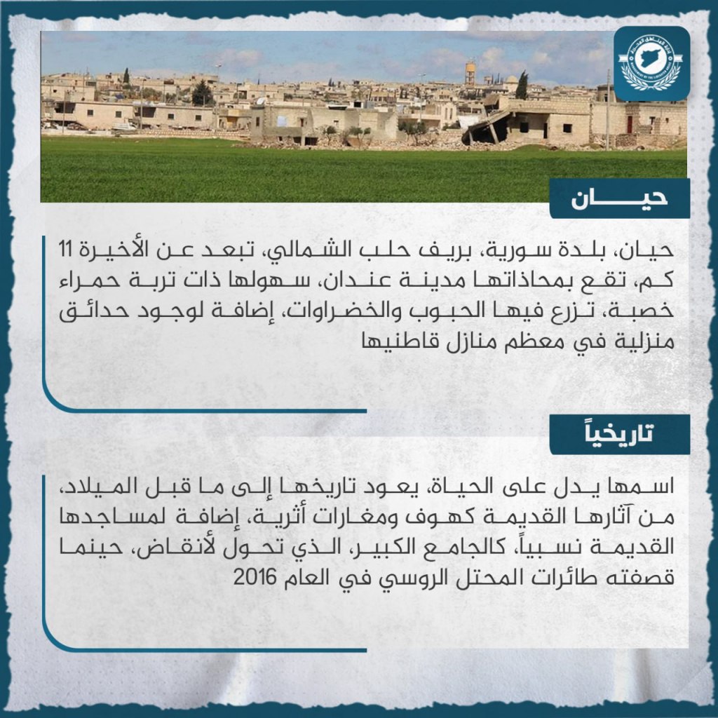
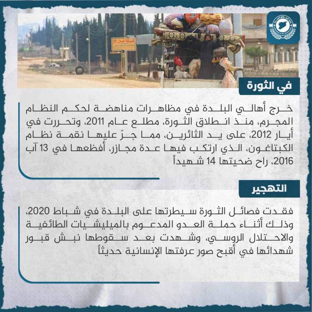
Hayan, a Syrian city located 11 km north of Aleppo. The city of Andan is located nearby, and its plains are composed of the same red dirt. Grains and vegetables are grown within it, in addition to the presence of household gardens in most of the homes of its residents. Its name is evidence of life. Its history goes back to before the common era, and its ancient ruins include caves and archeological hills, in addition to its relatively old mosques, such as al-Jama’a al-Kabir, which was turned into rubble when Russian airplanes bombed it in 2016. The residents of the city went out to demonstrate against the regime from the beginning of the revolution in early 2011, and it was liberated in May 2012 at the hand of revolutionaries. This earned the revenge of the captagon regime, which committed a number of massacres within the village, the worst of which came on August 13, 2016, in which 14 people were killed. Rebel divisions lost control of the village in February 2020 during the regime’s campaign, which was supported by sectarian militias and the Russian occupation. After its fall, it witnessed the exhumation of the graves of its martyrs, in one of the ugliest images known recently to humanity.
al-Litamina: An Abandoned City
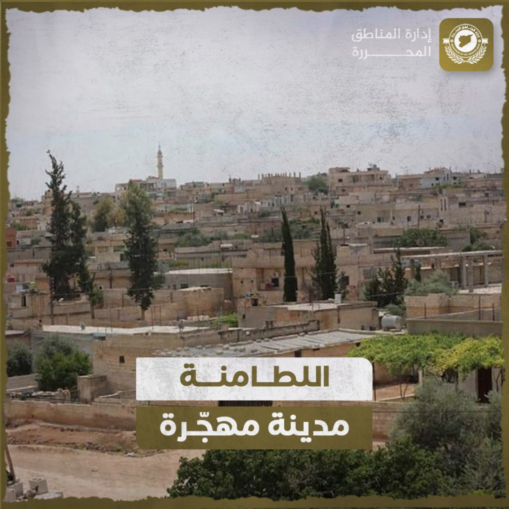

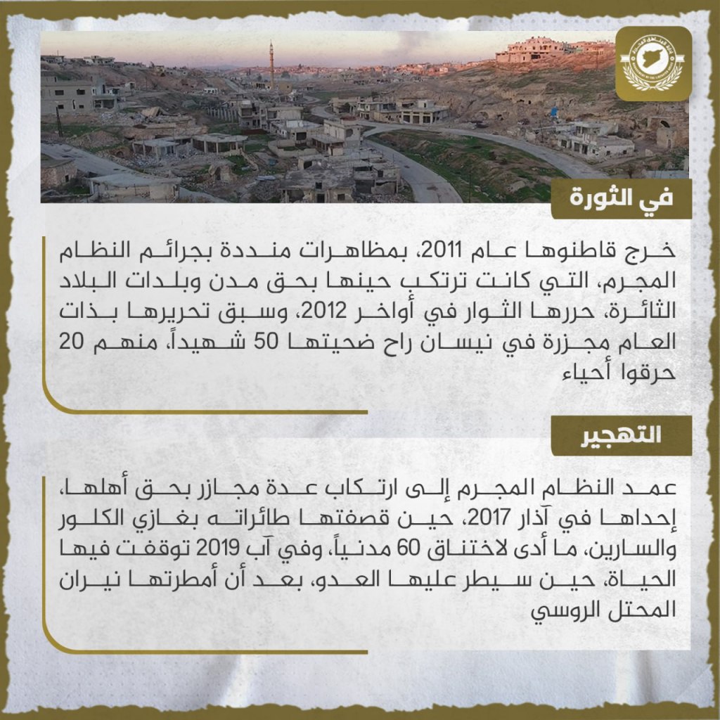
Litamina, a Syrian city in the northern Hama countryside, is located 12 km away from Khan Shaykhun. It is adjacent to the southern bank of the Orontes River. It is known for grown grains and vegetables of all types, and its agricultural territory is permeated by orchards of fruit and olive trees. It is impossible to ascertain the history of the settlement of the city. Ancient archeological artifacts have been found inside of it, including stone shovel-heads. It is considered to be one of the oldest human villages discovered in the world, after Africa. Its name is composed of two parts, “Lata” and “Amn,” or “stability” and “hidden,” and the reason behind its name is connected with its caves. In 2011 its residents went out in protests denouncing the crimes of the regime, which had at that time been committed against the cities and the town of the rebellious country. Rebels liberated it at the end of 2012. Its liberation was preceded that year by a massacre in April whose victims included 50 people killed, 20 of whom were burned alive. The regime intentionally committed a number of massacres against its residents, one of which was in March 2017, when its planes bombed the village with chlorine gas and sarin, leading to the strangling of 60 civilians. In August 2019 all life in the village stopped when the enemy took it over, after Russian planes rained fire down upon it.
Ma’arshurin: An Abandoned City
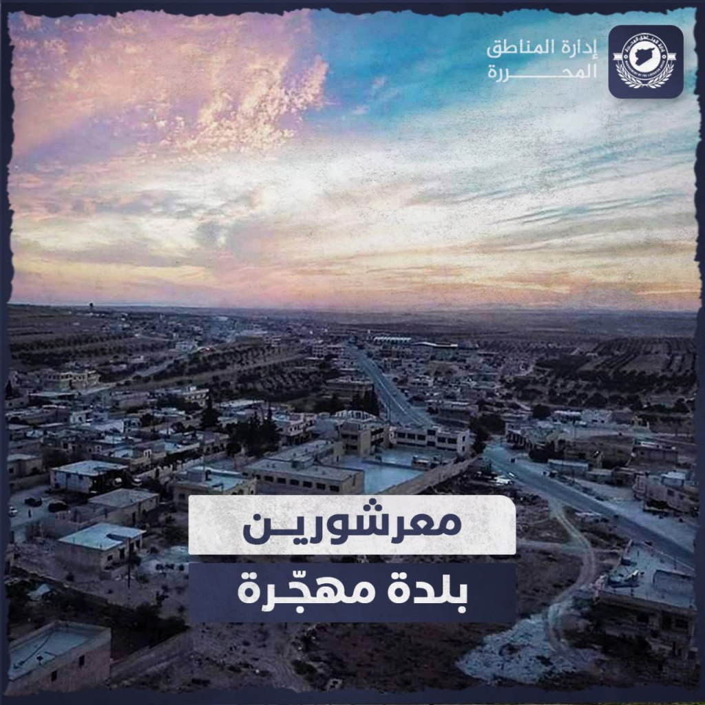
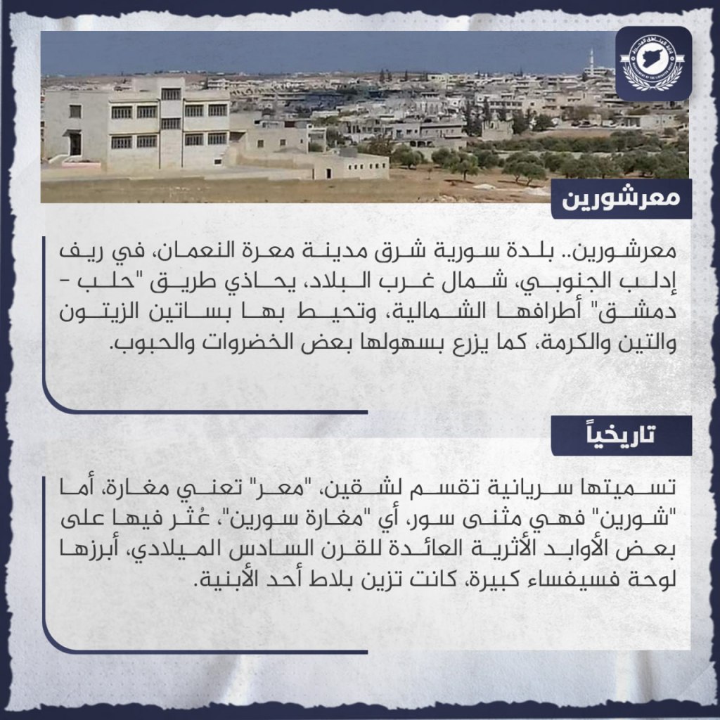
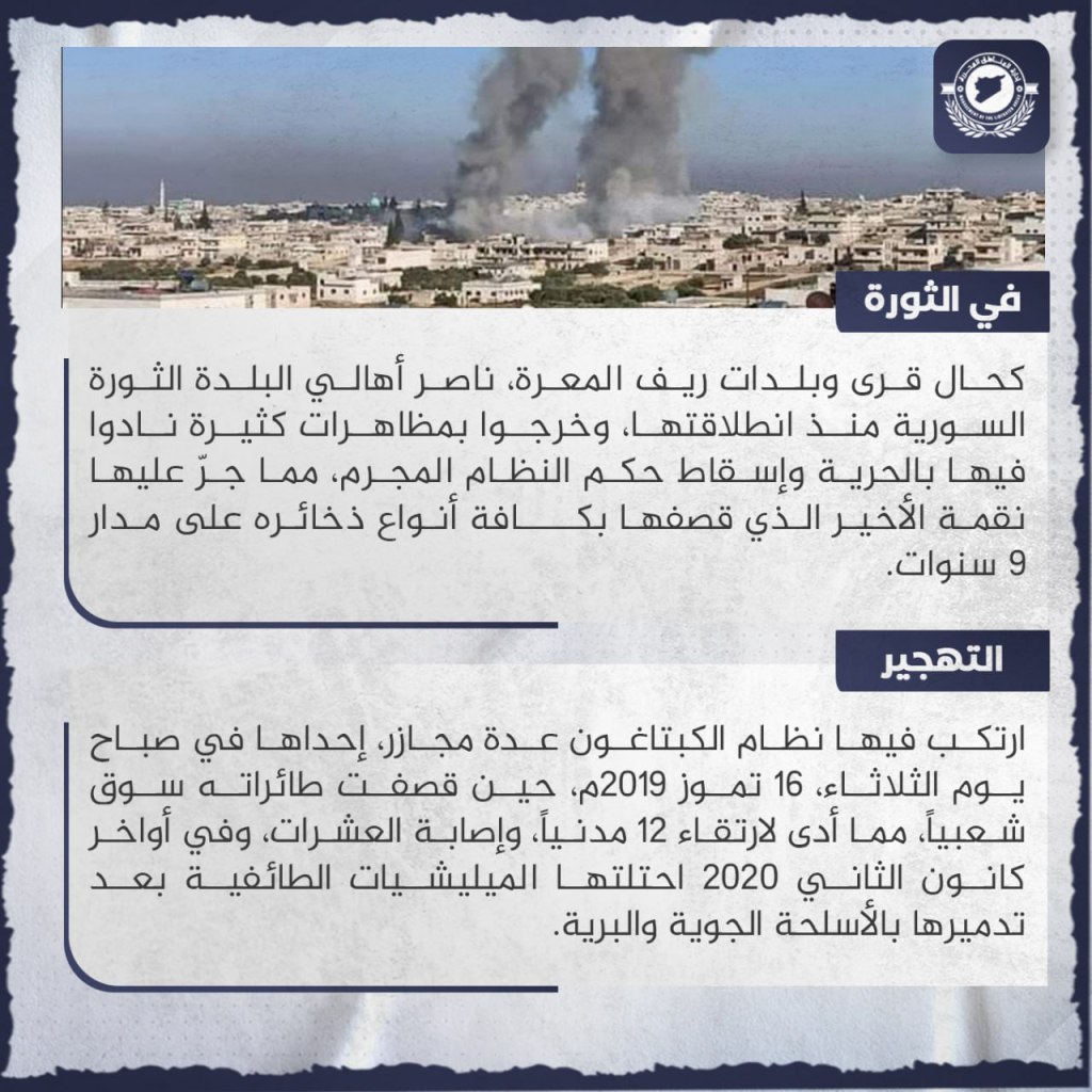
Ma’arshurin, a Syrian town east of Ma’arat al-Nu’aman in the southern Idlib countryside in the northwest of the country, is adjacent to the northern flank of Aleppo-Damascus road. It is surrounded by olive tree orchards, fig trees, and vines, and its fields also grow some vegetables and grains. Its name is Syriac, and is divided into two parts. “Ma’ar” means a cave, and “shurin” is the dual of “Syria”, so the name means “Syrian Caves.” Some archeological remains dating back to the sixth century C.E. have been found in it, the most prominent of which is a huge mosaic panel which decorated the courtyard of one of the buildings. As was the case in other villages and towns in the area of Ma’arat al-Nu’aman, the residents of the town supported the Syrian Revolution right from its outbreak, and went out in numerous demonstrations calling for peace and the downfall of the criminal regime. This brought down upon it later revenge, in which it was shelled with all types of ammunition over the course of nine years. The Captagon Regime committed a number of massacres in the town, one of which was on the morning of July 16, 2019, when airplanes bombed the popular market, leading to the deaths of 12 civilians and the wounding of dozens more. At the end of January 2020 it was occupied by sectarian militias after it was destroyed with air and ground weapons.
